


Summary
Ternate, also known as the City of Ternate, is a city in the Indonesian province of North Maluku and an island in the Maluku Islands. It was the de facto provincial capital of North Maluku before Sofifi on the nearby coast of Halmahera became the capital in 2010. It is off the west coast of Halmahera, and is composed of eight islands: Ternate, the biggest and main island of the city, and Moti, Hiri, Tifure, Mayau, Makka, Mano, and Gurida. In total, the city has a land area of 162.20 square kilometres and had a total population of 185,705 according to the 2010 census,[3] and 205,001 according to the 2020 census,[4] with a density of 1,264 people per square kilometre; the official estimate as at mid 2023 was 204,920 (comprising 104,128 males and 100,792 females).[2] It is the biggest and most densely populated city in the province, as well as the economic, cultural, and education center of North Maluku, and acts as a hub to neighbouring regions. It was the capital of the Sultanate of Ternate in the 15th and 16th centuries, and fought against the Sultanate of Tidore over control of the spice trade in the Moluccas before becoming a main interest to competing European powers.
Ternate | |
|---|---|
| City of Ternate Kota Ternate | |
 Skyline of Ternate | |
 Coat of arms | |
| Motto(s): Maku Gawene (Love Each Other) | |
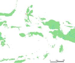 Location within Maluku Islands | |
OpenStreetMap .mw-parser-output .locmap .od{position:absolute}.mw-parser-output .locmap .id{position:absolute;line-height:0}.mw-parser-output .locmap .l0{font-size:0;position:absolute}.mw-parser-output .locmap .pv{line-height:110%;position:absolute;text-align:center}.mw-parser-output .locmap .pl{line-height:110%;position:absolute;top:-0.75em;text-align:right}.mw-parser-output .locmap .pr{line-height:110%;position:absolute;top:-0.75em;text-align:left}.mw-parser-output .locmap .pv>div{display:inline;padding:1px}.mw-parser-output .locmap .pl>div{display:inline;padding:1px;float:right}.mw-parser-output .locmap .pr>div{display:inline;padding:1px;float:left}html.skin-theme-clientpref-night .mw-parser-output .od,html.skin-theme-clientpref-night .mw-parser-output .od .pv>div,html.skin-theme-clientpref-night .mw-parser-output .od .pl>div,html.skin-theme-clientpref-night .mw-parser-output .od .pr>div{background:#000;color:#fff}html.skin-theme-clientpref-night .mw-parser-output .locmap{filter:grayscale(0.6)}@media(prefers-color-scheme:dark){html.skin-theme-clientpref-os .mw-parser-output .locmap{filter:grayscale(0.6)}html.skin-theme-clientpref-os .mw-parser-output .od,html.skin-theme-clientpref-os .mw-parser-output .od .pv>div,html.skin-theme-clientpref-os .mw-parser-output .od .pl>div,html.skin-theme-clientpref-os .mw-parser-output .od .pr>div{background:#000;color:#fff}}  Ternate  Ternate Ternate (Halmahera)  Ternate Ternate (Indonesia) | |
| Coordinates: 0°46′48″N 127°22′55″E / 0.78000°N 127.38194°E | |
| Country | |
| Province | |
| Settled | C. 13th century |
| Established | 15 February 1523 |
| Government | |
| • Mayor | Tauhid Suleiman |
| • Vice Mayor | Jasri Usman |
| Area | |
| • Land | 162.20 km2 (62.63 sq mi) |
| • Water | 5,547.55 km2 (2,141.92 sq mi) |
| Population (mid 2023 estimate) | |
| • Total | 204,920 |
| [2] | |
| Time zone | UTC+9 (Indonesia Eastern Time) |
| Area code | (+62) 921 |
| HDI | |
| Website | ternatekota.go.id/ |
History edit
Early history edit
Maluku is mentioned in Nagarakretagama. The term originally denoted the spice-producing islands of North Maluku, of which Ternate became the dominant one. The Ternate Kingdom was previously known as the Kingdom of Gapi.[5] Moluccan tradition says that there was an exodus of people moving out of Halmahera around 1250 due to political conflicts.[6]:4 The settlement founded by people from Halmahera was first situated close on the hillside of the Gamalama mountain and named Tobona. During this time, Tobona was ruled by a tribal chief with the title of Momole.[6]:4 This period was characterized by several smaller tribal settlements around Gamalama which were founded afterwards, such as Foramadiahi being established further downhill, while Sampalu, and Gamlamo were founded along the coast. These settlements also had their own Momole and were nominally independent from each other.[6]:4
In 1257, Tobona gathered all the Momole from other villages for a meeting, who all agreed to choose Cico, the chief of Sampalu village, as the collective ruler of Ternate. Cico may correspond to Kaicil Mashur Malamo, who was the first ruler according to other traditions and was a son of the Arab Jafar Sadik, who is claimed to be the father of the founding kings of Ternate, Tidore, Bacan and Jailolo. This political four-division had a great symbolic role. Cico replaced his title with Kolano, which means "king".[6]:4 The capital of the kingdom was first in Sampalu village, but moved to Formadiahi during the reign of Kaicil Siale (1284–1298).[6]:4 Under Kaicil Ngara Malamo (1304–1317), Ternate expanded its influence and conquered neighbouring islands.[6]:5 Ngara Malamo was succeeded by Patsyarangan Malamo (1317–1322) and later Sidang Arif Malamo (1322–1331). During this time, Ternate started to interact with Chinese and Arab traders, especially from Malacca and Java. Ternate became a major port city and center of the spice trade in the Moluccas region, competing with its rival, Tidore. Some of the foreign traders eventually created the foundations of the Chinese and Arab communities in the city today.[6]:5
Around 1322, Arif Malamo initiated the Moti Agreement, which was a result of discussions between the rulers in Moluccas about trade and standardization of government structures. As a result of this agreement, the Moluccas had relatively peaceful times of over the next twenty years and trade flourished.[6]:6 However, Arif was succeeded by Kaicil Tulu Malamo, who revoked the agreement as he thought it limited his expansionist ambitions. Ternate conquered neighbouring islands like the Sula Islands and Seram Island over the course of the 1400s.[6]:6
In the midst of this expansionist era, Ternate officially became an Islamic sultanate during the reign of Zainal Abidin (1468–1500) and supplemented the Kolano title with that of sultan. It was during this time that a period of Islamization began. Abidin also changed the traditional Moluccan government structure into a more Islamic one, including the foundation of the Jolabe, a council made up of Islamic clerics that would advise the sultan on religious matters. This structural and titular change was also adopted by Tidore and Bacan.[6]:7
Colonial era edit

Ternate and Tidore were the world's major producer of cloves, from which their rulers became among the wealthiest and most powerful sultans in the Indonesian region. Much of their wealth was used to fight each other. Until the Dutch completed the colonization of Maluku in the 19th century, the sultans of Ternate ruled an empire that periodically claimed at least nominal influence in magnitude as Ambon, Sulawesi, and Papua.[7][8]
The peak of the Ternate sultante's power came near the end of the 16th century under Sultan Baabullah, when it exerted influence over most of the eastern part of Sulawesi, the Ambon and Ceram area, the Banda Islands, Solor Islands, Mindanao, and parts of Papua. It engaged in a fierce competition for control of its periphery with Tidore. According to historian Leonard Andaya, Ternate's "dualistic" rivalry with Tidore was a dominant theme in the early history of the Maluku Islands.[9]
As a result of its trade-dependent culture, Ternate was one of the earliest places in the region to which Islam spread, originating from Java in the late 15th century,[10] though Islamic influence in the area can be traced further back to the late 14th century.[11] The faith was restricted to Ternate's small ruling family before spreading to the rest of the population.[10]

The first Europeans to arrive at Ternate were part of the Portuguese expedition of Francisco Serrão coming from Malacca; they were shipwrecked near Ceram and rescued by local residents. Sultan Abu Lais of Ternate heard of their plight and brought them to Ternate in 1512 when he saw a chance to ally himself with a powerful foreign nation. The Portuguese were allowed to build Fort Kastela on the island.[12]
Relations between the Ternateans and Portuguese were strained from the start; an outpost far from Europe generally only attracted the most desperate and avaricious figures. The poor behaviour of the Portuguese combined with feeble attempts at Christianisation strained relations with Ternate's Muslim ruler,[13] as did their efforts to monopolise the spice trade and dominate local politics.[7] In 1535 King Tabariji was deposed and sent to Goa by the Portuguese. He converted to Christianity and changed his name to Dom Manuel. After being declared innocent of the charges against him, he was sent back to reassume his throne, but died en route in Malacca in 1545, though he bequeathed Ambon to his Portuguese godfather Jordão de Freitas.[14]
When Sultan Hairun was murdered and his head displayed on a pike in 1570, the Muslim Ternateans rebelled against the Portuguese who were besieged in their castle. Their captain was Dom Álvaro de Ataíde, and Belchior Vieira de Ternate distinguished himself in the defense until the garrison was forced to capitulate to Sultan Babullah in 1575, who made the castle his palace.[7] Ambon and Tidore became the new centres for Portuguese activity in Maluku. European power in the region was weak and Ternate became an expanding, fiercely Islamic and anti-Portuguese state under the rule of Babullah (r. 1570–1583) and his son Sultan Saidi Berkat.[15]
In 1579, the sultan entertained the English adventurer and circumnavigator Francis Drake, who had little interest in buying cloves, as his ship, the Golden Hind, was too full of gold that he had raided from Spanish treasure ships to carry cloves.[7]

As the Portuguese battles in the Indian Ocean against Muslim powers continued, Ternate became a site of interest, particularly for the Ottomans, who had gained much information about maritime Southeast Asia from the Sultanate of Aceh. Kurtoğlu Hızır Reis, the Ottoman admiral, intended to reach both Java, Borneo and Ternate but was engaged in battle and outnumbered against the Portuguese fleet in Sumatra.
Spanish and Dutch traders competing for control over the lucrative clove trade were caught up in the competition between Ternate and Tidore. The Dutch eventually became the ruling power, though for a long time their influence was limited, and the sultanates are still in place today.[7] Spanish forces captured the former Portuguese fort from the Ternateans in 1606 and deported the Ternate sultan and his entourage to Manila,[16] a city which the Spanish captured from the Sultanate of Brunei by siding with the subjugated Kingdom of Tondo, the state which Manila displaced when Brunei invaded Luzon. The Spanish set up Manila as a captaincy-general under the Mexico-based Viceroyalty of New Spain, and Spanish Ternate in turn was ruled under the governor-general based in Manila. In 1607, the Dutch came back to Ternate and built a fort in Malayo with the locals' help.[17] The Spaniards occupied the southern part of the island where they had their main settlement, Ciudad del Rosario.[18] The island was divided between the two powers: the Spaniards were allied with Tidore and the Dutch with Ternate.
For the Ternatean rulers, the Dutch were a useful, if not particularly welcome, presence that gave them military advantages against Tidore and the Spanish. Ternate expanded its territory and strengthened its control over the periphery particularly under Hamzah's rule (r. 1627–1648). Dutch influence over the kingdom was limited, though Hamzah and his successor, Sultan Mandar Syah (r. 1648–1675) ceded some regions to the Dutch East India Company (VOC) in exchange for helping control rebellions. The Spanish abandoned Ternate and Tidore in 1663; when they abandoned Ternate, some of the people accompanied the Spanish in their retreat to the Philippines; about 200 families of mixed Mexican-Filipino-Spanish and Papuan-Indonesian-Portuguese descent left.[19] In the Philippines, they settled in Ermita, Manila; San Roque, Cavite; Tanza, Cavite; and Ternate, Cavite, which they named after their homeland. Some mixed people chose to stay in Ternate, Indonesia, though they were persecuted and went through Islamization by a resurgent sultanate. In the 18th century, Ternate was the site of a VOC governorship, which attempted to control all trade in the northern Moluccas.[citation needed]
By the 19th century, the spice trade had declined substantially, and the region was less central to the Netherlands colonial state, but the Dutch maintained a presence in the region to prevent another colonial power from occupying it. After the VOC was nationalised by the Dutch government in 1800, Ternate became part of the government of the Moluccas (Gouvernement der Molukken). Ternate was captured and occupied by the British in 1810 before being returned to Dutch control in 1817. In 1824, it became the capital of a residency (administrative region) covering Halmahera, the entire west coast of New Guinea, and the central east coast of Sulawesi. By 1867 all of Dutch-occupied New Guinea had been added to the residency, but its region was gradually transferred to Ambon (Amboina) before being subsumed into it in 1922.[citation needed]
20th century–present edit
Like the rest of Indonesia, Ternate was occupied by Japanese forces during World War II; eastern Indonesia was governed by the navy. After Japan surrendered in August 1945 and Indonesia declared independence, Ternate was reoccupied in early November 1945 by Allied forces who intended to return Indonesia to Dutch control. After World War 2, Ternate gained city status on 10 December 1946,[6]:18 but was demoted to a district on 30 March 1965. It regained its city designation on 11 March 1981.[6]:19 The sultanate still exists but with no power, and the titular rulers only act as cultural figures.[20]
Ternate became part of Maluku when Indonesia became independent. There was some violence in Ternate during the 1998–2000 sectarian conflict across the Maluku islands.[7] After the split of the new North Maluku province, it was assigned as the de facto capital of the province until 2010, when Sofifi was chosen. However, Sofifi still lacked infrastructure and city status, and today most activity in the province is still conducted in Ternate.[21]
Geography edit
Ternate lies in a very active seismic region where volcanic activity and earthquakes are common. Ternate belongs to a group of islands that make up part of the Ring of Fire.[22] Ternate is dominated by the volcanic Mount Gamalama (1,715 m). An 1840 eruption destroyed most houses, and additional ones occurred in 1980, 1983, 1994 and 2011.[7] During the 2011 eruption, Indonesia closed a domestic airport near the volcano for several days following ash emissions that reached 2,000 metres (6,600 feet) into the atmosphere.[23]
Native name: Pulau Ternate | |
|---|---|
 Location map of Ternate | |
 Topographic map of Ternate, within the Maluku Islands | |
| Geography | |
| Location | Pacific Ocean |
| Coordinates | 0°48′N 127°20′E / 0.800°N 127.333°E |
| Archipelago | Maluku |
| Area | 162.20 km2 (62.63 sq mi)[24] |
| Highest elevation | 5,627 ft (1715.1 m) |
| Highest point | Gamalama |
| Administration | |
Indonesia | |
| Province | North Maluku |
| Demographics | |
| Demonym | Ternateans |
| Population | 201.244 (2021[25][26]) |
| Pop. density | 4,695,7/sq mi (18130.2/km2)[25][26] |
| Additional information | |
| Time zone | |
The foothills are home to groves of clove trees, and climbs to the peak of the volcano can be made. The airport lies along the northeast coastline. Hiri island is a volcanic cone lying off the northern tip of Ternate. Crocodile-infested Tolire Lake lies in the northwest and is bordered by sheer cliffs. Ternate beaches include Sulamadaha in the north, Afetaduma and Jouburiki in the west, and the beach at the village of Kastela in the southeast.[7]
Climate edit
Ternate has a tropical rainforest climate with heavy rainfall year-round.
| Climate data for Ternate | |||||||||||||
|---|---|---|---|---|---|---|---|---|---|---|---|---|---|
| Month | Jan | Feb | Mar | Apr | May | Jun | Jul | Aug | Sep | Oct | Nov | Dec | Year |
| Mean daily maximum °C (°F) | 29.4 (84.9) |
29.5 (85.1) |
29.4 (84.9) |
30.2 (86.4) |
29.9 (85.8) |
29.6 (85.3) |
29.3 (84.7) |
30.0 (86.0) |
29.9 (85.8) |
30.2 (86.4) |
30.5 (86.9) |
29.1 (84.4) |
29.8 (85.6) |
| Daily mean °C (°F) | 25.8 (78.4) |
25.9 (78.6) |
25.8 (78.4) |
26.4 (79.5) |
26.3 (79.3) |
26.0 (78.8) |
25.8 (78.4) |
26.3 (79.3) |
25.9 (78.6) |
26.0 (78.8) |
26.6 (79.9) |
25.4 (77.7) |
26.0 (78.8) |
| Mean daily minimum °C (°F) | 22.2 (72.0) |
22.3 (72.1) |
22.3 (72.1) |
22.6 (72.7) |
22.7 (72.9) |
22.5 (72.5) |
22.3 (72.1) |
22.6 (72.7) |
21.9 (71.4) |
21.9 (71.4) |
22.7 (72.9) |
21.8 (71.2) |
22.3 (72.2) |
| Average rainfall mm (inches) | 200 (7.9) |
186 (7.3) |
183 (7.2) |
225 (8.9) |
244 (9.6) |
210 (8.3) |
158 (6.2) |
127 (5.0) |
125 (4.9) |
140 (5.5) |
197 (7.8) |
204 (8.0) |
2,199 (86.6) |
| Source: Climate-Data.org[27] | |||||||||||||
Governance edit
Administration edit
At the time of the 2010 census, Ternate city (which includes seven neighbouring islands and islets as well as the main island of Ternate) was divided into seven districts, but in 2018 an eighth district (Ternate Barat) was created in the west of the island from part of the Pulau Ternate District. The districts are tabulated below with their areas (in square kilometres) and their populations during the 2010[3] and 2020 censuses,[4] together with the official estimates as at mid 2023.[2] Five of these districts are on the island of Ternate, and the remaining three each consist of a smaller neighbouring island or (in the case of Pulau Batang Dua District) islands. The table also includes the locations of the district administrative centres, the number of administrative villages in each district (all classed as urban kelurahan), and its post code.
| Kode Wilayah |
Name of district (kecamatan) |
English version |
Area in km2 |
Pop'n 2010 Census[3] |
Pop'n 2020 Census |
Pop'n mid 2023 Estimate |
Admin centre |
No. of villages |
Post code |
|---|---|---|---|---|---|---|---|---|---|
| 82.71.06 | Ternate Tengah | Central Ternate | 13.26 | 52,072 | 53,643 | 54,690 | Salahuddin | 15 | 97711 -97732 |
| 82.71.02 | Kota Ternate Selatan | South Ternate | 20.22 | 63,746 | 74,329 | 72,190 | Kalumata | 17 | 97713 -97734 |
| 82.71.03 | Kota Ternate Utara | North Ternate | 13.92 | 45,574 | 48,982 | 49,520 | Dufa-Dufa | 14 | 97723 -97738 |
| 82.71.01 | Pulau Ternate (a) | Ternate island | 17.39 | 14,692 | 8,735 | 8,950 | Jambula | 13 | 97747 |
| Ternate Barat (b) | West Ternate | 33.88 | (c) | 8,788 | 9,310 | Sulamadaha | (c) | 97747 | |
| Total island | 98.67 | 176,084 | 194,477 | 194,660 | 59 | ||||
| 82.71.04 | Moti (d) | Moti (Island) | 24.78 | 4,399 | 4,811 | 4,680 | Moti Kota | 6 | 97741 |
| 82.71.05 | Pulau Batang Dua (e) | Batang Dua Islands | 29.03 | 2,487 | 2,791 | 2,720 | Mayau | 6 | 97743 |
| 82.71.07 | Pulau Hiri | Hiri Island | 9.72 | 2,735 | 2,922 | 2,880 | Faudu | 6 | 97745 |
Notes:
- Pulau Ternate District consists of a reduced part of the western section of Ternate island.
- The new Ternate Barat district includes the 22.05 km2 Hutan Lindung (protected forest) in the middle of the island and including the volcanic cone.
- The figure is included in the previous figure for Pulau Ternate District.
- Moti Island lies to the south of Ternate, between Tidore and Makian Islands.
- This district actually comprises five islands - Mayau (24.175 km2 with about 2,000 inhabitants), Tifure (4.604 km2 with about 900 inhabitants), Gurida (0.224 km2, uninhabited) and the islets Makka and Mano.
Local government edit
As with all Indonesian cities, the local government is a second-level administrative division run by a mayor and vice mayor with the city parliament, and it is equivalent to regency.[28] Executive power lies with the mayor and vice mayor, while legislation duties are carried by local parliament. Mayor, vice mayor, and parliament members are democratically elected by people of the city in an election.[29] Head of districts are appointed directly by city mayor with recommendation by the city secretary.[30][31]
Politics edit
Ternate city is part of the First North Maluku electoral district with the West Halmahera Regency, both of which have 12 out of 45 seats in provincial parliament combined. At the city level, it is divided into four electoral districts, which has 30 representatives in total.[32] The first electoral district consists of Central Ternate which has eight seats on city parliament, second electoral district with seven seats from North Ternate, third electoral district with 12 seats from South Ternate and Moti Island Districts, and the fourth electoral district with three seats from Ternate Island, Hiri Island, and Batang Dua Island Districts.[32]
| Electoral district | Region | Representatives |
|---|---|---|
| Ternate 1st | Central Ternate District | 8 |
| Ternate 2nd | North Ternate District | 7 |
| Ternate 3rd | South Ternate and Moti Island Districts | 12 |
| Ternate 4th | Ternate Island, Hiri Island, and Batang Dua Island Districts | 3 |
| Total | 30 | |
Economy edit
The city's economy is diverse. Its gross regional product is dominated by service sector, such as trade and wholesale, which made 25.13% of the city's gross regional product in 2020. Other big sectors are the transportation sector with 13.13%, public administration and social security service with 19.15%, information and communication with 8.17%, and financial and insurance services with 7.31%. In contrast with neighbouring regions, it does not rely much on extraction or agriculture, with mining making only 0.08% of the city's gross regional product in 2020, and agriculture and fishing combined only 4.08%.[33]
The fastest growing sector in 2020 was the administration service with a growth of 13.95% followed by communication and information with 10.46%. The transportation sector in 2020 was significantly affected by the COVID-19 pandemic and imposed restrictions, declining as much as 20.44%. Trading and manufacture sector also decreased 7.45% and 7.56%, respectively, in 2020.[33] The city's GDRP per capita stood at 46.13 million rupiahs in 2019, and total nominal GDRP of the city in 2020 was 10.55 trillion rupiahs, an increase of 100 million rupiahs from the previous year.[33] Economic growth in 2019 was 8.16% but later dropped to -0.85% in 2020.[33]
Historically, the city and surrounding region were major producers of nutmeg in the world. As of 2020, 1,006 tons of nutmeg was harvested. Other agricultural products are clove with 330 tons, mango with 120 tons, tomato with 74.30 tons, and eggplant with 58.80 tons.[34] The trading sector employed the most people in the city, with 12,683 working in 2020. Industries employed 5,068 people, and other service sectors employed 2,310 people. The total registered SMEs[clarification needed] in the city number around 13,765 units with 21,723 employed people in the city. Most of the SMEs are engaged in commerce and trading sector. There are also 976 business entities registered in the city.[34]
In 2020, there are total 73 hotel accommodations in the city, and 104 identified potential tourist spots according to Statistics Indonesia. In 2019, the city was visited by 1,501 international tourists and 208,871 domestic tourists.[34] The city experienced an inflation of 2.13% in 2020.[34]
Demographics edit
The most populous district is South Ternate with 74,960 people in 2022, while the least populous is Batang Dua Island District with 2,820 people.[35] The sex ratio in the city in 2020 was 101 males per 100 females. As with most places in Indonesia, the population is relatively young with the group above 15 years numbering around 182,439 people. Population growth in 2019 was 2.21%.[34][36]
Most inhabitants of Ternate are Muslim.[37] There is also a small Protestant minority, mostly migrants from neighbouring regions. The indigenous inhabitants of Ternate speak the Ternate language, which is a non-Austronesian language that belongs to the North Halmahera branch of the West Papuan languages.[37] Many inhabitants of Ternate use Ternatean as their first language and employ Ternate Malay as a means of interethnic or trade communication.[38]
Education edit
In 2020, the city had 114 kindergartens, 124 elementary schools, 43 junior high schools, 26 senior high schools, and 9 vocational high schools.[34] All three public higher education institutions in North Maluku are located in Ternate. Khairun University is a public university in the province, located in South Ternate District. It is the main university of the province and accepts students from the national SNMPTN system.[39][40] It was previously a private university, but was taken over by the Ministry of Education and Culture to serve as the public university of North Maluku in 2004.[41] There is also the Ternate State Islamic Institute, which is also public, and Ternate Medical Polytech.[42] Other private universities and institutions also exist, such as Muhammadiyah University, Wiratama Polytech of Science and Technology, Kie Raha Teaching and Education College, and Ternate Computer Academy.[43][44] Aside from formal education, there are six registered Islamic boarding schools in the city as of 2021.[45] Half of them are located in South Ternate District, while the rest are located in North Ternate and Central Ternate Districts.[45] Due to numbers of higher education institutions in the city, it is also known as "Education City".[36]
School participation rate is high: around 99.06% for children in the 15-year-old age group. Female student enrollment is higher than those of males as of 2020, reaching 100% as opposed to 98.05% on male students.[46] Literacy rate was 99.68% as of 2020.[46] Despite relatively developed infrastructure, schools in smaller islands, particularly such as those in the Moti and Hiri Districts, have fewer teachers in general compared to the mainland part of the city.[47][48] The teacher-to-student ratio in the city is relatively lower compared to other parts of Indonesia: one teacher per 14 students.[34]
Healthcare edit
The city has total 5 hospitals, 5 polyclinics, 26 puskesmas, and 22 pharmacies as of 2020. Three out of five hospitals are located in the Central Ternate District, and there are 12 healthcare centers.[34] The main public hospital in the city, Dr. H. Chasan Boesoirie Regional Hospital, is a public hospital owned by province government and classified as B-class by the Ministry of Health.[49] Another public hospital was inaugurated in 2021, named Ternate City Regional Hospital, which is maintained by the city's government.[50] There's also army hospital operated by the Indonesian Army.[51] Other private hospitals are also present, such as Dharma Ibu Ternate General Hospital and Medika Harifalm General Hospital, both classified as D-class hospital.[51][52]
Only 68% of city population has government-mandated healthcare insurance BPJS Kesehatan as of 2020, and major health problems in the city includes 27.59% of city population above 15 years old smoking an average 80 cigarettes per week.[46] Toddler inoculation in the city for basic vaccines such as BCG and polio is relatively high, at 92.29% and 89.70%, respectively, while 91.02% of births in the city were assisted by professional healthcare workers.[46] The city's population has a life expectancy of around 71 years, which is roughly similar to the national average.[53]
Culture and entertainment edit
Historical sites edit
The city houses historical forts built by both Europeans and the Ternate sultanate, such as Kalamata Fort, Kastela Fort, Oranje Fort, and Santo Pedro Fort. Fort Tolukko and Fort Kalamata were built by the Portuguese, while Fort Oranje was a temporary headquarters of Dutch East India Company.[54] The palace of the Ternate sultanate still exists and currently functions as a museum. It is named Kedaton Sultan Ternate and is considered the national cultural heritage of Indonesia. Another historical building is the Ternate Sultanate Mosque.[54]
Festivals edit
The city celebrates the kora-kora (traditional Moluccan boat) festival during their city anniversary, which is held in early December. It consists of a parade of decorated boats, a rowing competition, a fishing competition, and traditional art and dance shows.[55] Another festival is the Legu Gam Festival, which is held to celebrate the sultan's birthday. During the festival, several traditional dances are performed in a parade.[56] These festivals have been supported and promoted by the Ministry of Tourism.[57]

City parks edit
There are several city parks in Ternate, such as Nukila Park.[58] Another city park, Moya Park, located in the Moya subdistrict, was previously a dump site. [59]
Others edit
The city has several shopping malls, such as Jatiland Mall, Hypermart Ternate, and Muara Mall.[60][61]
Transportation edit
There are 319 kilometers of road in the city, out of which 284 kilometers have been paved with hotmix asphalt. There are also 18 kilometers that have been paved with concrete instead. As Ternate is made of several islands, water transport is an important part of the city's transportation system.[34] Goods transport is mostly done through Ahmad Yani Port;[62] it is a relatively large port with a quay length of 167 meters and container yards totalling 1,889 hectares.[63] The port is also served by routes operated by Pelni, and served 376,727 people out of the city in 2019.[62][36] The city also has a separate port for fishing vessels, which can handle ships up to 2,250 gigatons.[64] The city is served by Sultan Babullah Airport.[65]
The city has angkots and online ride-hailing services such as Gojek.[66][67]
Media edit
There are nine media companies registered in Ternate according to Indonesian Press Council, both digital and printed.[68] There are local television stations such as Gamalama TV, and also branches of nationwide private channels such as Trans TV Ternate Branch.[68] Printed news media in the city include Malut Post, Fajar Malut, and Posko Malut.[68][69] Radio Republik Indonesia also has a local branch in Ternate.[70][71][72]
See also edit
- Ternate, Cavite, a municipality in the Philippines
- Pre-Islamic rulers of Ternate
- Sultanate of Ternate
References edit
- ^ "Badan Pusat Statistik". ternatekota.bps.go.id. Retrieved 2020-02-02.
- ^ a b c Badan Pusat Statistik, Jakarta, 28 February 2024, Kota Ternate Dalam Angka 2024 (Katalog-BPS 1102001.8271)
- ^ a b c Biro Pusat Statistik, Jakarta, 2011.
- ^ a b Badan Pusat Statistik, Jakarta, 2021.
- ^ Media, Kompas Cyber (2021-05-01). "Sejarah Berdirinya Kerajaan Ternate Halaman all". KOMPAS.com (in Indonesian). Retrieved 2021-08-04.
- ^ a b c d e f g h i j k l "Citra Daerah Kota Ternate (ANRI)".
- ^ a b c d e f g h Witton, Patrick (2003). Indonesia. Melbourne: Lonely Planet. pp. 821–822. ISBN 1-74059-154-2.
- ^ Syed, Muzaffar Husain; Akhtar, Syed Saud; Usmani, B D (2011). Concise History of Islam. Vij Books India Pvt Ltd. p. 332. ISBN 9789382573470. OCLC 868069299.
- ^ Cribb, Robert (2013). Historical Atlas of Indonesia. Routledge. p. 103. ISBN 9780203824610. OCLC 7385581041.
- ^ a b Federspiel, Howard M. (2007). Sultans, Shamans, and Saints: Islam and Muslims in Southeast Asia. University of Hawaii Press. p. 52. ISBN 978-0-8248-3052-6.
- ^ Azra, Azyumardi (2006). Islam in the Indonesian World: An Account of Institutional Formation. Mizan Pustaka. pp. 39–40. ISBN 978-979-433-430-0.
- ^ Jarnagin, Laura (2012). "The fortress of Sao Joao Baptista on Ternate". Portuguese and Luso-Asian legacies in Southeast Asia, 1511-2011. Singapore: Institute of Southeast Asian Studies. ISBN 9789814345507. OCLC 864556584.
- ^ Ricklefs, M.C. (1993). A History of Modern Indonesia Since c.1300, 2nd Edition. London: MacMillan. p. 24. ISBN 0-333-57689-6.
- ^ The Cambridge history of Islam. Holt, P. M. (Peter Malcolm),, Lambton, Ann K. S., 1912-2008,, Lewis, Bernard, 1916-2018. Cambridge [England]: Cambridge University Press. 1977. pp. 135–136. ISBN 0-521-29135-6. OCLC 958834252.
{{cite book}}: CS1 maint: others (link) - ^ Ricklefs, M.C. (1993). A History of Modern Indonesia Since c.1300, 2nd Edition. London: MacMillan. p. 25. ISBN 0-333-57689-6.
- ^ Peter Borschberg (2015). Journal, Memorials and Letters of Cornelis Matelieff de Jonge. Security, Diplomacy and Commerce in 17th-Century Southeast Asia. Singapore: NUS Press. pp. 82, 84, 126, 421. Retrieved 30 Aug 2015.
- ^ Peter Borschberg (2015). Journal, Memorials and Letters of Cornelis Matelieff de Jonge. Security, Diplomacy and Commerce in 17th-Century Southeast Asia. Singapore: NUS Press. pp. 87, 102, 556. Retrieved 30 Aug 2015.
- ^ "Ternate: The Spanish town of Ternate Ciudad del Rosario". 2012-06-19. Archived from the original on 2012-06-19. Retrieved 2021-08-04.
- ^ Zamboangueño Chavacano: Philippine Spanish Creole or Filipinized Spanish Creole? By Tyron Judes D. Casumpang (Page 3)
- ^ Media, Kompas Cyber (2021-05-08). "Raja-Raja Kerajaan Ternate Halaman all". KOMPAS.com (in Indonesian). Retrieved 2021-08-04.
- ^ "Bermasalah Selama 22 Tahun Jadi Ibu Kota Baru, Persoalan di Sofifi Mau Diselesaikan!". Www.IndustriProperti.Com (in Indonesian). 2021-06-24. Retrieved 2021-08-04.
- ^ "Indonesia quake triggers brief tsunami alert". BBC News Asia. 15 November 2014.
- ^ "Indonesia Closes Airport after Volcano Erupts". December 5, 2011.
- ^ "Badan Pusat Statistik". ternatekota.bps.go.id. Retrieved 2020-02-02.
- ^ a b "Visualisasi Data Kependudukan - Kementerian Dalam Negeri 2020". www.dukcapil.kemendagri.go.id. Retrieved 19 February 2021.
- ^ a b "Kota Ternate Dalam Angka 2020". www.ternatekota.bps.go.id. Retrieved 31 May 2020.
- ^ "Climate: Ternate". Climate-Data.org. Retrieved August 9, 2020.
- ^ "UU 22 1999" (PDF).
- ^ "UU 8 2015" (PDF).
- ^ "PP No. 17 Tahun 2018 tentang Kecamatan [JDIH BPK RI]". peraturan.bpk.go.id. Retrieved 2021-04-16.
- ^ Government Law No.19 1998
- ^ a b "Keputusan KPU Nomor 295/PL.01.3-Kpt/06/KPU/IV/2018 tentang Penetapan Daerah Pemilihan dan Alokasi Kursi Anggota Dewan Perwakilan Rakyat Daerah Provinsi dan Dewan Perwakilan Rakyat Daerah Kabupaten/Kota di Wilayah Provinsi Maluku Utara dalam Pemilihan Umum Tahun 2019" (PDF). KPU RI. 2018-04-04. Retrieved 2021-01-25.
- ^ a b c d "Badan Pusat Statistik". ternatekota.bps.go.id. Retrieved 2021-08-04.
- ^ a b c d e f g h i "Badan Pusat Statistik". ternatekota.bps.go.id. Retrieved 2021-08-04.
- ^ Badan Pusat Statistik, Jakarta, 2023, Kota Ternate Dalam Angka 2023 (Katalog-BPS 1102001.8271)
- ^ a b c "Badan Pusat Statistik". ternatekota.bps.go.id. Retrieved 2021-08-04.
- ^ a b Lewis, M. Paul (2009). "Ternate - A language of Indonesia (Maluku)". Ethnologue: Languages of the World, Sixteenth edition. SIL International.
- ^ Litamahuputty, Betty (March 10, 2007). "Description of Ternate Malay". Max Planck Institute for Evolutionary Anthropology, Jakarta station. Archived from the original on 10 June 2007. Retrieved 28 April 2016.
- ^ "PDDikti - Pangkalan Data Pendidikan Tinggi". pddikti.kemdikbud.go.id. Retrieved 2021-08-04.
- ^ "SNMPTN 2021 : Daftar PTN dan Politeknik yang Buka Pendaftaran | Kabar24". Bisnis.com. 2021-02-15. Retrieved 2021-08-04.
- ^ "Universitas Negeri Khairun". campus.quipper.com (in Indonesian). Archived from the original on January 29, 2021. Retrieved 26 April 2023.
- ^ "PDDikti - Pangkalan Data Pendidikan Tinggi". pddikti.kemdikbud.go.id. Retrieved 2021-08-04.
- ^ "Daftar Perguruan Tinggi Kopertis Wilayah XII".
- ^ "PDDikti - Pangkalan Data Pendidikan Tinggi". pddikti.kemdikbud.go.id. Retrieved 2021-08-04.
- ^ a b "EMIS | Dashboard | Pendis Kemenag". emispendis.kemenag.go.id. Retrieved 2021-08-04.
- ^ a b c d "Badan Pusat Statistik". ternatekota.bps.go.id. Retrieved 2021-08-04.
- ^ "Pendidikan di Kota Ternate Masih Menyisakan Sejumlah Persoalan". Indotimur. Retrieved 2021-08-04.
- ^ "Infrastruktur Pendidikan di Pulau Terluar Ternate Masih Tertinggal". Cendana News (in Indonesian). 2019-04-13. Retrieved 2021-08-04.
- ^ "Informasi SDM Kesehatan Nasional". bppsdmk.kemkes.go.id. Retrieved 2021-08-04.
- ^ "RSUD Kota Ternate Resmi Beroperasi". iNews.ID (in Indonesian). 2021-02-15. Retrieved 2021-08-04.
- ^ a b "Informasi SDM Kesehatan Nasional". bppsdmk.kemkes.go.id. Retrieved 2021-08-04.
- ^ "Informasi SDM Kesehatan Nasional". bppsdmk.kemkes.go.id. Retrieved 2021-08-04.
- ^ "Badan Pusat Statistik". www.bps.go.id. Retrieved 2021-08-04.
- ^ a b "Profile Budaya & Bahasa Kota Ternate" [Ternate City Culture & Language Profile] (PDF) (in Indonesian). Archived from the original (PDF) on 2020-03-31.
- ^ Wijanarko, Tulus (12 November 2018). "Ternate Siapkan Festival Kora-Kora Sambut Libur Akhir Tahun". travel.tempo.co (in Indonesian). Tempo. Archived from the original on November 12, 2018. Retrieved 26 April 2023.
- ^ Media, Kompas Cyber (2016-01-22). "Sambut Gerhana Matahari, Festival Legu Gam Digelar Maret". KOMPAS.com (in Indonesian). Retrieved 2021-08-04.
- ^ "Festival Kora Kora 2018 Angkat Potensi Bahari Kota Seribu Benteng". merdeka.com. 2018-12-02. Retrieved 2021-08-04.
- ^ Liputan6.com (2020-04-11). "Senja nan Sepi Berteman Biru Laut Taman Nukila Kota Ternate". liputan6.com (in Indonesian). Retrieved 2021-08-04.
{{cite web}}: CS1 maint: numeric names: authors list (link) - ^ "Melihat Pemandangan Kota Ternate Dari Taman Moya". Indotimur. Retrieved 2021-08-04.
- ^ Hiar, Hairil (2021-07-16). "Kapal Barang Kedapatan Buang Sampah di Laut Belakang Mall Jatiland Ternate" (in Indonesian). Retrieved 2021-08-04.
- ^ "TNI-Polri Laksanakan Penyemprotan Disinfektan Massal di Kota Ternate". iNews.ID (in Indonesian). 2021-07-16. Retrieved 2021-08-04.
- ^ a b "Ternate". Inaport4. Retrieved 2021-08-04.
- ^ Rahman, Susanti (2016). Analisis Kinerja Pelayanan Terminal Peti Kemas Pelabuhan Ahmad Yani Ternate Terhadap Kepuasan Pelanggan (Thesis). Universitas Gadjah Mada.
- ^ "Profil Pelabuhan Perikanan Nusantara Ternate". kkp.go.id (in Indonesian). Archived from the original on August 4, 2021. Retrieved 26 April 2023.
- ^ "Direktorat Jenderal Perhubungan Udara | Data Bandar Udara". hubud.dephub.go.id. Retrieved 2021-08-04.
- ^ TV, Koper dan Ransel Trans. "Angkot, Transportasi Alternatif Untuk Berkeliling Kota Ternate". 20DETIK (in Indonesian). Retrieved 2021-08-04.
- ^ "Gojek Ternate: Satu Aplikasi Untuk Beragam Solusi | Gojek". www.gojek.com. Retrieved 2021-08-04.
- ^ a b c "Dewan Pers". dewanpers.or.id. Retrieved 2021-08-04.
- ^ "Malut Post | Jendela Informasi Malut". Library of Congress. Retrieved 2021-08-04.
- ^ "Berita Daerah | RRI Ternate". rri.co.id. Retrieved 2021-08-04.
- ^ "Media Radio berita online terpercaya | RRI Ternate". rri.co.id. Retrieved 2021-08-04.
- ^ "Surat Pengesahan Daftar Isian Pelaksanaan Anggaran Petikan". ppid.rri.co.id (in Indonesian). 2021. Archived from the original on August 4, 2021. Retrieved 26 April 2023.
Further reading edit
- Andaya, Leonard Y (1993). The world of Maluku: eastern Indonesia in the early modern period. Honolulu: University of Hawaii Press. ISBN 0-8248-1490-8
- Borschberg, Peter, "The value of Admiral Matelieff's writings for the history of Southeast Asia, c. 1600–1620", Journal of Southeast Asian Studies, 48(3), pp. 414–435. DOI: https://doi.org/10.1017/S002246341700056X
- The History of the Spanish Presence in the Moluccas (Indonesia): the Spanish Forts in Tidore Island, Maluku, Indonesia by Marco Ramerini
- Cribb, Robert (2000). Historical atlas of Indonesia. Surrey: Curson. ISBN 0-7007-0985-1.
- Hanna, Willard Anderson and Des Alwi (1990). Turbulent times past in Ternate and Tidore. Banda Naira: Yayasan Warisan dan Budaya.
- A 1750-1759 Historical map of Ternate | Southeast Asia Digital Library