
KNOWPIA
WELCOME TO KNOWPIA

Thoms Cove 
Summary
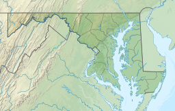
Thoms Cove,[3] the nickname for Thomas Cove,[4] is a natural cove approximately 1,500 feet (0.28 mi) in diameter in Hawkins Point, Baltimore on the northeastern end of the peninsula with the tidal Patapsco River to the northeast, Curtis Bay to the northwest, Hawkins Point[4][5] to the west and I-695 to the south.
| Thoms Cove | |
|---|---|
 Thoms Cove | |
| Location | Hawkins Point, Baltimore |
| Coordinates | 39°12′43″N 76°32′49″W / 39.212°N 76.547°W[1][2] |
| River sources | Patapsco River |
| Max. width | 3,000 feet (910 m) |
| Average depth | 80 feet (24 m) |
| Salinity | Brackish |
| Shore length1 | 6,000 feet (1,800 m) |
| Frozen | Seasonal |
| Islands | 0 |
| Settlements | Baltimore |
| 1 Shore length is not a well-defined measure. | |
Thoms Cove is bordered by Eastalco Aluminum Company's loading and storage facility[6] and a Superfund landfill.[4] It is in the USGS quadrangle "Curtis Bay" and a Maryland grid coordinate of 500800N and 928000E[3] and is largely administered by the Maryland Port Administration.

References edit
- ^ "Google Map of Thoms Cove". Retrieved January 17, 2013.
- ^ 369003013 Thoms Cove on OpenStreetMap
- ^ a b "Facts About Thoms Cove Site I & II" (PDF). Maryland Department of the Environment. August 21, 2007. Retrieved January 17, 2013.
- ^ a b c "MES Hawkins Point Hazardous Waste Landfill". US EPA. October 2012. Retrieved January 17, 2013.
- ^ Keith, Robert C. (21 April 2005). Baltimore Harbor: A Pictorial History. p. 38. ISBN 9780801879807.
- ^ "Facts About Eastalco Compensatory Storage Facility (MD-561)" (PDF). Maryland Department of the Environment. Retrieved January 17, 2013.