


Summary
Tianwendian (Chinese: 天文点; pinyin: Tiānwén diǎn; lit. 'astronomical point') is the name of a border outpost and a military defence area of China in the northern Aksai Chin region under its administration (as part of Xinjiang).[3][4] The region is roughly equivalent to the portion of Depsang Plains under Chinese control. Its headquarters, the Tianwendian outpost, is in the Chip Chap River valley close to China's Line of Actual Control with India.
Tianwendian
天文点 | |
|---|---|
military defence area and border post | |
 Tianwendian  Tianwendian | |
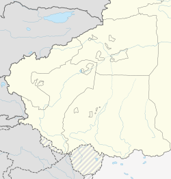
| Coordinates: 35°19′52″N 78°10′44″E / 35.331°N 78.179°E | |
| Elevation | 5,171.2 m (16,965.9 ft) |
| Tianwendian | |||||||||
|---|---|---|---|---|---|---|---|---|---|
| Traditional Chinese | 天文點 | ||||||||
| Simplified Chinese | 天文点 | ||||||||
| Literal meaning | astronomical point | ||||||||
| |||||||||
Name edit
Tianwendian means "astronomical point" in Chinese. The first two characters "tiānwén" (天文; lit. 'celestial pattern') is the Chinese word for "astronomy." The name is said to have been used to describe a military defence area in northern Aksai Chin in the run-up to the 1962 Sino-Indian War.[3][5] The region was also referred to as the "sky defence area" (Chinese: 天防区; pinyin: Tiān fángqū).[5] The name is an obvious allusion to the high elevation of the area, reported as 6200 metres above sea level.[6][5]
The region extends till the next defence area to the south, viz., Heweitan ("river beach").[7] The Depsang Bulge area has been referred to as the "South Tianwendian Valley",[8] its river Burtsa Nala as "Tiannan",[9] and its mountain pass to the Jeong Nala valley as the "Tianhexi Pass"—the "western pass between Tian(wendian) and He(weitan)".[10] In this respect, Tianwendian is the Chinese equivalent of India's "Depsang Plains".[8]
In the 1980s, a specific outpost named Tianwendian was established close to China's Line of Actual Control with India's Daulat Beg Oldi sector.[11][12] Now it is more common to use the name to refer to the outpost than the defence area.
Military outpost edit

China originally established a military outpost in 1959 at Point 5243 (Chinese: 5243哨卡), which is at an elevation of 5243 meters above sea level.[13][14][15][5] It was composed of a border company.[16][17] In the run up to the 1962 war, China called the entire area Tianwendian Defence Area and used the Point 5243 post as its headquarters.[14][15]
The newer Tianwendian post was established after the 1962 war. China said it was an astronomical observatory. A few years later India realised that it was an not an observatory but a military post. Over the years, China has continued to expand the post.[12]
Around the time of the 2013 Daulat Beg Oldi incident, PLA constructed a radar station, an 11 m radome at an elevation of 5530m, at this outpost.[18][12]
Forward Post 5390 edit
Between 2006 and 2008, China constructed forward post 5390 (named after the highest point in that area).[12]
India-China Border Meeting point edit
The highest of the five Border Personnel Meeting points is located near Tianwendian. The Indian camp at Daulat Beg Oldi serves as the counter-party for this meeting point.[19]
See also edit
References edit
- ^ Baiping, Zhang (2000). "Kunlun Mountains Region". Mountain Geoecology and Sustainable Development of the Tibetan Plateau. GeoJournal Library. Vol. 57. pp. 349–372. doi:10.1007/978-94-010-0965-2_17. ISBN 978-94-010-3800-3. ISSN 0924-5499.
Tianwendian (5171.2 m)
- ^ "海拔5170米 天文点官兵扎根奉献". Xinwen Lianbo. CCTV-13. 22 December 2013. Retrieved 30 December 2019.
海拔5170米 天文点官兵扎根奉献
- ^ a b Sandhu, Shankar & Dwivedi 2015, p. 44: "The northernmost area is called the Tianwendian or the Astronomical Defence Area which has very high (6200 m) and low mountain peaks and, a comparatively shallow and broad Chip Chap River Valley."
- ^ 地貌气候. 和田县政府门户网站 (in Simplified Chinese). 29 April 2019. Retrieved 23 December 2019.
海拔5 000米以上的天文点、空喀山口一带,
- ^ a b c d
分享至 (Fengxiang Zhi) (28 May 2018). "Nàxiē nián, wǒ zài zhōng yìn biānjiè de jiānshǒu" 那些年,我在中印边界的坚守 [In those years, I stood firm on the Sino-Indian border]. Sina. Archived from the original on 16 December 2020. Retrieved 16 December 2020.
总卡5243哨卡...我们天防区的总卡叫5243,海拔高度就是5243米,是天防区最低的哨卡
[The headquarters is 5243 checkpoint... The headquarters in our sky defense area is called 5243, and the altitude is 5243 meters, which is the lowest checkpoint in the sky defense area.] - ^ Sandhu, Shankar & Dwivedi 2015, p. 44.
- ^ Sandhu, Shankar & Dwivedi 2015, pp. 44–45.
- ^ a b
Wai, Jiao Bu, ed. (2014), China's Foreign Affairs, China Department of Policy Planning / World Affairs Press, p. 189,
The two countries also promptly handled the situation when their border troops came to a face-to-face situation in South Tianwendian Valley (Depsang Plains area referred to by the Indian side).
- ^ Burtsa Nala, OpenStreetMap, retrieved 8 September 2022.
- ^ Tianhexi Pass, OpenStreetMap, retrieved 8 September 2022.
- ^ Tianwendian, OpenStreetMap, retrieved 8 September 2022.
- ^ a b c d Bhat, Col Vinayak (25 June 2020). "New radar, water pipelines: Satellite images decode Chinese troop movement in Ladakh's Depsang". India Today. Retrieved 29 September 2020.
- ^ Point 5243, OpenStreetMap, retrieved 17 December 2020.
- ^ a b Sandhu, Shankar & Dwivedi 2015, pp. 44–46
- ^ a b Nath, Rajendra (2016). Strategic Ladakh: A Historical Narrative 1951-53 and a Military Perspective. Vij Books India Pvt Ltd. Chapter 12, p. 188. ISBN 978-93-85563-50-8.
- ^
陈杰 (Chen Jie) (19 December 2013). 王建民 (Wang Jianmin) (ed.). "守防在昆仑之巅 记新疆军区某边防团天文点边防连[组图]" [Defence at the top of Kunlun: A border defense company at the astronomical point of a border defense regiment in the Xinjiang Military Region [Photos]] (in Chinese). China.com.cn. Retrieved 14 December 2019.
天文点边防连组建于1959年。
[The Tianwendian Border Defence Company was established in 1959.] - ^
"Zǒng zhèngzhì bùxià fā tōngzhī yāoqiú quán jūn hé wǔjǐng bùduì rènzhēn xuéxí tiānwén diǎn biānfáng lián shìjì jīngyàn dàlì hóngyáng wǒ jūn guānbīng yīzhì yōuliáng chuántǒng" 总政治部下发通知要求全军和武警部队认真学习天文点边防连事迹经验 大力弘扬我军官兵一致优良传统 [The General Political Department issued a notice requesting the whole army and the armed police forces: Earnestly learn from the deeds and experience of the Astronomical Point Border Defense Company, and vigorously promote the consistent fine traditions of our military officers and soldiers], PLA Daily, 14 July 2014 – via cpc.people.com.cn,
The astronomical point border defense company of a regiment of the Xinjiang Military Region was established in 1959 and is stationed in a life restricted zone at an altitude of 5,170 meters.
- ^ Bhat, Vinayak (25 August 2017). "China's string of radars in Ladakh track every move of Indian Army – ThePrint". ThePrint. Retrieved 5 January 2020.
The Depsang area came into the limelight during 2013 Daulat Beg Oldie incident when the PLA pitched tents and constructed watchtowers much higher than required. At that time, China had also constructed a huge radar on a hillock north of their post called Tianwendian.
- ^ "Indian, Chinese armies decide to improve ties at functional level". News18. 2 January 2016. Retrieved 14 September 2017.
Bibliography edit
- Sandhu, P. J. S.; Shankar, Vinay; Dwivedi, G. G. (2015). 1962: A View from the Other Side of the Hill. Vij Books India Pvt Ltd. ISBN 978-93-84464-37-0.