
KNOWPIA
WELCOME TO KNOWPIA

Tianzhu County, Guizhou 
Summary
Tianzhu County (simplified Chinese: 天柱县; traditional Chinese: 天柱縣; pinyin: Tiānzhù Xiàn) is a county in eastern Guizhou province, China, bordering Hunan province to the north, east, and southeast. It is under the administration of the Qiandongnan Miao and Dong Autonomous Prefecture.
Tianzhu County
天柱县 | |
|---|---|
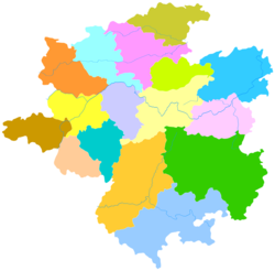 Tianzhu is the easternmost division in this map of Qiandongnan | |
 Qiandongnan in Guizhou | |
| Coordinates (Tianzhu County government): 26°54′35″N 109°12′28″E / 26.9097°N 109.2078°E | |
| Country | China |
| Province | Guizhou |
| Autonomous prefecture | Qiandongnan |
| Area | |
| • Total | 2,201 km2 (850 sq mi) |
| Population (2010) | |
| • Total | 263,841 |
| • Density | 120/km2 (310/sq mi) |
| Time zone | UTC+8 (China Standard) |
Administrative divisions edit
Tianzhu County is divided into 3 subdistricts, 11 towns and 2 townships:[1]
- subdistricts
- Fengcheng 凤城街道
- Bangdong 邦洞街道
- Shexue 社学街道
- towns
- Pingdi 坪地镇
- Lantian 兰田镇
- Wengdong 瓮洞镇
- Gaoniang 高酿镇
- Shidong 石洞镇
- Yuankou 远口镇
- Chachu 坌处镇
- Baishi 白市镇
- Duma 渡马镇
- Zhulin 竹林镇
- Jiangdong 江东镇
- townships
- Zhuxi 注溪乡
- Dihu 地湖乡
Climate edit
| Climate data for Tianzhu, elevation 401 m (1,316 ft), (1991–2020 normals, extremes 1981–2010) | |||||||||||||
|---|---|---|---|---|---|---|---|---|---|---|---|---|---|
| Month | Jan | Feb | Mar | Apr | May | Jun | Jul | Aug | Sep | Oct | Nov | Dec | Year |
| Record high °C (°F) | 26.0 (78.8) |
31.5 (88.7) |
35.4 (95.7) |
35.1 (95.2) |
35.2 (95.4) |
35.7 (96.3) |
38.1 (100.6) |
37.8 (100.0) |
36.9 (98.4) |
34.9 (94.8) |
30.7 (87.3) |
25.2 (77.4) |
38.1 (100.6) |
| Mean daily maximum °C (°F) | 8.6 (47.5) |
11.5 (52.7) |
15.9 (60.6) |
22.3 (72.1) |
26.2 (79.2) |
28.9 (84.0) |
31.6 (88.9) |
31.5 (88.7) |
28.0 (82.4) |
22.2 (72.0) |
17.2 (63.0) |
11.4 (52.5) |
21.3 (70.3) |
| Daily mean °C (°F) | 5.1 (41.2) |
7.5 (45.5) |
11.4 (52.5) |
17.1 (62.8) |
21.2 (70.2) |
24.4 (75.9) |
26.6 (79.9) |
25.9 (78.6) |
22.4 (72.3) |
17.3 (63.1) |
12.3 (54.1) |
7.1 (44.8) |
16.5 (61.7) |
| Mean daily minimum °C (°F) | 2.8 (37.0) |
4.8 (40.6) |
8.4 (47.1) |
13.5 (56.3) |
17.6 (63.7) |
21.3 (70.3) |
22.9 (73.2) |
22.2 (72.0) |
18.8 (65.8) |
14.2 (57.6) |
9.1 (48.4) |
4.3 (39.7) |
13.3 (56.0) |
| Record low °C (°F) | −8.2 (17.2) |
−5.3 (22.5) |
−2.3 (27.9) |
3.1 (37.6) |
6.7 (44.1) |
12.6 (54.7) |
15.4 (59.7) |
16.0 (60.8) |
10.7 (51.3) |
2.8 (37.0) |
−1.3 (29.7) |
−5.3 (22.5) |
−8.2 (17.2) |
| Average precipitation mm (inches) | 54.8 (2.16) |
55.5 (2.19) |
94.4 (3.72) |
129.6 (5.10) |
197.2 (7.76) |
236.0 (9.29) |
173.3 (6.82) |
133.8 (5.27) |
96.1 (3.78) |
86.6 (3.41) |
61.9 (2.44) |
44.7 (1.76) |
1,363.9 (53.7) |
| Average precipitation days (≥ 0.1 mm) | 15.8 | 14.9 | 18.4 | 17.7 | 17.5 | 16.9 | 12.8 | 12.3 | 10.6 | 13.4 | 11.8 | 11.6 | 173.7 |
| Average snowy days | 3.8 | 2.0 | 0.4 | 0 | 0 | 0 | 0 | 0 | 0 | 0 | 0 | 1.3 | 7.5 |
| Average relative humidity (%) | 83 | 81 | 82 | 81 | 81 | 83 | 80 | 81 | 81 | 82 | 82 | 80 | 81 |
| Mean monthly sunshine hours | 36.8 | 45.9 | 59.5 | 89.3 | 105.1 | 96.7 | 168.5 | 172.2 | 127.2 | 91.9 | 84.2 | 65.3 | 1,142.6 |
| Percent possible sunshine | 11 | 14 | 16 | 23 | 25 | 23 | 40 | 43 | 35 | 26 | 26 | 20 | 25 |
| Source: China Meteorological Administration[2][3] | |||||||||||||
References edit
- ^ 2023年统计用区划代码和城乡划分代码:天柱县 (in Simplified Chinese). National Bureau of Statistics of China.
- ^ 中国气象数据网 – WeatherBk Data (in Simplified Chinese). China Meteorological Administration. Retrieved 28 April 2023.
- ^ 中国气象数据网 (in Simplified Chinese). China Meteorological Administration. Retrieved 28 April 2023.