
KNOWPIA
WELCOME TO KNOWPIA

Tiaret Province 
Summary
Tiaret (Arabic: ولاية تيارت) is a province (wilaya) of Algeria. The capital is Tiaret.
Tiaret Province
ولاية تيارت | |
|---|---|
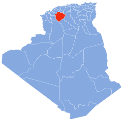 Map of Algeria highlighting Tiaret | |
| Coordinates: 35°23′N 01°20′E / 35.383°N 1.333°E | |
| Country | |
| Capital | Tiaret |
| Area | |
| • Total | 20,673 km2 (7,982 sq mi) |
| Population (2008)[1] | |
| • Total | 842,063 |
| • Density | 41/km2 (110/sq mi) |
| Time zone | UTC+01 (CET) |
| Area Code | +213 (0) 46 |
| ISO 3166 code | DZ-14 |
| Districts | 14 |
| Municipalities | 42 |
The National Stud Farm of Chaouchaoua is located in the province of Tiaret.
History edit
The province was created from El Asnam department and Tiaret department in 1974. In 1984 Tissemsilt Province was carved out of its territory.
Administrative division edit
The province is divided into 14 districts (daïras), which are further divided into 42 communes or municipalities.
Districts edit
Communes edit
- Aïn Bouchekif
- Aïn Deheb
- Aïn El Hadid
- Aïn Kermes
- Aïn Zarit
- Bougara
- Chehaima
- Dahmouni
- Djebilet Rosfa
- Djillali Ben Omar
- Faidja
- Frenda
- Guertoufa
- Hamadia
- Ksar Chellala
- Madna
- Mahdia
- Mechraa Safa
- Medrissa
- Medroussa
- Meghila
- Mellakou
- Nadorah
- Naima
- Oued Lilli
- Rahouia
- Rechaiga
- Sebaine
- Sebt
- Serghine
- Si Abdelghani
- Sidi Abderrahmane
- Sidi Ali Mellal
- Sidi Bakhti
- Sidi Hosni
- Sougueur
- Tagdemt
- Takhemaret
- Tiaret
- Tidda
- Tousnina
- Zmalet El Emir Abdelkader
References edit
- ^ Office National des Statistiques, Recensement General de la Population et de l’Habitat 2008 Archived 2008-07-24 at the Wayback Machine Preliminary results of the 2008 population census. Accessed on 2008-07-02.
External links edit
- (in French) Official website