


Summary
Timoudi (Arabic: ﺗﻴﻤﻮدى) is a town and commune in Kerzaz District, Béchar Province, in western Algeria. According to the 2008 census its population is 2,389,[2] up from 2,116 in 1998,[3] with an annual population growth rate of 1.2%.[2] The area of the commune is 6,175 square kilometres (2,384 sq mi).[1]
Timoudi
ﺗﻴﻤﻮدى | |
|---|---|
Commune and town | |
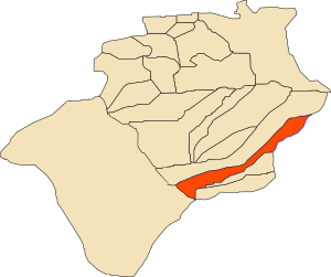 Location of Timoudi commune within Béchar Province | |
 Timoudi Location of Timoudi within Algeria | |
| Coordinates: 29°19′N 1°8′W / 29.317°N 1.133°W | |
| Country | |
| Province | Béchar Province |
| District | Kerzaz District |
| Area | |
| • Total | 6,175 km2 (2,384 sq mi) |
| Elevation | 359 m (1,178 ft) |
| Population (2008)[2] | |
| • Total | 2,389 |
| • Density | 0.39/km2 (1.0/sq mi) |
| Time zone | UTC+1 (CET) |
Geography edit
Timoudi lies at 359 metres (1,178 ft) in the Saoura valley on the banks of Oued Saoura, a wadi that marks the western edge of the Grand Erg Occidental, a large area of sand dunes in the Sahara desert.
Climate edit
Timoudi has a hot desert climate (Köppen climate classification BWh), with extremely hot summers and cool winters, and very little precipitation throughout the year.
Economy edit
Agriculture is the main industry in Timoudi. The commune has a total of 571 hectares (1,410 acres) of arable land, of which 366 hectares (900 acres) is irrigated.[4] There are a total of 54,000 date palms planted in the commune.[5] As of 2009 there were 1,009 sheep, 684 goats, 45 camels, and 10 cattle.[6]
Infrastructure and housing edit
95% of Timoudi's population is connected to drinking water,[7] 95% is connected to the sewerage system,[8] and 90% (including 729 buildings) have access to electricity.[9] There are no fuel service stations in the town; the nearest is in Kerzaz.[10]
Timoudi has a total of 628 houses, of which 204 are occupied, giving an occupation rate of 11.7 inhabitants per occupied building, by far the highest in the province.[11]
Transportation edit
Timoudi is located 9 kilometres (5.6 mi) from the N6 highway, on a local road that leads northeast from the highway to the town. The town of Ouled Khoudir is 11 kilometres (7 mi) southeast of Timoudi, while the town of Kerzaz is 34 kilometres (21 mi) to the northwest, and 60 kilometres (37 mi) by road.[12] Timoudi is 391 kilometres (243 mi) from the provincial capital, Béchar.[12]
There is a total length of 42.2 kilometres (26.2 mi) of roads in the commune.[13]
Education edit
There are 3 elementary schools, with 21 classrooms including 15 in use.[14] There are a total of 634 school students.[15]
4.3% of the population has a tertiary education, and another 16.7% has competed secondary education.[16] The overall literacy rate is 72.3%, and is 86.4% among males and 58.3% among females.[17]
Health edit
Timoudi has 3 room care facilities, but otherwise few healthcare services are available. The nearest polyclinic is in Ouled Khoudir, and the nearest hospital is in Béni Abbès.[18]
Religion edit
Localities edit
The commune is composed of four localities:[20]
- Timoudi
- Boutarfaya
- Ben-Abdelkader
- Lemouih
References edit
- ^ a b "Population, Area and Density per Commune" (in French). Official Website of the Wilaya of Bechar. Archived from the original on 22 February 2014. Retrieved 16 March 2013.
- ^ a b c "Population: Béchar Wilaya" (PDF) (in French). Office National des Statistiques Algérie. Retrieved 13 February 2013.
- ^ "Algeria Communes". Statoids. Retrieved 9 March 2013.
- ^ "Distribution of Agricultural Land" (in French). Official Website of the Wilaya of Bechar. Archived from the original on 10 July 2014. Retrieved 9 March 2013.
- ^ "Plant Productions" (in French). Official Website of the Wilaya of Bechar. Archived from the original on 20 August 2014. Retrieved 9 March 2013.
- ^ "Animal Production" (in French). Official Website of the Wilaya of Bechar. Archived from the original on 20 August 2014. Retrieved 9 March 2013.
- ^ "Drinking Water" (in French). Official Website of the Wilaya of Bechar. Archived from the original on 9 July 2014. Retrieved 9 March 2013.
- ^ "Sewerage Networks" (in French). Official Website of the Wilaya of Bechar. Archived from the original on 10 July 2014. Retrieved 9 March 2013.
- ^ "Electrification" (in French). Official Website of the Wilaya of Bechar. Archived from the original on 9 July 2014. Retrieved 9 March 2013.
- ^ "Fuel Distribution" (in French). Official Website of the Wilaya of Bechar. Archived from the original on 10 July 2014. Retrieved 9 March 2013.
- ^ "Housing" (in French). Official Website of the Wilaya of Bechar. Archived from the original on 4 March 2016. Retrieved 9 March 2013.
- ^ a b "Presentation" (in French). Site Officiel de la Wilaya de Béchar. Archived from the original on 16 February 2013. Retrieved 19 February 2013.
- ^ "Density Kilometres" (in French). Official Website of the Wilaya of Bechar. Archived from the original on 29 April 2014. Retrieved 9 March 2013.
- ^ "School Infrastructure" (in French). Official Website of the Wilaya of Bechar. Archived from the original on 29 April 2014. Retrieved 9 March 2013.
- ^ "Number of Pupils" (in French). Official Website of the Wilaya of Bechar. Archived from the original on 4 March 2016. Retrieved 9 March 2013.
- ^ "Structure relative de la population résidente des ménages ordinaires et collectifs âgée de 6 ans et plus selon le niveau d'instruction et la commune de résidence" (PDF) (in French). Office National des Statistiques Algérie. Retrieved 13 February 2013.
- ^ "Taux d'analphabétisme et taux d'alphabétisation de la population âgée de 15 ans et plus, selon le sexe et la commune de résidence " (PDF) (in French). Office National des Statistiques Algérie. Retrieved 13 February 2013.
- ^ "Health Facilities by Commune" (in French). Official Website of the Wilaya of Bechar. Archived from the original on 29 April 2014. Retrieved 9 March 2013.
- ^ "Mosques and Koranic Rooms" (in French). Official Website of the Wilaya of Bechar. Archived from the original on 4 March 2016. Retrieved 9 March 2013.
- ^ "Décret n° 84-365, fixant la composition, la consistance et les limites territoriale des communes. Wilaya d'El Oued" (PDF) (in French). Journal officiel de la République Algérienne. 19 December 1984. p. 1490. Archived from the original (PDF) on 2011-07-31. Retrieved 2 March 2013.