
KNOWPIA
WELCOME TO KNOWPIA

Tinchebray 
Summary
Tinchebray (French pronunciation: [tɛ̃ʃ(ə)bʁɛ] ⓘ) is a former commune in the Orne department in the Lower Normandy region in north-western France. On 1 January 2015, Tinchebray and six other communes merged becoming one commune called Tinchebray-Bocage.
Tinchebray | |
|---|---|
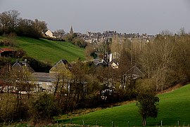
Part of Tinchebray-Bocage | |
 | |
Location of Tinchebray .mw-parser-output .locmap .od{position:absolute}.mw-parser-output .locmap .id{position:absolute;line-height:0}.mw-parser-output .locmap .l0{font-size:0;position:absolute}.mw-parser-output .locmap .pv{line-height:110%;position:absolute;text-align:center}.mw-parser-output .locmap .pl{line-height:110%;position:absolute;top:-0.75em;text-align:right}.mw-parser-output .locmap .pr{line-height:110%;position:absolute;top:-0.75em;text-align:left}.mw-parser-output .locmap .pv>div{display:inline;padding:1px}.mw-parser-output .locmap .pl>div{display:inline;padding:1px;float:right}.mw-parser-output .locmap .pr>div{display:inline;padding:1px;float:left}html.skin-theme-clientpref-night .mw-parser-output .od,html.skin-theme-clientpref-night .mw-parser-output .od .pv>div,html.skin-theme-clientpref-night .mw-parser-output .od .pl>div,html.skin-theme-clientpref-night .mw-parser-output .od .pr>div{background:#000;color:#fff}html.skin-theme-clientpref-night .mw-parser-output .locmap{filter:grayscale(0.6)}@media(prefers-color-scheme:dark){html.skin-theme-clientpref-os .mw-parser-output .locmap{filter:grayscale(0.6)}html.skin-theme-clientpref-os .mw-parser-output .od,html.skin-theme-clientpref-os .mw-parser-output .od .pv>div,html.skin-theme-clientpref-os .mw-parser-output .od .pl>div,html.skin-theme-clientpref-os .mw-parser-output .od .pr>div{background:#000;color:#fff}}  Tinchebray  Tinchebray | |
| Coordinates: 48°45′49″N 0°43′59″W / 48.7636°N 0.7331°W | |
| Country | France |
| Region | Normandy |
| Department | Orne |
| Arrondissement | Argentan |
| Canton | Domfront |
| Commune | Tinchebray-Bocage |
| Area 1 | 26.52 km2 (10.24 sq mi) |
| Population (2019)[1] | 2,580 |
| • Density | 97/km2 (250/sq mi) |
| Demonym | Tinchebrayens |
| Time zone | UTC+01:00 (CET) |
| • Summer (DST) | UTC+02:00 (CEST) |
| Postal code | 61800 |
| Elevation | 152–311 m (499–1,020 ft) |
| Website | www.tinchebray.fr |
| 1 French Land Register data, which excludes lakes, ponds, glaciers > 1 km2 (0.386 sq mi or 247 acres) and river estuaries. | |
History edit
It was the scene of the Battle of Tinchebray fought on 28 September 1106.
During the Second World War, it was liberated by Allied forces on 15 August 1944.[2]
Heraldry edit
 |
The arms of Tinchebray are blazoned : Gules, a key between 2 pairs of shuttles each pair in saltire argent, on a chief gules a lion passant between 2 fleurs de lys Or. |
See also edit
References edit
Wikimedia Commons has media related to Tinchebray.