


Summary
The Tod Reservoir is located on the Eyre Peninsula in South Australia, in the localities of Whites Flat and Koppio, 27 km north of Port Lincoln. It is situated on the Tod River, the only stream on Eyre Peninsula, South Australia providing reliable flows; the reservoir is supplied by concrete channels fed from weirs constructed across the Tod River and its major tributary, Pillaworta Creek.[1][2] The river was named after Robert Tod, who discovered it during explorations in 1839.[3] The Tod River flows into Louth Bay in Spencer Gulf. The reservoir is listed on the South Australian Heritage Register.[4]
| Tod Reservoir | |
|---|---|
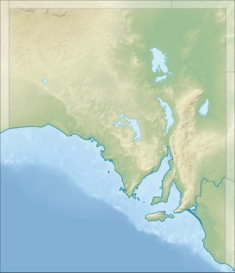 Location of the Tod Reservoir in South Australia | |
| Location | South Australia |
| Coordinates | 34°28′55″S 135°50′49″E / 34.482°S 135.847°E |
| Construction began | 1918 |
| Opening date | 1922 |
| Dam and spillways | |
| Height | 25 m |
| Length | 351 m |
| Reservoir | |
| Total capacity | 11 300 ML |
| Catchment area | Tod River & Pillaworta Creek |
| Surface area | 134 hectares (330 acres) |
Tod River Reservoir Museum & Picnic Area edit
A museum which features audio and visual displays is located off White Flat Road, northwest of Poonindie. Grounds include a playground, tennis court, coin-operated barbecues and a picnic area. Grounds are open 7 days. The museum is open Monday to Friday, from 9am to 4pm.[5][6]
Construction edit

Mr C. A. Bayer presented the merits of a dam on the Tod River to the Royal Commission in 1916.[3] An earth embankment dam was built on the Tod River between 1918 and 1922 at a cost of $562,000.[1] In 1921, 600 men were employed on the project.[7] The reservoir overflowed for the first time in August 1932.[8] The water level reached its lowest point in its history in 1949. Low water problems persisted in 1950. In 1951, new pumps were installed at the reservoir.[citation needed]
Fatalities edit
Seven people died during the dam's construction. In late 1918, three men were killed in a cave-in. Another four died in two separate blasting accidents in 1921.[1] A memorial to all seven men was erected at the picnic area near the embankment in 1982.[1]
Status edit
The catchment yield for the Tod River is estimated to be 11 gigalitres per annum, though this can reduce significantly during periods of drought.[9]
While for some years[when?] up to 3,000 ML/year of water was extracted from the reservoir for potable use, negligible water has been extracted since 2001-2002. Reasons for the change include increasing salinity and concerns about the levels of agricultural chemicals in the reservoir. The reservoir has been retained as a ‘contingency' water supply measure since that time.[1][10]
In April 2011, the Department for Water listed three possible options for the future use of the Tod Reservoir. They were:[9]
- Catchment rehabilitation to improve the health of the Tod Reservoir and the quality of its inflows
- Potential recreational use
- Decommissioning and removing the dam wall
There is widespread support in the Eyre Peninsula community for recommissioning the Tod Reservoir using desalination.
SA Water investigated this option and concluded it was not viable because of the difficulty in finding an environmentally suitable location for brine waste disposal. SA Water also concluded there was insufficient volume of water available in the reservoir to justify desalination. Alternative views exist, with others suggesting that desalination could be viable with some further engineering and catchment management considerations.[10]
In 2013, the reservoir's future has been the topic of Parliamentary debate, including speculation over its future use by iron ore mining company, Centrex Metals.[11]
In September 2014, the Port Lincoln Times reported that the Tod River Reservoir would be opened to recreational fishing and would be stocked with "recreationally attractive species." The change was expected to occur within the 2014-2015 financial year.[12]
Statistics edit
Capacity: 11,300 megalitres
Length of wall: 351m
Height of wall: 25m
Type of wall: Earth with clay core
Area of water spread: 134 hectares[1]
See also edit
References edit
- ^ a b c d e f "Tod River Reservoir". SA Water - Community and Education - Our Water Systems. Archived from the original on 18 March 2015. Retrieved 7 December 2013.
- ^ "Tod River Reservoir". SA Water. Retrieved 28 July 2022.
- ^ a b Trove "Tod River Reservoir - A Triumph of Engineering" Port Lincoln Times, Friday 7 February 1930.
- ^ "Tod Reservoir". South Australian Heritage Register. Department of Environment, Water and Natural Resources. Retrieved 2 March 2016.
- ^ "Tod River Reservoir Museum & Picnic Area" SACommunity.org Retrieved 2013-12-07.
- ^ "Tod River Reservoir". District Council of Tumby Bay. Retrieved 15 July 2015.
- ^ Trove "Three Excavators Killed at Tod River Reservoir" Barrier Miner Friday 9 December 1921
- ^ Trove "Tod River Reservoir Overflowing" News Thursday 11 August 1932
- ^ a b Eyre Peninsula Demand & Supply Statement. Adelaide, South Australia: Government of South Australia, Department for Water. 2011. pp. 23, 34.
- ^ a b "Eyre Peninsula Water Supply Final Report 85th Report of the Natural Resources Committee - Under the lens" (PDF). 13 November 2013. Archived (PDF) from the original on 13 November 2013. Retrieved 29 July 2021.
- ^ "The Future of the Tod Reservoir" Port Lincoln Residents & Ratepayers Association Retrieved 2013-12-07.
- ^ Harrison, Billie. "Plan to fish in the Tod". Retrieved 20 June 2015.