
KNOWPIA
WELCOME TO KNOWPIA

Transdanubian Mountains 
Summary
The Transdanubian Mountains (sometimes also referred to as Bakony Forest, Dunántúl Highlands, Highlands of Dunántúl, Highlands of Transdanubia, Mountains of Dunántúl, Mountains of Transdanubia, Transdanubian Central Range, Transdanubian Hills, Transdanubian Midmountains or Transdanubian Mid-Mountains, Hungarian: Dunántúli-középhegység)[1][2] are a mountain range in Hungary covering about 7000 km2. Its highest peak is the Pilis, with a height of 757 m (2,484 ft).
| Transdanubian Mountains | |
|---|---|
 | |
| Location | Komárom-Esztergom, Fejér, Veszprém, Zala, Pest counties, Hungary |
| Territory | 7,000 km2 |
| Highest point | Pilis, 757 m |
| Lowest point | Danube river |
| Terrain | Lower mountains and hills |

Parts of the mountains edit
- Bakony
- Southern Bakony
- Northern Bakony
- Keszthely Plateau
- Tapolca Basin
- Balaton Uplands
- Bakonyalja
- Sokoró Hills
- Vértes Mountains
- Vértesalja (Bársonyos)
- Velence Hills
- Dunazug Mountains
Visegrád Mountains are often considered a part of it for geopolitical reasons, but geographically they are part of the North Hungarian Mountains.
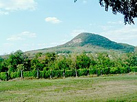
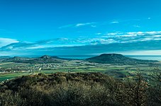
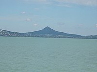
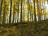
Gallery edit
References edit
- ^ Gábor Gercsák (2002). "Hungarian geographical names in English language publications" (PDF). Studia Cartologica. Eötvös Loránd University. Archived from the original (PDF) on 20 March 2012. Retrieved 30 April 2011.
- ^ Gábor Gercsák (2005). "Magyar tájnevek angol fordítása" (PDF). Fasciculi Linguistici / Series Lexicographica (in Hungarian). Eötvös Loránd University. Archived from the original (PDF) on 20 March 2012. Retrieved 30 April 2011.
Sources edit
- https://www.arcanum.hu/hu
- http://www.karpat-medence.hu (In Hungarian)
See also edit
Wikimedia Commons has media related to Transdanubian Mountains.
47°15′00″N 17°50′00″E / 47.25°N 17.8333°E