


Summary
Trawden Forest is a civil parish in the Pendle district of Lancashire, England. It has a population of 2,765,[1] and contains the village of Trawden (formerly called Beardshaw) and the hamlets of Cottontree, Winewall and Wycoller. Boulsworth Hill is a well known local landmark situated within the parish. It takes its name from a medieval royal forest or "chase" which was in the same area.
| Trawden Forest | |
|---|---|
 Trawden countryside | |
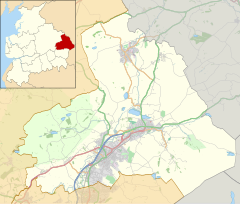 Trawden Forest Location in Pendle Borough  Trawden Forest Location within Lancashire | |
| Population | 2,765 (2011) |
| OS grid reference | SD9139 |
| Civil parish |
|
| District | |
| Shire county | |
| Region | |
| Country | England |
| Sovereign state | United Kingdom |
| Post town | Colne |
| Postcode district | BB8 |
| Dialling code | 01282 |
| Police | Lancashire |
| Fire | Lancashire |
| Ambulance | North West |
| UK Parliament | |
Trawden was once a township in the ancient parish of Whalley. This became a civil parish in 1866, forming an urban district from 1894.[2]
The parish adjoins the Pendle parishes of Nelson, Colne and Laneshaw Bridge, the Burnley parish of Briercliffe and West Yorkshire.
According to the United Kingdom Census 2011, the parish has a population of 2,765,[1] an increase from 2,580 in the 2001 census.[3]
Media gallery edit
-

-
 The Brontë Way crossing Brink Ends Moor
 -
 Church of St Mary the Virgin, Trawden
 -
 Wycoller Beck
 -
 The ruins of Wycoller Hall


See also edit
References edit
Citations
- ^ a b UK Census (2011). "Local Area Report – Trawden Forest Parish (1170215077)". Nomis. Office for National Statistics. Retrieved 23 February 2018.
- ^ "Trawden Tn/CP through time". visionofbritain.org.uk. GB Historical GIS / University of Portsmouth. Retrieved 27 June 2015.
- ^ Office for National Statistics : Census 2001 : Parish Headcounts : Pendle Retrieved 2009-09-18
External links edit
![]() Media related to Trawden Forest at Wikimedia Commons
Media related to Trawden Forest at Wikimedia Commons
- Map of modern parish boundary at Lancashire County Council website