


Summary
Treeby is a southern suburb of Perth, Western Australia, located within the City of Cockburn. It is located on the east side of the Kwinana Freeway, close to Cockburn Central.
| Treeby Perth, Western Australia | |||||||||||||||
|---|---|---|---|---|---|---|---|---|---|---|---|---|---|---|---|
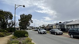 Elderflower Street, Treeby, viewed from east. | |||||||||||||||
 | |||||||||||||||
| Coordinates | 32°07′15″S 115°53′33″E / 32.120817°S 115.8924972°E[1] | ||||||||||||||
| Population | 4,214 (SAL 2021)[2] | ||||||||||||||
| Established | 2016 | ||||||||||||||
| Postcode(s) | 6164 | ||||||||||||||
| Area | 8.2 km2 (3.2 sq mi)[3] | ||||||||||||||
| Location | 23 km (14 mi) from Perth | ||||||||||||||
| LGA(s) | City of Cockburn | ||||||||||||||
| Region | South Metropolitan Perth | ||||||||||||||
| State electorate(s) | Jandakot | ||||||||||||||
| Federal division(s) | Fremantle | ||||||||||||||
| |||||||||||||||
History edit
Treeby is primarily a rural area, originally part of Banjup but made a separate suburb in 2016 from the portion of Banjup that extended north of Armadale Road.[4][5] Situated on land traditionally inhabited by the Beeliar Whadjuk of the Noongar people, it is named after Joseph and Emma Treeby, early colonial settlers of the area.[5][6] Arriving from South Australia with plans for apple orchards, the Treeby family established a market garden on over 14 hectares (35 acres) growing mainly cauliflower and cabbage.[citation needed]
In recent years, an area previously[when?] mined for sand was developed into a new residential estate called Calleya.[when?] Stockland has a large display village called Calleya with terraces, townhomes, house and land packages, and completed land. Stockland has sold over 1,100 house and land packages in Treeby.[1][7] There is also a new estate called Kara in the western part of the suburb.[8]
Geography edit
Treeby is bounded in the north by the eastern border of the Jandakot Industrial Area, Dollier Street, Fraser Road, and the City of Canning, and in the east by the City of Armadale. The suburb is also bounded by Jandakot Road, Candelore Road and Acourt Road in the north, Warton Road in the east, Armadale Road in the south, and the suburb of Jandakot, Dollier Street and Solomon Road in the west.
Education edit
Treeby has one primary school, Treeby Primary School, that opened in 2022 and caters for students from Kindergarten to Year 6.[9] Its intake area encompasses southern parts of Treeby and Jandakot.[10]
Transport edit
Road edit
Treeby is served by nearby roads including Jandakot Road, Armadale Road, and Warton Road. Access to Perth in the north and Rockingham in the south is via the Kwinana Freeway, accessible via interchanges at Armadale Road and Berrigan Drive. Jandakot Airport, the general aviation airport in its immediate northwestern vicinity, is reachable via Berrigan Drive, and Armadale Road is connected to North Lake Road via a bridge over Kwinana Freeway that opened in 2021.[11] Major roads in the suburb include Clementine Boulevard, Ghostgum Avenue, Greensand Promenade and Sapphire Drive.
Public transport edit
Transperth provides public bus services and trains for the Perth metropolitan area, and this includes regular bus services on route 523, which operates west to Cockburn Central station, located just outside the western boundary of Treeby, and Cockburn Gateway Shopping City in Success. Train services connect to Perth and Mandurah.
The suburb's closest railway stations are Cockburn Central and Aubin Grove, located in the suburbs of Cockburn Central and Atwell, respectively.
Bus edit
- 233 Cockburn Central Station to Gosnells Station – serves Armadale Road[12]
- 518 Cockburn Central Station to Murdoch TAFE – serves Armadale Road[13]
- 523 Cockburn Central Station to Treeby – serves Armadale Road, Ghostgum Avenue, Clementine Boulevard and Sapphire Drive[14]
- 529 Cockburn Central Station to Armadale Station – serves Armadale Road[15]
See also edit
References edit
- ^ a b "Treeby, the newest suburb for the City of Cockburn". Comment on Cockburn. Retrieved 23 September 2016.
- ^ Australian Bureau of Statistics (28 June 2022). "Treeby (suburb and locality)". Australian Census 2021 QuickStats. Retrieved 28 June 2022.
- ^ Australian Bureau of Statistics (28 June 2022). "2021 Community Profiles: Treeby (Suburbs and Localities)". 2021 Census of Population and Housing. Retrieved 16 July 2022.
- ^ David Allan-Petale (23 September 2016). "Perth's newest suburb revealed...and it's going to have plenty of shade". WA Today. Retrieved 23 September 2016.
- ^ a b "Banjup". City of Cockburn. 2022. Retrieved 16 February 2022.
As suburban development has moved south over the years, modern Cockburn suburbs have been carved out of the old Banjup borders: Success and Atwell in 1973, Hammond Park and Aubin Grove in 2002 and 2003 respectively, and Treeby in 2016.
- ^ Luff, Bryce (4 October 2016). "Treeby descendant says ancestors would've been embarrassed by fuss". Fremantle Gazette. Seven West Media. Retrieved 16 February 2022.
- ^ Luff, Bryce (16 February 2016). "City stands by Treeby decision". Community News Group. Retrieved 23 September 2016.
- ^ "Aerial Plan" (PDF). LWP Property Group. 2022. Retrieved 16 February 2022.
- ^ "Principal's Welcome". Treeby Primary School. 2022. Retrieved 17 February 2022.
- ^ "Treeby Primary School: Local Intake Area". Schools Online. Department of Education, Government of Western Australia. 2022. Retrieved 17 February 2022.
- ^ Saffioti, Rita (15 December 2021). "Congestion relief for Cockburn with opening of new bridge over Kwinana Freeway". Minister for Transport; Planning; Ports (Media Release). Western Australia: Commonwealth of Australia. Retrieved 17 February 2022.
- ^ "Route 233". Bus Timetable 17 (PDF). Transperth. 11 January 2024 [effective from 28 January 2024].
- ^ "Route 518". Bus Timetable 17 (PDF). Transperth. 11 January 2024 [effective from 28 January 2024].
- ^ "Route 523". Bus Timetable 122 (PDF). Transperth. 25 August 2023 [effective from 20 November 2023].
- ^ "Route 529". Bus Timetable 10 (PDF). Transperth. 25 August 2023 [effective from 20 November 2023].
External links edit
![]() Media related to Treeby, Western Australia at Wikimedia Commons
Media related to Treeby, Western Australia at Wikimedia Commons