


Summary
Tulum Municipality (Spanish: Municipio de Tulum, [muniˈsipjo ðe tuˈlum]) is one of the eleven municipalities that make up the Mexican state of Quintana Roo. It became a municipality when it was formed on 13 March 2008, at which time it was separated from Solidaridad Municipality.[3]
Tulum | |
|---|---|
 Palacio Municipal | |
 | |
 Location of Tulum Municipality in Quintana Roo | |
 Tulum | |
| Coordinates: 20°13′N 87°28′W / 20.217°N 87.467°W | |
| Country | Mexico |
| State | Quintana Roo |
| Established | 19 May 2008 |
| Municipal seat | Tulum |
| Government | |
| • Municipal President[1] | Victor Mas Tah |
| Area | |
| • Land | 2,040 km2 (790 sq mi) |
| Elevation | 10 m (30 ft) |
| Population (2010, 2019) | |
| • Municipality | 46,721 |
| • Density | 13.9/km2 (36/sq mi) |
| • Urban | 46,721 |
| Demonym | Tulumense |
| Time zone | UTC-5 (Eastern Time) |
| INEGI Code | 23009 |
| Website | www |
Tulum is home to the Maya archaeological sites of Tulum and Cobá.
Geography edit
The municipality of Tulum borders the municipalities of Solidaridad to the north and Felipe Carrillo Puerto to the south, in the state of Quintana Roo. It also borders Chemax Municipality and Valladolid Municipality in the state of Yucatán on the northwest, and the Caribbean Sea on the east.
Orography and hydrography edit
Like most of the Yucatan Peninsula Tulum is entirely flat with a gentle slope towards the sea, so from west to east, the area never reaches an altitude higher than 25 metres (82 ft) above sea level. The municipality is 5 metres (16 ft) above sea level on average.[4]
Like the rest of the peninsula's surface the land has a limestone base that does not allow the formation of surface water flows such as rivers and streams; the water instead flows in underground rivers that sometimes rise to the surface in the cenotes. Lakes and cenotes are the major bodies of water in the municipality.
Communities edit
The municipality consists of 170 populated localities, plus an additional 224 unpopulated localities, and includes part of a biosphere reserve (Sian Ka'an, which lies mostly in neighboring Felipe Carrillo Puerto Municipality). The largest localities (cities, towns, and villages) are:[5]
| Name | Population (2020 census) |
|---|---|
| Tulum | 33,374
|
| Akumal | 2,154
|
| Cobá | 1,738
|
| Chanchen Primero | 1,078
|
| Francisco Hu May | 1,288
|
| San Juan | 770
|
| Macario Gómez | 884
|
| Cuidad Chemuyil | 548
|
| Manuel Antonio Hay | 621
|
| Total municipality | 46,721 |
-
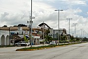 Tulum
Tulum -
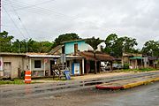
 Francisco Hu May
 -
 Macario Gomez
 -
 Manuel Antonio Hay


Demographics edit
| Year | Pop. | ±% p.a. |
|---|---|---|
| 2010 | 28,263 | — |
| 2020 was the 2nd census year for Tulum. Source: INEGI Instituto Nacional de Estadística y Geografía[6] | ||
Tulum has 46,721 inhabitants according to the 2020 census, a figure that reflects over five percent annual growth since the last census in 2010.[4] There is an additional 15,000 to 20,000 people living and working in Tulum as part of its floating population. That number rises and falls with the tourist season and is not reflected in the census figures.[7]
References edit
- ^ "Municipio de Tulum". Retrieved 24 April 2020.
- ^ "Discuten por nuevo municipio". Archived from the original on 9 October 2008. Retrieved 5 November 2009.
- ^ Javier Chávez. "Tulum se convierte en el noveno municipio de Quintana Roo". Retrieved 13 March 2008. [dead link]
- ^ a b "Municipio de Tulum en Quintana Roo". Archived from the original on 24 March 2012. Retrieved 12 May 2011.
- ^ [https://www.inegi.org.mx/app/scitel/consultas/index#}}
- ^ INEGI. Instituto Nacional de Estadística y Geografía. Censo de Población y Vivienda 1995, 2000, 2005, 2010, 2020. Archived 2013-09-28 at the Wayback Machine
- ^ "Esperan beneficios presupuestales tras resultados del Censo en Tulum - Riviera Maya". www.noticaribe.com.mx. Archived from the original on 22 July 2011.