


Summary
Tundla (Ṭūṇḍlā) is a town and a municipal board in Firozabad district in the Indian state of Uttar Pradesh.[2] It is an important railway junction between the Delhi-Kanpur main line and the Agra branch line. Tundla is a railway town that sprang up when the railway was built in the late 1800s. It is served by Tundla Junction railway station. As of 2011, Tundla has a population of 50,423 people, in 8,744 households.
Tundla | |
|---|---|
Town | |
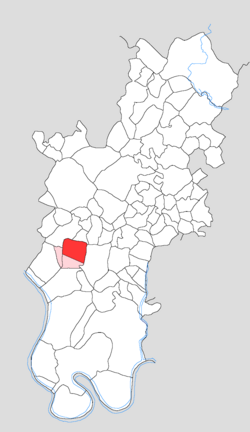 Map showing Tundla in Tundla block | |
 Tundla Location in Uttar Pradesh, India | |
| Coordinates: 27°12′53″N 78°14′13″E / 27.21460°N 78.23683°E | |
| Country | |
| State | Uttar Pradesh |
| District | Firozabad |
| Government | |
| • Body | Municipal Corporation |
| Area | |
| • Total | 8.25 km2 (3.19 sq mi) |
| Elevation | 168 m (551 ft) |
| Population (2011)[1] | |
| • Total | 50,423 |
| • Density | 6,100/km2 (16,000/sq mi) |
| Languages | |
| • Official | Hindi |
| Time zone | UTC+5:30 (IST) |
| PIN | 283204 |
| Vehicle registration | UP-83 |
Location edit
Tundla is situated on NH19 which connects it to nearest major city of Agra, 24 km away, 17 km away from District Firozabad and 5 km away from Etmadpur. It also serves as a major railway junction in North Central Railway zone. Numerous trains ply from capital city New Delhi which is 210 km away. Tundla is very near to Taj Yamuna Expressway. Tundla is well connected to other major cities of the country via regular trains. Due to proximity to Agra and hence the borders of Uttar Pradesh with Rajasthan, Madhya Pradesh states several inter-state bus services also serve the city. Intra-city transport typically consists of rickshaws and three-wheelers.
History edit
Tundla is a railway town: before the opening of the railway, it was a mere agricultural village. That changed in 1862, when the East Indian Railway's main line was extended from Shikohabad to Tundla. This, along with the connecting branch line from Tundla to Agra, officially opened on 1 April 1862. A further extension of the main line from Tundla to Aligarh was completed in March 1863. Tundla's importance quickly grew, and it was constituted as a municipality in 1870. By the turn of the century, its bazar was one of the main commercial centres in what was then Agra district, and it was a point of export through the railway. As of 1901, the population of Tundla was 5,167, although only 1,601 people were described as living within the municipality limits. Besides the train station and market, the town had a post office, a police station, a dispensary, a sarai, and a couple of schools. There was also a "railway hospital". An Anglican church had also been built in Tundla.[3]: 58, 129, 134, 332
Tundla is a town in Tundla tahsil of Firozabad district, Uttar Pradesh. In 1901 the population of Tundla was 3044. It was a major junction on the East Indian Railway. Tundla has a rich heritage of British rule. High walled British constructions, huge barracks, a Catholic church built in 1860, an old Jain temple, Kothis (Bungalows) of officers surrounded by sprawling lawns adorn Tundla as the main center of British administration. These old and beautiful British buildings have now been converted into railway quarters. Tundla also have a very old NCR College which was also made by the british for their training purposes.
Demographics edit
| Year | Pop. | ±% |
|---|---|---|
| 1911 | 3,863 | — |
| 1921 | 3,352 | −13.2% |
| 1931 | 2,716 | −19.0% |
| 1941 | 7,318 | +169.4% |
| 1951 | 5,651 | −22.8% |
| 1961 | 7,571 | +34.0% |
| 1971 | 9,660 | +27.6% |
| 1981 | 15,997 | +65.6% |
| 1991 | 21,463 | +34.2% |
| 2001 | 24,514 | +14.2% |
| 2011 | 50,423 | +105.7% |
| Source: 2011 Census of India[1] | ||
As of the 2011 census, Tundla had a population of 50,423, in 8,744 households. This population was 52.6% male (26,510) and 47.4% female (23,913). The 0-6 age group numbered 6,154 (3,290 male and 2,864 female), or 12.2% of the total population. 9,603 residents were members of Scheduled Castes, or 19.0% of the total. The town's literacy rate was 86.4% (counting only people age 7 and up).[4]: 208–9 The male literacy rate was 91.7%, while the female literacy rate was 80.6%.[1]: 40
Tehsil-wide statistics edit
As of 2011, Tundla tehsil had a population of 361,489, making it the least populous tehsil in the district. The overall population was predominantly rural, with 82.0% of the population (296,583 people) living in rural areas and 18.0% (64,906 people) living in the tehsil's three urban areas of Tundla, Tundla Kham, and Tundla Railway Colony. The tehsil's overall sex ratio was 867 females to every 1000 males. Its literacy rate was 74.8%; there was a 21.2% gender literacy gap, with 74.8% of males but only 63.4% of females capable of reading and writing. This discrepancy was higher in rural areas (23.4%) than in urban ones (12.3%).[1]: 28–38
Politics edit
Tundla (Assembly constituency) represents the area.
Transportation edit
Tundla Junction is an important station in Uttar Pradesh. It is located on the Delhi–Kanpur main line 25 km from Agra City. Tundla is a technical halt for changing drivers and guards for almost all of the trains on the New Delhi–Pandit Deen Dayal Junction / Lucknow sections. The station was built by the British and remains essentially unchanged. The railway station is a site in itself and takes one back to the pre-independence era. Tundla Junction is important for the people of Agra and for tourists providing connections to the east of the country, i.e. Kolkata, Guwahati, Patna etc., and especially to the northern state of Uttar Pradesh. It has connections to Agra Cantonment, Etawah, Aligarh Junction, Phaphund,tundla, Kanpur Central railway station etc.[citation needed]
Administration edit
Tundla is a statutory town with a Nagar Palika Parishad (municipal council) and it also serves as a tehsil headquarters.[1]: 4, 26
List of villages edit
The following 93 villages are counted as part of Tundla CD block:[1]: 68–70
- Alai
- Alawalpur
- Anandpur
- Anwara
- Bachhgaon
- Badanpur
- Baghai
- Baghai
- Bankat
- Basai
- Bhainsabrijpur
- Bhikanpur Bajhera
- Chhakau
- Chhitrai
- Chulhaoli
- Danauli
- Deo Khera
- Dharampur
- Dhir Pur
- Eta
- Garai Thakur
- Garhi Bhopal
- Garhi Fateh
- Garhi Harrai
- Garhi Nirbhai
- Garhi Purani
- Garhi Sidhari
- Garhi Ummed
- Garhijafar
- Garhiranchhor
- Ghirauli
- Gothua
- Guarinagla Singhi
- Hazratpur
- Hemrajpur
- Himmatpur
- Husainpur
- Jajpur
- Jarkhi
- Jondhri
- Kartiki
- Khera Langar
- Kheria Jarkhi
- Khushhal Pur
- Kotki
- Kutabpur Sahibmustaqil
- Kutubpur Jarkhi
- Kutubpur Sahibahat Mali
- Lalgarhi
- Latifpur
- Madauli
- Marsena
- Mohammadabad
- Mohammadpur
- Mohammdi
- Nagala Dal
- Nagalapunu
- Nagalaraiya
- Nagla Balia
- Nagla Barisani
- Nagla Kalua
- Nagla Sikandar
- Nagla Suraj
- Niamatpur
- Pachokara
- Paharipur Bhodela
- Panwari
- Piprauli
- Pratapur
- Raja Wali
- Ram Pur
- Ramgarh Urf Ummergarh
- Ramnagarjarkhi
- Rampur
- Rampur Katailia
- Rasulabad
- Rudau Mustaqil
- Rudau Pahar Pur
- Rudaunat Mali
- Sakhawat Pur
- Salempur
- Sarainoor Mahal
- Satauli
- Seosinghpur
- Shekhpur Mandanpur
- Shekhupur Rajmal
- Sikrari
- Siraulia
- Tikri
- Tilokpur
- Tundla Kham (CT)
- Tundla Railway Colony (CT)
- Tundli
References edit
- ^ a b c d e f g "Census of India 2011: Uttar Pradesh District Census Handbook - Firozabad, Part A (Village and Town Directory)" (PDF). Census of India. Retrieved 19 June 2023.
- ^ "Map of Tundla Village in Tundla Tehsil, Firozabad, Uttar Pradesh". www.mapsofindia.com. Retrieved 23 September 2020.
- ^ Nevill, H. R., ed. (1905). Agra: A Gazetteer, Being Volume VIII of the District Gazetteers of the United Provinces of Agra and Oudh. Allahabad: Government Press. Retrieved 18 November 2023.
- ^ "Census of India 2011: Uttar Pradesh District Census Handbook - Firozabad, Part B (Village and Town Wise Primary Census Abstract)" (PDF). Census of India. Retrieved 19 June 2023.