


Summary
Undavalli is a southern neighbourhood of Vijayawada city of the Indian state of Andhra Pradesh.[4] It was a village in Tadepalle mandal of Guntur district, prior to its de-notification as gram panchayat.[2][5] 5th century Buddhist and Hindu Undavalli Caves which signify Monolithic Indian rock-cut architecture are present at this place. It is a part of Vijayawada Urban Agglomeration.[6]
Undavalli | |
|---|---|
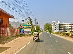 Undavalle village along Amaravathi road | |
 Undavalli Location in Andhra Pradesh, India | |
| Coordinates: 16°29′45″N 80°34′48″E / 16.4957°N 80.5800°E | |
| Country | India |
| State | Andhra Pradesh |
| District | Guntur |
| Mandal | Tadepalle |
| Area | |
| • Total | 13.05 km2 (5.04 sq mi) |
| Elevation | 24 m (79 ft) |
| Population | |
| • Total | 9,743 |
| • Density | 750/km2 (1,900/sq mi) |
| Languages | |
| • Official | Telugu |
| Time zone | UTC+5:30 (IST) |
| PIN | 522501 |
| Vehicle registration | AP–07 |
Geography edit
Undavalli is located at 16°29′45″N 80°34′48″E / 16.4957°N 80.5800°E.[7] It has an average elevation of 24 m (79 ft). It is situated on the south bank of Krishna River.
Governance edit
Kakarlamudi gram panchayat is the local self-government of the village.[8] The gram panchayat was awarded Nirmala Grama Puraskaram for the year 2013.[9]
Transport edit
The Vijayawada-Amaravati road connects Undavalli with Vijayawada.[10] APSRTC operates buses on this route from Pandit Nehru bus station of Vijayawada.[11]
See also edit
References edit
- ^ "Elevation for Pedakurapadu". Veloroutes. Retrieved 1 August 2014.
- ^ a b "District Census Handbook – Guntur" (PDF). Census of India. p. 15,28. Retrieved 18 January 2015.
- ^ "Statistical Abstract of Andhra Pradesh, 2015" (PDF). Directorate of Economics & Statistics. Government of Andhra Pradesh. p. 43. Retrieved 26 April 2019.
- ^ "New Andhra capital Amaravati to compete for Smart City tag". The New Indian Express. 25 May 2016. Archived from the original on 26 May 2016. Retrieved 6 June 2016.
- ^ "Declaration of A.P. Capital City Area–Revised orders" (PDF). Andhra Nation. Municipal Administration and Urban Development Department. 22 September 2015. Archived from the original (PDF) on 24 June 2016. Retrieved 21 February 2016.
- ^ "Name of Urban Agglomeration and its State constituent Units-2011" (PDF). Census of India. p. 23. Retrieved 21 September 2015.
- ^ Falling Rain Genomics, Inc – Undavalli
- ^ "Gram Panchayat Identification Codes" (PDF). Saakshar Bharat Mission. National Informatics Centre. p. 120. Archived from the original (PDF) on 18 August 2017. Retrieved 7 May 2019.
- ^ "2 Terms for Sarpanch Proposed to Centre". The New Indian Express. Visakhapatnam. 23 August 2015. Archived from the original on 22 April 2016. Retrieved 10 April 2016.
- ^ "Four-lane road to Andhra Pradesh new capital soon". The Hindu. Guntur. 6 August 2015. Retrieved 4 June 2016.
- ^ "RTC to introduce bus services in Guntur city".