


Summary
Uradome Coast (浦富海岸, Uradome-kaigan) is a scenic ria coastal inlet located on the Sea of Japan in Iwami, Tottori Prefecture, Japan. This area was nationally designated as a Place of Scenic Beauty and Natural Monument on March 27, 1928[1] It was also voted one of the 100 Landscapes of Japan in1927.[2] It is one of the major geosites of San'in Kaigan Global Geopark.
| Uradome Coast | |
|---|---|
 Kamogaiso, Uradome Coast | |
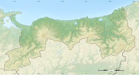 Uradome Coast  Uradome Coast (Japan) | |
| Location | Iwami, Tottori, Japan |
| Coordinates | 35°35′25.37″N 134°19′34.39″E / 35.5903806°N 134.3262194°E |
| Length | 15 km (9.3 mi) |
| Established | March 27, 1928 |

Geography edit
The Uradome Coast is made up of rocks formed by marine erosion,[3] white sandy beaches, and dense scrub pines. The coast stretches for approximately 15 kilometers (9.3 mi) to 16 kilometers (9.9 mi) along the Sea of Japan on the eastern tip of Tottori Prefecture from Cape Kugami to Mount Shichiyama.[4] Marine erosion has formed distinctive natural sea walls, cliffs, tunnels, caves, and large rocks of unusual shapes. The Uradome Coast is an important part of the Sanin Kaigan National Park.[5]
The Uradome Coast is known as the "San'in Matsushima" due to its resemblance to Matsushima in Miyagi Prefecture. The author Tōson Shimazaki (1872–1943) was especially fond of the Uradome Coast. He praised the area with the quote "Matsushima is Matsushima, Uradome is Uradome".[6]
Etymology edit
The name of the Uradome Coast in Japanese is formed from two kanji. The first, 浦, means "inlet" and the second, 富 means "abundant" or "rich".
Transportation edit
The Uradome Coast is to the east in close proximity to the Tottori Sand Dunes. The coast is a 25-minute drive from Tottori Station on the JR West Sanin Main Line.
See also edit
External links edit
- 浦富海岸(in Japanese)
- いわみのマップ(in Japanese)
References edit
- ^ "浦富海岸". Agency for Cultural Affairs. Retrieved 1 January 2023.
- ^ "日本八景(昭和2年)の選定内容" (PDF). Ministry of the Environment. Retrieved 17 March 2011.
- ^ "Uradome-kaigan". Dijitaru daijisen (in Japanese). Tokyo: Shogakukan. 2012. Archived from the original on 25 August 2007. Retrieved 26 March 2012.
- ^ 浦富海岸(in Japanese)
- ^ "San'in Coast National Park". Encyclopedia of Japan. Tokyo: Shogakukan. 2012. Archived from the original on 25 August 2007. Retrieved 12 April 2012.
- ^ 浦富海岸(in Japanese)