


Summary
Urrao is a town and municipality of Colombia, located in the subregion southwest of the department of Antioquia. Limited by the north with the municipalities of Frontino and Abriaquí, in the east with the municipalities of Abriaquí, Caicedo, Anzá, Betulia and Salgar, and in the south and west with Vigía del Fuerte and the department of Chocó. It is the second largest municipality in the department. As of 2015, the population comprised 44,648 people. Professional cyclist Rigoberto Urán was born and raised here.[1]
Urrao, Antioquia | |
|---|---|
Municipality & Town | |
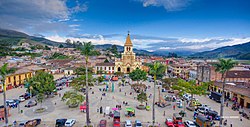 Panorámica de Urrao. | |
 Flag | |
 Location of the municipality of Urrao, Antioquia in the Antioquia Department of Colombia | |
 Urrao, Antioquia Location in Colombia | |
| Coordinates: 6°19′0.7″N 76°8′4.19″W / 6.316861°N 76.1344972°W | |
| Country | |
| Department | |
| Subregion | Southwestern |
| Founded | June 12 of 1781 |
| Area | |
| • Municipality & Town | 2,556 km2 (987 sq mi) |
| Elevation | 1,830 m (6,004 ft) |
| Population (2015) | |
| • Municipality & Town | 44,648 |
| • Urban | 17,401 |
| • Metro density | 17.47/km2 (45.2/sq mi) |
| Demonym(s) | Urraeño, -a |
| Time zone | UTC-5 (Colombia Standard Time) |
| Website | http://www.urrao-antioquia.gov.co |
Climate edit
The climate is warm and temperate in Urrao. There is significant rainfall throughout the year in Urrao. Even the driest month still has a lot of rainfall. According to Köppen and Geiger, this climate is classified as Cfb. The average temperature in Urrao is 15.7 °C | 60.3 °F. About 7573 mm | 298.1 inch of precipitation falls annually.
| Climate data for Urrao | |||||||||||||
|---|---|---|---|---|---|---|---|---|---|---|---|---|---|
| Month | Jan | Feb | Mar | Apr | May | Jun | Jul | Aug | Sep | Oct | Nov | Dec | Year |
| Mean daily maximum °C (°F) | 18.8 (65.8) |
20.2 (68.4) |
20.5 (68.9) |
20.2 (68.4) |
19.8 (67.6) |
20 (68) |
20.2 (68.4) |
20.5 (68.9) |
20.1 (68.2) |
19.3 (66.7) |
18.9 (66.0) |
19.3 (66.7) |
19.8 (67.7) |
| Mean daily minimum °C (°F) | 12.6 (54.7) |
12.8 (55.0) |
12.1 (53.8) |
13.4 (56.1) |
13.5 (56.3) |
13 (55) |
12.7 (54.9) |
12.7 (54.9) |
12.8 (55.0) |
13.1 (55.6) |
13.1 (55.6) |
12.9 (55.2) |
12.9 (55.2) |
| Average rainfall mm (inches) | 415 (16.3) |
412 (16.2) |
532 (20.9) |
605 (23.8) |
729 (28.7) |
678 (26.7) |
740 (29.1) |
809 (31.9) |
788 (31.0) |
729 (28.7) |
662 (26.1) |
474 (18.7) |
7,573 (298.1) |
| Source: Climate-Data.org[2] | |||||||||||||
References edit
6°18′56″N 76°08′03″W / 6.31556°N 76.13417°W