


Summary
Uryupinsk (Russian: Урю́пинск) is a town in Volgograd Oblast, Russia, located 340 kilometers (210 mi) northwest of Volgograd on the Khopyor River. Population: 41,590 (2010 Census);[3] 41,960 (2002 Census);[9] 42,954 (1989 Census).[10]
Uryupinsk
Урюпинск | |
|---|---|
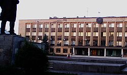 Government building in Uryupinsk | |
 Flag  Coat of arms | |
Location of Uryupinsk .mw-parser-output .locmap .od{position:absolute}.mw-parser-output .locmap .id{position:absolute;line-height:0}.mw-parser-output .locmap .l0{font-size:0;position:absolute}.mw-parser-output .locmap .pv{line-height:110%;position:absolute;text-align:center}.mw-parser-output .locmap .pl{line-height:110%;position:absolute;top:-0.75em;text-align:right}.mw-parser-output .locmap .pr{line-height:110%;position:absolute;top:-0.75em;text-align:left}.mw-parser-output .locmap .pv>div{display:inline;padding:1px}.mw-parser-output .locmap .pl>div{display:inline;padding:1px;float:right}.mw-parser-output .locmap .pr>div{display:inline;padding:1px;float:left}html.skin-theme-clientpref-night .mw-parser-output .od,html.skin-theme-clientpref-night .mw-parser-output .od .pv>div,html.skin-theme-clientpref-night .mw-parser-output .od .pl>div,html.skin-theme-clientpref-night .mw-parser-output .od .pr>div{background:#000;color:#fff}html.skin-theme-clientpref-night .mw-parser-output .locmap{filter:grayscale(0.6)}@media(prefers-color-scheme:dark){html.skin-theme-clientpref-os .mw-parser-output .locmap{filter:grayscale(0.6)}html.skin-theme-clientpref-os .mw-parser-output .od,html.skin-theme-clientpref-os .mw-parser-output .od .pv>div,html.skin-theme-clientpref-os .mw-parser-output .od .pl>div,html.skin-theme-clientpref-os .mw-parser-output .od .pr>div{background:#000;color:#fff}}  Uryupinsk Location of Uryupinsk  Uryupinsk Uryupinsk (Volgograd Oblast) | |
| Coordinates: 50°48′N 42°01′E / 50.800°N 42.017°E | |
| Country | Russia |
| Federal subject | Volgograd Oblast[2] |
| Founded | late 14th–early 15th century |
| Town status since | 1929 |
| Elevation | 80 m (260 ft) |
| Population | |
| • Total | 41,590 |
| • Estimate (2018)[4] | 37,620 (−9.5%) |
| • Subordinated to | town of oblast significance of Uryupinsk[2] |
| • Capital of | Uryupinsky District,[1] town of oblast significance of Uryupinsk[2] |
| • Urban okrug | Uryupinsk Urban Okrug[5] |
| • Capital of | Uryupinsk Urban Okrug,[5] Uryupinsky Municipal District[6] |
| Time zone | UTC+3 (MSK |
| Postal code(s)[8] | 403120 |
| Dialing code(s) | +7 84442 |
| OKTMO ID | 18725000001 |
Etymology edit
There are two theories of the historical background for the town's name. One is that it is from name of a Tartar prince Uryup, who got bogged down in a swamp near this location, during a fight with Yermak and got captured. Another is that it is from either the family name Uryupin or the word "урюпа" (uryupa). According to the 1866 Explanatory Dictionary of the Living Great Russian Language by Vladimir Dal, this archaic word means untidy person, which probably in this context characterizes not a person, but the swampy area.
The name of this town is known to many Russian people as a synonym for "backwater town". This usage became widespread after the popular Soviet film Destiny of a Man. The film was based on a short story by Mikhail Sholokhov, and Uryupinsk was the place of the action, shown as an inconspicuous provincial town.
History edit
Founded in the late 14th–early 15th century as Uryupin, it was a border outpost of the Principality of Ryazan, populated by Don Cossacks.[citation needed] Since 1857, it is the stanitsa Uryupinskaya and home of Pokrovskaya Fair, a center for trade on the southeastern side of the East European Plain.[citation needed] It was renamed Uryupinsk and granted town status in 1929.[citation needed]
It is assumed that it is listed in the historical List of Ruthenian Cities Far and Near under the name "Uryupesk" (Урюпеск).[11]
Administrative and municipal status edit
Within the framework of administrative divisions, Uryupinsk serves as the administrative center of Uryupinsky District,[1] even though it is not a part of it.[2] As an administrative division, it is incorporated separately as the "town of oblast significance of Uryupinsk"—an administrative unit with the status equal to that of the districts.[2] As a municipal division, the town of oblast significance of Uryupinsk is incorporated as Uryupinsk Urban Okrug.[5]
Climate edit
| Climate data for Uryupinsk (1991–2020, extremes 1881–present) | |||||||||||||
|---|---|---|---|---|---|---|---|---|---|---|---|---|---|
| Month | Jan | Feb | Mar | Apr | May | Jun | Jul | Aug | Sep | Oct | Nov | Dec | Year |
| Record high °C (°F) | 11.1 (52.0) |
12.2 (54.0) |
20.8 (69.4) |
30.0 (86.0) |
36.2 (97.2) |
39.5 (103.1) |
42.1 (107.8) |
41.1 (106.0) |
35.5 (95.9) |
29.1 (84.4) |
19.0 (66.2) |
12.3 (54.1) |
42.1 (107.8) |
| Mean daily maximum °C (°F) | −3.6 (25.5) |
−2.9 (26.8) |
3.6 (38.5) |
15.2 (59.4) |
22.7 (72.9) |
26.5 (79.7) |
28.7 (83.7) |
28.1 (82.6) |
21.3 (70.3) |
12.6 (54.7) |
3.4 (38.1) |
−2.0 (28.4) |
12.8 (55.1) |
| Daily mean °C (°F) | −6.6 (20.1) |
−6.4 (20.5) |
−0.8 (30.6) |
8.8 (47.8) |
15.9 (60.6) |
19.9 (67.8) |
21.9 (71.4) |
20.8 (69.4) |
14.5 (58.1) |
7.6 (45.7) |
0.2 (32.4) |
−4.8 (23.4) |
7.6 (45.7) |
| Mean daily minimum °C (°F) | −9.4 (15.1) |
−9.6 (14.7) |
−4.3 (24.3) |
3.2 (37.8) |
9.2 (48.6) |
13.3 (55.9) |
15.2 (59.4) |
13.7 (56.7) |
8.6 (47.5) |
3.5 (38.3) |
−2.4 (27.7) |
−7.5 (18.5) |
2.8 (37.0) |
| Record low °C (°F) | −37.7 (−35.9) |
−40.5 (−40.9) |
−33.5 (−28.3) |
−16.8 (1.8) |
−5.0 (23.0) |
0.5 (32.9) |
4.7 (40.5) |
1.8 (35.2) |
−6.2 (20.8) |
−15.1 (4.8) |
−26.2 (−15.2) |
−38.4 (−37.1) |
−40.5 (−40.9) |
| Average precipitation mm (inches) | 30 (1.2) |
25 (1.0) |
25 (1.0) |
27 (1.1) |
38 (1.5) |
52 (2.0) |
51 (2.0) |
33 (1.3) |
43 (1.7) |
34 (1.3) |
32 (1.3) |
32 (1.3) |
422 (16.7) |
| Source: Pogoda.ru.net[12] | |||||||||||||
Economy edit

Uryupinsk is an industrial center with heavy industries such as agricultural machinery (harvesting machines) and loading equipment (a large crane-making plant is located here). The city also contains factories of light industry production (such as knitted fabric, shoe fabric, and furniture fabric), paper production plant, and a packing plant.
Another major industry involving the outlying areas of the town is goat farming and goat leather production. Because of its mild southern climate, the region is a good area for agriculture, and there are many agricultural processing factories in the region, specializing mainly in beef, oil and butter production.
References edit
Notes edit
- ^ a b c Государственный комитет Российской Федерации по статистике. Комитет Российской Федерации по стандартизации, метрологии и сертификации. №ОК 019-95 1 января 1997 г. «Общероссийский классификатор объектов административно-территориального деления. Код 18 254», в ред. изменения №278/2015 от 1 января 2016 г.. (State Statistics Committee of the Russian Federation. Committee of the Russian Federation on Standardization, Metrology, and Certification. #OK 019-95 January 1, 1997 Russian Classification of Objects of Administrative Division (OKATO). Code 18 254, as amended by the Amendment #278/2015 of January 1, 2016. ).
- ^ a b c d e Law #139-OD
- ^ a b Russian Federal State Statistics Service (2011). Всероссийская перепись населения 2010 года. Том 1 [2010 All-Russian Population Census, vol. 1]. Всероссийская перепись населения 2010 года [2010 All-Russia Population Census] (in Russian). Federal State Statistics Service.
- ^ "26. Численность постоянного населения Российской Федерации по муниципальным образованиям на 1 января 2018 года". Federal State Statistics Service. Retrieved January 23, 2019.
- ^ a b c Law #1008-OD
- ^ Law #1037-OD
- ^ "Об исчислении времени". Официальный интернет-портал правовой информации (in Russian). June 3, 2011. Retrieved January 19, 2019.
- ^ Почта России. Информационно-вычислительный центр ОАСУ РПО. (Russian Post). Поиск объектов почтовой связи (Postal Objects Search) (in Russian)
- ^ Russian Federal State Statistics Service (May 21, 2004). Численность населения России, субъектов Российской Федерации в составе федеральных округов, районов, городских поселений, сельских населённых пунктов – районных центров и сельских населённых пунктов с населением 3 тысячи и более человек [Population of Russia, Its Federal Districts, Federal Subjects, Districts, Urban Localities, Rural Localities—Administrative Centers, and Rural Localities with Population of Over 3,000] (XLS). Всероссийская перепись населения 2002 года [All-Russia Population Census of 2002] (in Russian).
- ^ Всесоюзная перепись населения 1989 г. Численность наличного населения союзных и автономных республик, автономных областей и округов, краёв, областей, районов, городских поселений и сёл-райцентров [All Union Population Census of 1989: Present Population of Union and Autonomous Republics, Autonomous Oblasts and Okrugs, Krais, Oblasts, Districts, Urban Settlements, and Villages Serving as District Administrative Centers]. Всесоюзная перепись населения 1989 года [All-Union Population Census of 1989] (in Russian). Институт демографии Национального исследовательского университета: Высшая школа экономики [Institute of Demography at the National Research University: Higher School of Economics]. 1989 – via Demoscope Weekly.
- ^ М. Н. Тихомиров. Список русских городов дальних и ближних
- ^ "Weather and Climate - The Climate of Uryupinsk" (in Russian). Weather and Climate (Погода и климат). Retrieved November 24, 2023.
Sources edit
- Волгоградская областная Дума. Закон №139-ОД от 7 октября 1997 г. «Об административно-территориальном устройстве Волгоградской области», в ред. Закона №107-ОД от 10 июля 2015 г. «О внесении изменений в отдельные законодательные акты Волгоградской области в связи с приведением их в соответствие с Уставом Волгоградской области». Вступил в силу со дня официального опубликования. Опубликован: "Волгоградская правда", №207, 1 ноября 1997 г. (Volgograd Oblast Duma. Law #139-OD of October 7, 1997 On the Administrative-Territorial Structure of Volgograd Oblast, as amended by the Law #107-OD of July 10, 2015 On Amending Various Legislative Acts of Volgograd Oblast to Ensure Compliance with the Charter of Volgograd Oblast. Effective as of the day of the official publication.).
- Волгоградская областная Дума. Закон №1008-ОД от 21 февраля 2005 г. «Об установлении границ и наделении статусом города Урюпинска Волгоградской области». Вступил в силу со дня официального опубликования. Опубликован: "Волгоградская правда", №36, 2 марта 2005 г. (Volgograd Oblast Duma. Law #1008-OD of February 21, 2005 On Establishing the Borders and Granting the Status to the Town of Uryupinsk of Volgograd Oblast. Effective as of the day of the official publication.).
- Волгоградская областная Дума. Закон №1037-ОД от 30 марта 2005 г. «Об установлении границ и наделении статусом Урюпинского района и муниципальных образований в его составе», в ред. Закона №67-ОД от 4 июля 2013 г. «О внесении изменений в некоторые законодательные акты Волгоградской области по вопросам исключения из учётных данных отдельных населённых пунктов Волгоградской области». Вступил в силу со дня официального опубликования. Опубликован: "Волгоградская правда", №60, №147 (уточнение), 6 апреля 2005 г., 11 августа 2005 г. (Volgograd Oblast Duma. Law #1037-OD of March 30, 2005 On Establishing the Borders and Granting the Status to Uryupinsky District and the Municipal Formations Comprising It, as amended by the Law #67-OD of July 4, 2013 On Amending Various Legislative Acts of Volgograd Oblast Due to the Exclusion from the Registries of Several Inhabited Localities of Volgograd Oblast. Effective as of the day of the official publication.).