


Summary
Ust-Omchug (Russian: Усть-Омчуг) is an urban locality (an urban-type settlement) and the administrative center of Tenkinsky District of Magadan Oblast, Russia, located at the 271-kilometer (168 mi) mark of the highway to the northwest of Magadan. Population: 3,914 (2010 Census);[1] 4,867 (2002 Census);[6] 11,343 (1989 Census).[7]
Ust-Omchug
Усть-Омчуг | |
|---|---|
 Ust-Omchug, September 2004 | |
Location of Ust-Omchug .mw-parser-output .locmap .od{position:absolute}.mw-parser-output .locmap .id{position:absolute;line-height:0}.mw-parser-output .locmap .l0{font-size:0;position:absolute}.mw-parser-output .locmap .pv{line-height:110%;position:absolute;text-align:center}.mw-parser-output .locmap .pl{line-height:110%;position:absolute;top:-0.75em;text-align:right}.mw-parser-output .locmap .pr{line-height:110%;position:absolute;top:-0.75em;text-align:left}.mw-parser-output .locmap .pv>div{display:inline;padding:1px}.mw-parser-output .locmap .pl>div{display:inline;padding:1px;float:right}.mw-parser-output .locmap .pr>div{display:inline;padding:1px;float:left}html.skin-theme-clientpref-night .mw-parser-output .od,html.skin-theme-clientpref-night .mw-parser-output .od .pv>div,html.skin-theme-clientpref-night .mw-parser-output .od .pl>div,html.skin-theme-clientpref-night .mw-parser-output .od .pr>div{background:#000;color:#fff}html.skin-theme-clientpref-night .mw-parser-output .locmap{filter:grayscale(0.6)}@media(prefers-color-scheme:dark){html.skin-theme-clientpref-os .mw-parser-output .locmap{filter:grayscale(0.6)}html.skin-theme-clientpref-os .mw-parser-output .od,html.skin-theme-clientpref-os .mw-parser-output .od .pv>div,html.skin-theme-clientpref-os .mw-parser-output .od .pl>div,html.skin-theme-clientpref-os .mw-parser-output .od .pr>div{background:#000;color:#fff}}  Ust-Omchug Location of Ust-Omchug 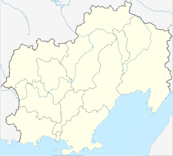 Ust-Omchug Ust-Omchug (Magadan Oblast) | |
| Coordinates: 61°09′N 149°38′E / 61.150°N 149.633°E | |
| Country | Russia |
| Federal subject | Magadan Oblast |
| Administrative district | Tenkinsky District |
| Population | |
| • Total | 3,914 |
| • Estimate (2018)[2] | 3,128 (−20.1%) |
| Time zone | UTC+11 (MSK+8 |
| Postal code(s)[4] | 686050 |
| OKTMO ID | 44716000051 |
History edit
Urban-type settlement status was granted to Ust-Omchug in 1953.
Some 56 kilometers (35 mi) north from the settlement there are couple of other abandoned settlements that once were part of the TenLag. They are Butugichag and Lower Butugichag. The settlements were part of the Soviet correctional system of GULAG.
Economy edit
There is an ore-mining and processing plant, a mining equipment repair shop, a timber industry company, and a poultry farming sovkhoz.
Climate edit
Ust-Omchug has a very cold subarctic climate (Köppen climate classification Dfc). Winters are prolonged and very cold, with up to eight months of sub-zero maximum daily temperatures, such that the soil remains permanently frozen. Permafrost and tundra cover most of the region. Average temperatures range from −32.6 °C (−26.7 °F) in January to +12.7 °C (54.9 °F) in July.
| Climate data for Ust-Omchug | |||||||||||||
|---|---|---|---|---|---|---|---|---|---|---|---|---|---|
| Month | Jan | Feb | Mar | Apr | May | Jun | Jul | Aug | Sep | Oct | Nov | Dec | Year |
| Daily mean °C (°F) | −32.6 (−26.7) |
−31.2 (−24.2) |
−24.2 (−11.6) |
−13.4 (7.9) |
−3.3 (26.1) |
8.4 (47.1) |
12.7 (54.9) |
9.1 (48.4) |
1.2 (34.2) |
−12.5 (9.5) |
−26.2 (−15.2) |
−32.4 (−26.3) |
−12.0 (10.4) |
| Average precipitation mm (inches) | 15 (0.6) |
13 (0.5) |
7 (0.3) |
13 (0.5) |
28 (1.1) |
46 (1.8) |
67 (2.6) |
60 (2.4) |
48 (1.9) |
38 (1.5) |
24 (0.9) |
16 (0.6) |
375 (14.7) |
| Average relative humidity (%) | 69.4 | 69.6 | 74.5 | 80.7 | 82.4 | 69.9 | 68.0 | 74.7 | 80.8 | 80.2 | 74.4 | 69.6 | 74.5 |
| Source 1: NASA RETScreen Database | |||||||||||||
| Source 2: Climate-data.org | |||||||||||||
Gallery edit
-
 Aerial view in 1958
 -
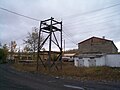
 Ruined structures
 -
 Electricity substation
 -
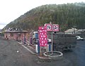 Gas station


References edit
- ^ a b Russian Federal State Statistics Service (2011). Всероссийская перепись населения 2010 года. Том 1 [2010 All-Russian Population Census, vol. 1]. Всероссийская перепись населения 2010 года [2010 All-Russia Population Census] (in Russian). Federal State Statistics Service.
- ^ "26. Численность постоянного населения Российской Федерации по муниципальным образованиям на 1 января 2018 года". Federal State Statistics Service. Retrieved January 23, 2019.
- ^ "Об исчислении времени". Официальный интернет-портал правовой информации (in Russian). June 3, 2011. Retrieved January 19, 2019.
- ^ Почта России. Информационно-вычислительный центр ОАСУ РПО. (Russian Post). Поиск объектов почтовой связи (Postal Objects Search) (in Russian)
- ^ Office of the Federal State Statistics Service for Khabarovsk Krai, Magadan Oblast, Jewish Autonomous Oblast and Chukotka Autonomous Okrug. Численность населения Магаданская область по муниципальным образованиям на 1 января 2017 года (in Russian)
- ^ Russian Federal State Statistics Service (May 21, 2004). Численность населения России, субъектов Российской Федерации в составе федеральных округов, районов, городских поселений, сельских населённых пунктов – районных центров и сельских населённых пунктов с населением 3 тысячи и более человек [Population of Russia, Its Federal Districts, Federal Subjects, Districts, Urban Localities, Rural Localities—Administrative Centers, and Rural Localities with Population of Over 3,000] (XLS). Всероссийская перепись населения 2002 года [All-Russia Population Census of 2002] (in Russian).
- ^ Всесоюзная перепись населения 1989 г. Численность наличного населения союзных и автономных республик, автономных областей и округов, краёв, областей, районов, городских поселений и сёл-райцентров [All Union Population Census of 1989: Present Population of Union and Autonomous Republics, Autonomous Oblasts and Okrugs, Krais, Oblasts, Districts, Urban Settlements, and Villages Serving as District Administrative Centers]. Всесоюзная перепись населения 1989 года [All-Union Population Census of 1989] (in Russian). Институт демографии Национального исследовательского университета: Высшая школа экономики [Institute of Demography at the National Research University: Higher School of Economics]. 1989 – via Demoscope Weekly.