


Summary
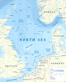
Utsira High (Norwegian: Utsirahøgda) is a basement high and horst in the southwest of the Norwegian continental shelf.[1] It lies east of the Viking Graben and west of the Stord and Egersund basins 190 km west of Stavanger.[2][3] It was on the Balder oil field at the flank of the Utsira High that oil was first discovered in Norway in 1967.[3]

The basement is of Utsira High is composed of granite that formed in Ordovician times.[1] Parts of these granites contain saprolite and saprock that formed from weathering above sea level during the Early Mesozoic.[2] before they became buried in Late Jurassic and Early Cretaceous-aged sandstone.[1] These weathered rocks may be unconventional petroleum reservoirs.[2]
The strandflat at Bømlo island is considered a sedimentary rock-free equivalent to the Utsira High.[1]
References edit
- ^ a b c d Fredin, Ola; Viola, Giulio; Zwingmann, Horst; Sørlie, Ronald; Brönner, Marco; Lie, Jan-Erik; Margrethe Grandal, Else; Müller, Axel; Margeth, Annina; Vogt, Christoph; Knies, Jochen (2017). "The inheritance of a Mesozoic landscape in western Scandinavia". Nature. 8: 14879. doi:10.1038/ncomms14879. PMC 5477494. PMID 28452366.
- ^ a b c Riber, Lars; Dypvik, Henning; Sørlie, Ronald; Aal-E-Muhammad Naqvi, Syed Asmar; Stangvik, Kristian; Oberhardt, Nikolas; Schroeder, Paul A. (2017). "Comparison of deeply buried paleoregolith profiles, Norwegian North Sea, with outcrops from southern Sweden and Georgia, USA — Implications for petroleum exploration". Palaeogeography, Palaeoclimatology, Palaeoecology. 471: 82–95. doi:10.1016/j.palaeo.2017.01.043.
- ^ a b Riber, Lars; Dypvik, Henning; Sørlie, Ronald (2015). "Altered basement rocks on the Utsira High and its surroundings, Norwegian North Sea" (PDF). Norwegian Journal of Geology. 95 (1): 57–89. Retrieved February 3, 2018.