


Summary
Vajska (Serbian Cyrillic: Вајска ⓘ; Romanian: Vaisca) is a village in Serbia. It is situated in the Bač municipality, in the South Bačka District, Vojvodina province. Two neighbouring settlements, Labudnjača (Serbian Cyrillic: Лабудњача; 45°27′N 19°02′E / 45.450°N 19.033°E) and Živa, are also officially regarded as parts of Vajska although they are physically separated from it. The name Labudnjača is derived from Serbian labud 'swan'.
Vajska
Вајска (Serbian) | |
|---|---|
 Labudnjača | |
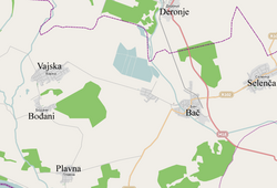 Map of Vajska and other settlements in the neighborhood | |
 Vajska  Vajska  Vajska | |
| Coordinates: 45°25′N 19°07′E / 45.417°N 19.117°E | |
| Country | |
| Province | |
| Region | Bačka (Podunavlje) |
| District | South Bačka |
| Municipality | Bač |
| Population (2011) | |
| • Total | 2,834 |
| Time zone | UTC+1 (CET) |
| • Summer (DST) | UTC+2 (CEST) |
Name edit
In Serbian the village is known as Vajska (Вајска), in Croatian as Vajska, in Hungarian as Vajszka or Józsefháza, in German as Wajska and in Romanian as Vaisca.
History edit
During the early stage of the Yugoslav Wars and following the Battle of Borovo Selo in neighbouring Croatia, Danube river link was established between Vajska and Borovo 4 of May 1991 which during its operation reportedly served between 10-30,000 passengers including Croat refugees leaving the village of Borovo.[1]
Demographics edit
The population of the village numbered 2,834 people as of the 2011 census.[2] In 2002, the population included 1,319 Serbs, 569 Romanians, 353 Croats, 341 Hungarians, 207 Yugoslavs, and others.
Historical population edit
- 1961: 4,355
- 1971: 3,798
- 1981: 3,448
- 1991: 3,272
- 2002: 3,169
Gallery edit
-
 Map of the Bač municipality showing the location of Vajska.
 -
 Saint George the Martyr Catholic church.


See also edit
References edit
- ^ Filipović, Vladimir (2022). "Srpska pobuna u selima vukovarske općine 1990. - 1991" [Serb Rebelion in the Villages of Vukovar Municipality 1990. - 1991.]. Scrinia Slavonica (in Croatian). 22 (1). Department for the History of Slavonia, Srijem and Baranja of the Croatian Institute of History: 291–319. doi:10.22586/ss.22.1.9. Retrieved 4 December 2022 – via Hrčak.
- ^ "COMPARATIVE OVERVIEW OF THE NUMBER OF POPULATION IN 1948, 1953, 1961, 1971, 1981, 1991, 2002 AND 2011" (PDF). Publikacije Stat. Statistical Office of the Republic of Serbia. 2014. Archived (PDF) from the original on 20 January 2022.
- Slobodan Ćurčić, Broj stanovnika Vojvodine, Novi Sad, 1996.
45°25′N 19°07′E / 45.417°N 19.117°E