


Summary
Valderrama, officially the Municipality of Valderrama (Kinaray-a: Banwa kang Valderrama; Hiligaynon: Banwa sang Valderrama; Tagalog: Bayan ng Valderrama), is a 4th class municipality in the province of Antique, Philippines. According to the 2020 census, it has a population of 19,971 people.[4] Making it 15th most populous municipality in the province of Antique and the second largest municipality in terms of land area, with a total area of 273.79 square kilometers.
Valderrama | |
|---|---|
| Municipality of Valderrama | |
 Flag | |
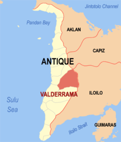 Map of Antique with Valderrama highlighted | |
OpenStreetMap .mw-parser-output .locmap .od{position:absolute}.mw-parser-output .locmap .id{position:absolute;line-height:0}.mw-parser-output .locmap .l0{font-size:0;position:absolute}.mw-parser-output .locmap .pv{line-height:110%;position:absolute;text-align:center}.mw-parser-output .locmap .pl{line-height:110%;position:absolute;top:-0.75em;text-align:right}.mw-parser-output .locmap .pr{line-height:110%;position:absolute;top:-0.75em;text-align:left}.mw-parser-output .locmap .pv>div{display:inline;padding:1px}.mw-parser-output .locmap .pl>div{display:inline;padding:1px;float:right}.mw-parser-output .locmap .pr>div{display:inline;padding:1px;float:left}html.skin-theme-clientpref-night .mw-parser-output .od,html.skin-theme-clientpref-night .mw-parser-output .od .pv>div,html.skin-theme-clientpref-night .mw-parser-output .od .pl>div,html.skin-theme-clientpref-night .mw-parser-output .od .pr>div{background:#000;color:#fff}html.skin-theme-clientpref-night .mw-parser-output .locmap{filter:grayscale(0.6)}@media(prefers-color-scheme:dark){html.skin-theme-clientpref-os .mw-parser-output .locmap{filter:grayscale(0.6)}html.skin-theme-clientpref-os .mw-parser-output .od,html.skin-theme-clientpref-os .mw-parser-output .od .pv>div,html.skin-theme-clientpref-os .mw-parser-output .od .pl>div,html.skin-theme-clientpref-os .mw-parser-output .od .pr>div{background:#000;color:#fff}}  Valderrama Location within the Philippines | |
| Coordinates: 11°00′13″N 122°07′46″E / 11.0036°N 122.1294°E | |
| Country | Philippines |
| Region | Western Visayas |
| Province | Antique |
| District | Lone district |
| Named for | Manuel Blanco Valderrama |
| Barangays | 22 (see Barangays) |
| Government | |
| • Type | Sangguniang Bayan |
| • Mayor | Jocelyn L. Posadas |
| • Vice Mayor | Christopher B. Maguad |
| • Representative | Anthony Agapito B. Legarda Jr. |
| • Municipal Council | Members |
| • Electorate | 14,313 voters (2022) |
| Area | |
| • Total | 273.79 km2 (105.71 sq mi) |
| Elevation | 479 m (1,572 ft) |
| Highest elevation [3] (Mount Baloy) | 1,960 m (6,430 ft) |
| Lowest elevation | 25 m (82 ft) |
| Population (2020 census)[4] | |
| • Total | 19,971 |
| • Density | 73/km2 (190/sq mi) |
| • Households | 4,750 |
| Economy | |
| • Income class | 4th municipal income class |
| • Poverty incidence | 42.59 |
| • Revenue | ₱ 130.3 million (2020) |
| • Assets | ₱ 300.8 million (2020) |
| • Expenditure | ₱ 110 million (2020) |
| • Liabilities | ₱ 46.12 million (2020) |
| Service provider | |
| • Electricity | Antique Electric Cooperative (ANTECO) |
| Time zone | UTC+8 (PST) |
| ZIP code | 5703 |
| PSGC | 060618000 |
| IDD : area code | +63 (0)36 |
| Native languages | Karay-a Sulod Hiligaynon Tagalog |
The area is home to the indigenous Iraynun-Bukidnon, speakers of a dialect of the Kiniray-a language, who have crafted the only rice terrace clusters in the Visayas through indigenous knowledge and sheer vernacular capabilities. The rice terraces of the Iraynun-Bukidnon are divided into three terraced fields, namely, Lublub rice terraces, Baking rice terraces, and San Agustin rice terraces. All of the rice terrace clusters have been researched on by the National Commission for Culture and the Arts and various scholars from the University of the Philippines. There have been campaigns to nominate the Iraynun-Bukidnon Rice Terraces, along with the central Panay mountain range, into the UNESCO World Heritage List.
Etymology edit
The municipality was named after Spanish captain-general (governor) ad interim Manuel Blanco de Valderrama.
Geography edit
Valderrama is 53 kilometres (33 mi) from the provincial capital, San Jose de Buenavista.
According to the Philippine Statistics Authority, the municipality has a land area of 273.79 square kilometres (105.71 sq mi) [6] constituting 10.03% of the 2,729.17-square-kilometre- (1,053.74 sq mi) total area of Antique.
Climate edit
| Climate data for Valderrama, Antique | |||||||||||||
|---|---|---|---|---|---|---|---|---|---|---|---|---|---|
| Month | Jan | Feb | Mar | Apr | May | Jun | Jul | Aug | Sep | Oct | Nov | Dec | Year |
| Mean daily maximum °C (°F) | 28 (82) |
30 (86) |
31 (88) |
33 (91) |
32 (90) |
30 (86) |
29 (84) |
29 (84) |
29 (84) |
29 (84) |
29 (84) |
29 (84) |
30 (86) |
| Mean daily minimum °C (°F) | 22 (72) |
22 (72) |
22 (72) |
24 (75) |
25 (77) |
25 (77) |
25 (77) |
25 (77) |
25 (77) |
24 (75) |
24 (75) |
23 (73) |
24 (75) |
| Average precipitation mm (inches) | 64 (2.5) |
44 (1.7) |
58 (2.3) |
83 (3.3) |
204 (8.0) |
304 (12.0) |
334 (13.1) |
291 (11.5) |
310 (12.2) |
281 (11.1) |
172 (6.8) |
97 (3.8) |
2,242 (88.3) |
| Average rainy days | 12.5 | 8.9 | 11.3 | 14.1 | 24.2 | 28.0 | 29.6 | 28.2 | 28.1 | 28.1 | 20.2 | 15.2 | 248.4 |
| Source: Meteoblue (modeled/calculated data, not measured locally)[7] | |||||||||||||
Barangays edit
Valderrama is politically subdivided into 22 barangays.[8] Each barangay consists of puroks and some have sitios.
| PSGC | Barangay | Population | ±% p.a. | |||
|---|---|---|---|---|---|---|
| 2020[4] | 2010[9] | |||||
| 060618022 | Alon | 1.1% | 222 | 219 | 0.14% | |
| 060618001 | Bakiang | 2.9% | 588 | 569 | 0.33% | |
| 060618002 | Binanogan | 3.4% | 673 | 534 | 2.34% | |
| 060618003 | Borocboroc | 4.1% | 820 | 840 | −0.24% | |
| 060618004 | Bugnay | 4.8% | 953 | 936 | 0.18% | |
| 060618005 | Buluangan I | 9.0% | 1,800 | 1,563 | 1.42% | |
| 060618006 | Buluangan II | 2.4% | 479 | 463 | 0.34% | |
| 060618007 | Bunsod | 3.9% | 772 | 779 | −0.09% | |
| 060618008 | Busog | 1.3% | 259 | 255 | 0.16% | |
| 060618009 | Cananghan | 1.4% | 274 | 265 | 0.33% | |
| 060618010 | Canipayan | 2.9% | 587 | 579 | 0.14% | |
| 060618011 | Cansilayan | 1.3% | 269 | 268 | 0.04% | |
| 060618012 | Culyat | 0.8% | 162 | 149 | 0.84% | |
| 060618013 | Iglinab | 4.6% | 925 | 884 | 0.45% | |
| 060618014 | Igmasandig | 1.4% | 273 | 271 | 0.07% | |
| 060618015 | Lublub | 5.0% | 991 | 1,016 | −0.25% | |
| 060618016 | Manlacbo | 5.5% | 1,092 | 1,040 | 0.49% | |
| 060618017 | Pandanan | 10.0% | 1,993 | 1,809 | 0.97% | |
| 060618018 | San Agustin | 6.2% | 1,232 | 1,310 | −0.61% | |
| 060618019 | Takas (Poblacion) | 9.4% | 1,878 | 1,869 | 0.05% | |
| 060618020 | Tigmamale | 4.4% | 871 | 851 | 0.23% | |
| 060618021 | Ubos (Poblacion) | 10.1% | 2,011 | 1,973 | 0.19% | |
| Total | 19,971 | 18,442 | 0.80% | |||
Demographics edit
| Year | Pop. | ±% p.a. |
|---|---|---|
| 1903 | 4,885 | — |
| 1918 | 5,424 | +0.70% |
| 1939 | 7,742 | +1.71% |
| 1948 | 9,388 | +2.17% |
| 1960 | 8,683 | −0.65% |
| 1970 | 9,821 | +1.24% |
| 1975 | 11,936 | +3.99% |
| 1980 | 12,968 | +1.67% |
| 1990 | 14,197 | +0.91% |
| 1995 | 15,433 | +1.58% |
| 2000 | 17,874 | +3.20% |
| 2007 | 18,878 | +0.76% |
| 2010 | 18,442 | −0.85% |
| 2015 | 19,124 | +0.69% |
| 2020 | 19,971 | +0.86% |
| Source: Philippine Statistics Authority[10][9][11][12] | ||
In the 2020 census, Valderrama had a population of 19,971.[4] The population density was 73 inhabitants per square kilometre (190/sq mi).
Economy edit
Government edit
The newly-elected Mayor Jocelyn Posadas took her oath on June 21, 2016, after winning the elections May 9, 2016. The new set of the municipality's government officials are Josefino Castillón as Vice Mayor and 8 Sangguniang Bayan (SB) Members: Richel Pagayônan, Pedro Labánon, Jose Mervin Gonzales, Keking Otadoy, Mary Joyce Roquero, Christopher Maguad, Anthony Gade and Budak Pon-an.[20][full citation needed]
References edit
- ^ Municipality of Valderrama | (DILG)
- ^ "2015 Census of Population, Report No. 3 – Population, Land Area, and Population Density" (PDF). Philippine Statistics Authority. Quezon City, Philippines. August 2016. ISSN 0117-1453. Archived (PDF) from the original on May 25, 2021. Retrieved July 16, 2021.
- ^ "Valderrama". Official Antique Website. 2012. Archived from the original on 28 July 2012. Retrieved 11 February 2013.
- ^ a b c d Census of Population (2020). "Region VI (Western Visayas)". Total Population by Province, City, Municipality and Barangay. Philippine Statistics Authority. Retrieved 8 July 2021.
- ^ "PSA Releases the 2018 Municipal and City Level Poverty Estimates". Philippine Statistics Authority. 15 December 2021. Retrieved 22 January 2022.
- ^ "Province: Antique". PSGC Interactive. Quezon City, Philippines: Philippine Statistics Authority. Retrieved 12 November 2016.
- ^ "Valderrama: Average Temperatures and Rainfall". Meteoblue. Retrieved 1 May 2020.
- ^ "Municipal: Valderrama, Antique". PSGC Interactive. Quezon City, Philippines: Philippine Statistics Authority. Retrieved 8 January 2016.
- ^ a b Census of Population and Housing (2010). "Region VI (Western Visayas)" (PDF). Total Population by Province, City, Municipality and Barangay. National Statistics Office. Retrieved 29 June 2016.
- ^ Census of Population (2015). "Region VI (Western Visayas)". Total Population by Province, City, Municipality and Barangay. Philippine Statistics Authority. Retrieved 20 June 2016.
- ^ Censuses of Population (1903–2007). "Region VI (Western Visayas)". Table 1. Population Enumerated in Various Censuses by Province/Highly Urbanized City: 1903 to 2007. National Statistics Office.
{{cite encyclopedia}}: CS1 maint: numeric names: authors list (link) - ^ "Province of Antique". Municipality Population Data. Local Water Utilities Administration Research Division. Retrieved 17 December 2016.
- ^ "Poverty incidence (PI):". Philippine Statistics Authority. Retrieved December 28, 2020.
- ^ "Estimation of Local Poverty in the Philippines" (PDF). Philippine Statistics Authority. 29 November 2005.
- ^ "2003 City and Municipal Level Poverty Estimates" (PDF). Philippine Statistics Authority. 23 March 2009.
- ^ "City and Municipal Level Poverty Estimates; 2006 and 2009" (PDF). Philippine Statistics Authority. 3 August 2012.
- ^ "2012 Municipal and City Level Poverty Estimates" (PDF). Philippine Statistics Authority. 31 May 2016.
- ^ "Municipal and City Level Small Area Poverty Estimates; 2009, 2012 and 2015". Philippine Statistics Authority. 10 July 2019.
- ^ "PSA Releases the 2018 Municipal and City Level Poverty Estimates". Philippine Statistics Authority. 15 December 2021. Retrieved 22 January 2022.
- ^ ivote.ph: Comelec Election Returns May 2016 Elections
External links edit
- Philippine Standard Geographic Code