


Summary
Vanavara (Russian: Ванава́ра) is a rural locality (a selo) in Evenkiysky District of Krasnoyarsk Krai, Russia, located on the Podkamennaya Tunguska River at the mouth of the local Vanavarki River. Population: 3,153 (2010 Census);[1] 3,313 (2002 Census);[4] 5,697 (1989 Census).[5]
Vanavara
Ванавара | |
|---|---|
Location of Vanavara .mw-parser-output .locmap .od{position:absolute}.mw-parser-output .locmap .id{position:absolute;line-height:0}.mw-parser-output .locmap .l0{font-size:0;position:absolute}.mw-parser-output .locmap .pv{line-height:110%;position:absolute;text-align:center}.mw-parser-output .locmap .pl{line-height:110%;position:absolute;top:-0.75em;text-align:right}.mw-parser-output .locmap .pr{line-height:110%;position:absolute;top:-0.75em;text-align:left}.mw-parser-output .locmap .pv>div{display:inline;padding:1px}.mw-parser-output .locmap .pl>div{display:inline;padding:1px;float:right}.mw-parser-output .locmap .pr>div{display:inline;padding:1px;float:left}html.skin-theme-clientpref-night .mw-parser-output .od,html.skin-theme-clientpref-night .mw-parser-output .od .pv>div,html.skin-theme-clientpref-night .mw-parser-output .od .pl>div,html.skin-theme-clientpref-night .mw-parser-output .od .pr>div{background:#000;color:#fff}html.skin-theme-clientpref-night .mw-parser-output .locmap{filter:grayscale(0.6)}@media(prefers-color-scheme:dark){html.skin-theme-clientpref-os .mw-parser-output .locmap{filter:grayscale(0.6)}html.skin-theme-clientpref-os .mw-parser-output .od,html.skin-theme-clientpref-os .mw-parser-output .od .pv>div,html.skin-theme-clientpref-os .mw-parser-output .od .pl>div,html.skin-theme-clientpref-os .mw-parser-output .od .pr>div{background:#000;color:#fff}}  Vanavara Location of Vanavara 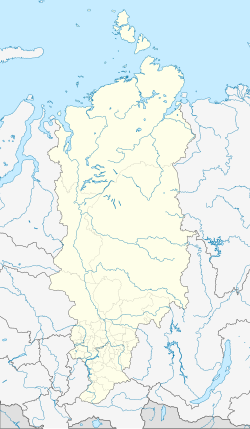 Vanavara Vanavara (Krasnoyarsk Krai) | |
| Coordinates: 60°20′40″N 102°17′00″E / 60.34444°N 102.28333°E | |
| Country | Russia |
| Federal subject | Krasnoyarsk Krai[1] |
| Founded | 1932 |
| Population | |
| • Total | 3,153 |
| • Subordinated to | Evenkiysky District[1] |
| Time zone | UTC+7 (MSK+4 |
| Postal code(s)[3] | 648490 |
| OKTMO ID | 04650459101 |
Vanavara is notable for being the nearest populated place to the site of the 1908 Tunguska event.
History edit
The locality, also occasionally named Anavar (Анавар), as it exists today was founded in 1932 as a base for herders, hunters, and fishermen, as well as a location for a weather station.[6]
A plane crash occurred on September 26, 1994, when a plane flying from Krasnoyarsk to Tura had diverted to Vanavara Airport due to bad weather: on running out of fuel the crew then attempted an emergency landing on the bank of the Chamba River 41 km from Vanavara centre. All twenty-four passengers and four crew died in the crash.[7]
On December 10, 2010, an explosion occurred in a boiler in the heating plant in Vanavara. A fireman was killed in the incident and heating was cut off for 720 houses, forcing the evacuation of many children to Krasnoyarsk.[8] Heating has since been fully restored.[9]
Transportation edit
The locality is served by Vanavara Airport.[10]
Climate edit
Vanavara has a subarctic climate (Köppen climate classification Dfc). Winters are severely cold with average temperatures from −34.5 to −22.7 °C (−30.1 to −8.9 °F) in January, while summers are warm with average temperatures from +10.2 to +24.9 °C (50.4 to 76.8 °F). Precipitation is moderate and is somewhat higher in summer than at other times of the year.
| Climate data for Vanavara | |||||||||||||
|---|---|---|---|---|---|---|---|---|---|---|---|---|---|
| Month | Jan | Feb | Mar | Apr | May | Jun | Jul | Aug | Sep | Oct | Nov | Dec | Year |
| Record high °C (°F) | 1.0 (33.8) |
5.3 (41.5) |
13.8 (56.8) |
25.3 (77.5) |
33.9 (93.0) |
35.7 (96.3) |
36.0 (96.8) |
34.8 (94.6) |
29.6 (85.3) |
19.2 (66.6) |
6.9 (44.4) |
1.7 (35.1) |
36.0 (96.8) |
| Mean daily maximum °C (°F) | −22.7 (−8.9) |
−15.8 (3.6) |
−4.9 (23.2) |
3.6 (38.5) |
13.1 (55.6) |
21.6 (70.9) |
24.9 (76.8) |
20.9 (69.6) |
11.7 (53.1) |
0.5 (32.9) |
−12.8 (9.0) |
−21.6 (−6.9) |
1.5 (34.8) |
| Daily mean °C (°F) | −28.4 (−19.1) |
−24.2 (−11.6) |
−13.8 (7.2) |
−3.4 (25.9) |
6.3 (43.3) |
14.4 (57.9) |
17.8 (64.0) |
13.8 (56.8) |
5.6 (42.1) |
−3.9 (25.0) |
−18.3 (−0.9) |
−27.1 (−16.8) |
−5.1 (22.8) |
| Mean daily minimum °C (°F) | −34.5 (−30.1) |
−31.7 (−25.1) |
−22.9 (−9.2) |
−10.9 (12.4) |
−0.4 (31.3) |
7.0 (44.6) |
10.2 (50.4) |
6.9 (44.4) |
0.3 (32.5) |
−8.2 (17.2) |
−23.8 (−10.8) |
−32.7 (−26.9) |
−11.7 (10.9) |
| Record low °C (°F) | −61.0 (−77.8) |
−57.7 (−71.9) |
−50.3 (−58.5) |
−39.0 (−38.2) |
−26.4 (−15.5) |
−6.2 (20.8) |
−3.0 (26.6) |
−5.9 (21.4) |
−16.2 (2.8) |
−39.2 (−38.6) |
−54.5 (−66.1) |
−58.2 (−72.8) |
−61.0 (−77.8) |
| Average precipitation mm (inches) | 21 (0.8) |
15 (0.6) |
15 (0.6) |
28 (1.1) |
35 (1.4) |
56 (2.2) |
55 (2.2) |
54 (2.1) |
42 (1.7) |
42 (1.7) |
33 (1.3) |
24 (0.9) |
420 (16.6) |
| Average snowfall cm (inches) | 46 (18) |
53 (21) |
54 (21) |
41 (16) |
4 (1.6) |
0.2 (0.1) |
0 (0) |
0 (0) |
1 (0.4) |
5 (2.0) |
21 (8.3) |
35 (14) |
260.2 (102.4) |
| Average rainy days | 0 | 0 | 1 | 8 | 17 | 17 | 15 | 16 | 16 | 10 | 1 | 0.1 | 101.1 |
| Average snowy days | 25 | 21 | 17 | 10 | 2 | 0.2 | 0 | 0 | 1 | 14 | 24 | 25 | 139.2 |
| Average relative humidity (%) | 77 | 74 | 66 | 60 | 57 | 62 | 66 | 73 | 75 | 78 | 79 | 78 | 70 |
| Mean monthly sunshine hours | 54 | 119 | 186 | 226 | 245 | 288 | 295 | 216 | 142 | 86 | 62 | 27 | 1,946 |
| Source 1: pogoda.ru.net[11] | |||||||||||||
| Source 2: NOAA (sun only, 1961-1990)[12] | |||||||||||||
References edit
- ^ a b c d e f Russian Federal State Statistics Service (2011). Всероссийская перепись населения 2010 года. Том 1 [2010 All-Russian Population Census, vol. 1]. Всероссийская перепись населения 2010 года [2010 All-Russia Population Census] (in Russian). Federal State Statistics Service.
- ^ "Об исчислении времени". Официальный интернет-портал правовой информации (in Russian). June 3, 2011. Retrieved January 19, 2019.
- ^ Почта России. Информационно-вычислительный центр ОАСУ РПО. (Russian Post). Поиск объектов почтовой связи (Postal Objects Search) (in Russian)
- ^ Russian Federal State Statistics Service (May 21, 2004). Численность населения России, субъектов Российской Федерации в составе федеральных округов, районов, городских поселений, сельских населённых пунктов – районных центров и сельских населённых пунктов с населением 3 тысячи и более человек [Population of Russia, Its Federal Districts, Federal Subjects, Districts, Urban Localities, Rural Localities—Administrative Centers, and Rural Localities with Population of Over 3,000] (XLS). Всероссийская перепись населения 2002 года [All-Russia Population Census of 2002] (in Russian).
- ^ Всесоюзная перепись населения 1989 г. Численность наличного населения союзных и автономных республик, автономных областей и округов, краёв, областей, районов, городских поселений и сёл-райцентров [All Union Population Census of 1989: Present Population of Union and Autonomous Republics, Autonomous Oblasts and Okrugs, Krais, Oblasts, Districts, Urban Settlements, and Villages Serving as District Administrative Centers]. Всесоюзная перепись населения 1989 года [All-Union Population Census of 1989] (in Russian). Институт демографии Национального исследовательского университета: Высшая школа экономики [Institute of Demography at the National Research University: Higher School of Economics]. 1989 – via Demoscope Weekly.
- ^ "Aerological station Vanavara" (in Russian). Archived from the original on May 2, 2013. Retrieved January 20, 2013.
- ^ "Disaster Yak-40" (in Russian). Accidents, incidents and crashes in the Soviet Union and Russia. Retrieved August 13, 2013.
- ^ Белькович, Светлана (December 10, 2010). Котельная взорвалась в посёлке в Красноярском крае, погиб кочегар. РИА Новости (in Russian). Retrieved August 13, 2013.
- ^ Теплоснабжение полностью восстановлено в красноярском посёлке Ванавара. РИА Новости (in Russian). January 16, 2011. Retrieved August 13, 2013.
- ^ "Vanavara Airport". OurAirports. Retrieved January 20, 2013.
- ^ "Weather And Climate - Climate Vanavara" (in Russian). Retrieved January 20, 2013.
- ^ "Climate Normals for Vanavara". National Oceanic and Atmospheric Administration. Retrieved January 20, 2013.