
KNOWPIA
WELCOME TO KNOWPIA

Vassens 
Summary
Vassens (French pronunciation: [vasɑ̃]) is a commune in the Aisne department in Hauts-de-France in northern France near the town of Laon.
Vassens | |
|---|---|
 War memorial | |
Location of Vassens .mw-parser-output .locmap .od{position:absolute}.mw-parser-output .locmap .id{position:absolute;line-height:0}.mw-parser-output .locmap .l0{font-size:0;position:absolute}.mw-parser-output .locmap .pv{line-height:110%;position:absolute;text-align:center}.mw-parser-output .locmap .pl{line-height:110%;position:absolute;top:-0.75em;text-align:right}.mw-parser-output .locmap .pr{line-height:110%;position:absolute;top:-0.75em;text-align:left}.mw-parser-output .locmap .pv>div{display:inline;padding:1px}.mw-parser-output .locmap .pl>div{display:inline;padding:1px;float:right}.mw-parser-output .locmap .pr>div{display:inline;padding:1px;float:left}html.skin-theme-clientpref-night .mw-parser-output .od,html.skin-theme-clientpref-night .mw-parser-output .od .pv>div,html.skin-theme-clientpref-night .mw-parser-output .od .pl>div,html.skin-theme-clientpref-night .mw-parser-output .od .pr>div{background:#000;color:#fff}html.skin-theme-clientpref-night .mw-parser-output .locmap{filter:grayscale(0.6)}@media(prefers-color-scheme:dark){html.skin-theme-clientpref-os .mw-parser-output .locmap{filter:grayscale(0.6)}html.skin-theme-clientpref-os .mw-parser-output .od,html.skin-theme-clientpref-os .mw-parser-output .od .pv>div,html.skin-theme-clientpref-os .mw-parser-output .od .pl>div,html.skin-theme-clientpref-os .mw-parser-output .od .pr>div{background:#000;color:#fff}}  Vassens  Vassens | |
| Coordinates: 49°28′07″N 3°09′16″E / 49.4686°N 3.1544°E | |
| Country | France |
| Region | Hauts-de-France |
| Department | Aisne |
| Arrondissement | Soissons |
| Canton | Vic-sur-Aisne |
| Government | |
| • Mayor (2020–2026) | Patrick Thiel[1] |
| Area 1 | 9.87 km2 (3.81 sq mi) |
| Population (2021)[2] | 160 |
| • Density | 16/km2 (42/sq mi) |
| Time zone | UTC+01:00 (CET) |
| • Summer (DST) | UTC+02:00 (CEST) |
| INSEE/Postal code | 02762 /02290 |
| Elevation | 59–156 m (194–512 ft) (avg. 80 m or 260 ft) |
| 1 French Land Register data, which excludes lakes, ponds, glaciers > 1 km2 (0.386 sq mi or 247 acres) and river estuaries. | |
Geography edit
The commune with the districts of Le Mesnil, Vézin and Le Pont is located at the Ru de Vassens stream and on the border with the Département of Oise between Noyon and Soissons. Neighboring communes are Blérancourt and Saint-Aubin in the north, Selens in the north-east, Morsain in the east, Autrêches (which is located in the Département Oise) in the south Audignicourt in the west.
Places of interest edit
- The church
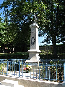
- The war memorial crowned by a Gallic rooster (Monument aux morts).
Population edit
| Year | Pop. | ±% |
|---|---|---|
| 1962 | 169 | — |
| 1968 | 138 | −18.3% |
| 1975 | 110 | −20.3% |
| 1982 | 91 | −17.3% |
| 1990 | 105 | +15.4% |
| 1999 | 126 | +20.0% |
| 2008 | 169 | +34.1% |
See also edit
References edit
- ^ "Répertoire national des élus: les maires". data.gouv.fr, Plateforme ouverte des données publiques françaises (in French). 9 August 2021.
- ^ "Populations légales 2021". The National Institute of Statistics and Economic Studies. 28 December 2023.
Wikimedia Commons has media related to Vassens.