
KNOWPIA
WELCOME TO KNOWPIA

Vatan, Indre 
Summary
Vatan is a French commune in the Indre department in Centre-Val de Loire region.[3] The town has been labeled Village étape since 1997 and Ville fleurie with 2 flowers.
Vatan | |
|---|---|
 The town hall in Vatan | |
 Coat of arms | |
Location of Vatan .mw-parser-output .locmap .od{position:absolute}.mw-parser-output .locmap .id{position:absolute;line-height:0}.mw-parser-output .locmap .l0{font-size:0;position:absolute}.mw-parser-output .locmap .pv{line-height:110%;position:absolute;text-align:center}.mw-parser-output .locmap .pl{line-height:110%;position:absolute;top:-0.75em;text-align:right}.mw-parser-output .locmap .pr{line-height:110%;position:absolute;top:-0.75em;text-align:left}.mw-parser-output .locmap .pv>div{display:inline;padding:1px}.mw-parser-output .locmap .pl>div{display:inline;padding:1px;float:right}.mw-parser-output .locmap .pr>div{display:inline;padding:1px;float:left}html.skin-theme-clientpref-night .mw-parser-output .od,html.skin-theme-clientpref-night .mw-parser-output .od .pv>div,html.skin-theme-clientpref-night .mw-parser-output .od .pl>div,html.skin-theme-clientpref-night .mw-parser-output .od .pr>div{background:#000;color:#fff}html.skin-theme-clientpref-night .mw-parser-output .locmap{filter:grayscale(0.6)}@media(prefers-color-scheme:dark){html.skin-theme-clientpref-os .mw-parser-output .locmap{filter:grayscale(0.6)}html.skin-theme-clientpref-os .mw-parser-output .od,html.skin-theme-clientpref-os .mw-parser-output .od .pv>div,html.skin-theme-clientpref-os .mw-parser-output .od .pl>div,html.skin-theme-clientpref-os .mw-parser-output .od .pr>div{background:#000;color:#fff}}  Vatan  Vatan | |
| Coordinates: 47°04′27″N 1°48′41″E / 47.0742°N 1.8114°E | |
| Country | France |
| Region | Centre-Val de Loire |
| Department | Indre |
| Arrondissement | Issoudun |
| Canton | Levroux |
| Government | |
| • Mayor (2020–2026) | Philippe Metivier[1] |
| Area 1 | 29.8 km2 (11.5 sq mi) |
| Population (2021)[2] | 1,926 |
| • Density | 65/km2 (170/sq mi) |
| Time zone | UTC+01:00 (CET) |
| • Summer (DST) | UTC+02:00 (CEST) |
| INSEE/Postal code | 36230 /36150 |
| Elevation | 118–201 m (387–659 ft) (avg. 132 m or 433 ft) |
| 1 French Land Register data, which excludes lakes, ponds, glaciers > 1 km2 (0.386 sq mi or 247 acres) and river estuaries. | |
Population edit
| Year | Pop. | ±% p.a. |
|---|---|---|
| 1968 | 2,194 | — |
| 1975 | 2,270 | +0.49% |
| 1982 | 2,046 | −1.47% |
| 1990 | 2,022 | −0.15% |
| 1999 | 1,972 | −0.28% |
| 2009 | 2,059 | +0.43% |
| 2014 | 2,038 | −0.20% |
| 2020 | 1,935 | −0.86% |
| Source: INSEE[4] | ||
See also edit
References edit
- ^ "Répertoire national des élus: les maires". data.gouv.fr, Plateforme ouverte des données publiques françaises (in French). 9 August 2021.
- ^ "Populations légales 2021". The National Institute of Statistics and Economic Studies. 28 December 2023.
- ^ INSEE commune file
- ^ Population en historique depuis 1968, INSEE
Gallery edit
 |
 |
 |
 |
 |
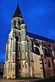
Wikimedia Commons has media related to Vatan.