
KNOWPIA
WELCOME TO KNOWPIA

Verlinghem 
Summary
Verlinghem (French pronunciation: [vɛʁlɛ̃ɡɛm]; Dutch: Everlingem) is a commune in the Nord department in northern France. It is part of the Métropole Européenne de Lille.[3]
Verlinghem | |
|---|---|
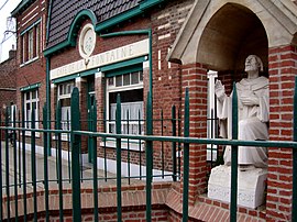 The Saint-Chrysole fountain in Verlinghem | |
 Coat of arms | |
Location of Verlinghem .mw-parser-output .locmap .od{position:absolute}.mw-parser-output .locmap .id{position:absolute;line-height:0}.mw-parser-output .locmap .l0{font-size:0;position:absolute}.mw-parser-output .locmap .pv{line-height:110%;position:absolute;text-align:center}.mw-parser-output .locmap .pl{line-height:110%;position:absolute;top:-0.75em;text-align:right}.mw-parser-output .locmap .pr{line-height:110%;position:absolute;top:-0.75em;text-align:left}.mw-parser-output .locmap .pv>div{display:inline;padding:1px}.mw-parser-output .locmap .pl>div{display:inline;padding:1px;float:right}.mw-parser-output .locmap .pr>div{display:inline;padding:1px;float:left}html.skin-theme-clientpref-night .mw-parser-output .od,html.skin-theme-clientpref-night .mw-parser-output .od .pv>div,html.skin-theme-clientpref-night .mw-parser-output .od .pl>div,html.skin-theme-clientpref-night .mw-parser-output .od .pr>div{background:#000;color:#fff}html.skin-theme-clientpref-night .mw-parser-output .locmap{filter:grayscale(0.6)}@media(prefers-color-scheme:dark){html.skin-theme-clientpref-os .mw-parser-output .locmap{filter:grayscale(0.6)}html.skin-theme-clientpref-os .mw-parser-output .od,html.skin-theme-clientpref-os .mw-parser-output .od .pv>div,html.skin-theme-clientpref-os .mw-parser-output .od .pl>div,html.skin-theme-clientpref-os .mw-parser-output .od .pr>div{background:#000;color:#fff}}  Verlinghem  Verlinghem | |
| Coordinates: 50°40′57″N 2°59′50″E / 50.6825°N 2.9972°E | |
| Country | France |
| Region | Hauts-de-France |
| Department | Nord |
| Arrondissement | Lille |
| Canton | Lambersart |
| Intercommunality | Métropole Européenne de Lille |
| Government | |
| • Mayor (2020–2026) | Thierry Bonte[1] |
| Area 1 | 10.08 km2 (3.89 sq mi) |
| Population (2021)[2] | 2,673 |
| • Density | 270/km2 (690/sq mi) |
| Time zone | UTC+01:00 (CET) |
| • Summer (DST) | UTC+02:00 (CEST) |
| INSEE/Postal code | 59611 /59237 |
| Elevation | 12–34 m (39–112 ft) (avg. 29 m or 95 ft) |
| 1 French Land Register data, which excludes lakes, ponds, glaciers > 1 km2 (0.386 sq mi or 247 acres) and river estuaries. | |
Population edit
| Year | Pop. | ±% p.a. |
|---|---|---|
| 1968 | 1,363 | — |
| 1975 | 1,729 | +3.46% |
| 1982 | 1,941 | +1.67% |
| 1990 | 2,182 | +1.47% |
| 1999 | 2,377 | +0.96% |
| 2007 | 2,303 | −0.39% |
| 2012 | 2,330 | +0.23% |
| 2017 | 2,460 | +1.09% |
| Source: INSEE[4] | ||
Heraldry edit
 |
The arms of Verlinghem are blazoned : Quarterly 1&4: Argent, a lion gules, armed and langued azure, crowned Or; 2&3: Gules, a mullet of 16 argent.
|
See also edit
References edit
- ^ (in French). data.gouv.fr, Plateforme ouverte des données publiques françaises. 13 September 2022 https://www.data.gouv.fr/fr/datasets/r/2876a346-d50c-4911-934e-19ee07b0e503.
{{cite web}}: Missing or empty|title=(help) - ^ "Populations légales 2021". The National Institute of Statistics and Economic Studies. 28 December 2023.
- ^ INSEE commune file
- ^ Population en historique depuis 1968, INSEE
External links edit
Wikimedia Commons has media related to Verlinghem.
- Official website of the commune (in French)