
KNOWPIA
WELCOME TO KNOWPIA

Virkie 
Summary
Virkie is the most southerly district of Shetland, other than Fair Isle and is best defined as the area south of the Ward Hill in Dunrossness, also locally referred to as "below da hill" (below the hill), or "da laich Ness" (the low headland).
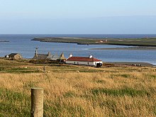
Virkie encompasses the following settlements; Exnaboe, Toab, Scatness, and Sumburgh.
Virkie is the only place which uses a ZE3 postcode.
There is an Iron Age Broch and Village which was discovered in 1975 in old Scatness, part of Virkie.[1][2]
Attractions edit
See also edit
- Virkie Marina
- Ness Boating Club
References edit
External links edit
- Link to Sumburgh Airport
- Sumburgh Hotel
Sources edit
- This article is based on http://shetlopedia.com/Virkie a GFDL wiki.
59°53′N 1°18′W / 59.883°N 1.300°W