
KNOWPIA
WELCOME TO KNOWPIA

Voorst 
Summary
Voorst (Dutch pronunciation: [voːrst] ⓘ) is a municipality and a town in the eastern Netherlands.
Voorst | |
|---|---|
 De Vecht | |
 Flag Coat of arms | |
 Location in Gelderland | |
| Coordinates: 52°14′N 6°7′E / 52.233°N 6.117°E | |
| Country | Netherlands |
| Province | Gelderland |
| Government | |
| • Body | Municipal council |
| • Mayor | Jos Penninx (PvdA) |
| Area | |
| • Total | 126.47 km2 (48.83 sq mi) |
| • Land | 122.97 km2 (47.48 sq mi) |
| • Water | 3.50 km2 (1.35 sq mi) |
| Elevation | 6 m (20 ft) |
| Population (January 2021)[4] | |
| • Total | 24,790 |
| • Density | 202/km2 (520/sq mi) |
| Demonym | Voorstenaar |
| Time zone | UTC+1 (CET) |
| • Summer (DST) | UTC+2 (CEST) |
| Postcode | 7382–7397, 7439 |
| Area code | 055, 0571 |
| Website | www |

Population centres edit
- Appen (near a wood where nice walks can be taken)
- Bussloo (with a recreation centre with a small lake and beach)
- De Kar (near a motorway junction (A1, Amsterdam- Berlin)
- De Vecht
- De Wijk
- Gietelo (castle ruin of Nijenbeek on the IJssel dyke)
- Klarenbeek (partly in the municipality Apeldoorn; small railroad station)
- Klein-Amsterdam
- Nijbroek
- Posterenk (also near the A1, with an old Dutch wind-mill)
- Spekhoek
- Steenenkamer, actually an outskirt of Deventer
- Terwolde
- Teuge (with an airfield, where parachuting is taught)
- Twello, half-way between Apeldoorn and Deventer, which is the main village of the municipality, having over 11,000 inhabitants; the town-hall, some industry, most schools, a railway station, a shopping centre etc. can be found there
- Voorst, an old village along the road between Apeldoorn and Zutphen, with a beautiful old church; 1 mile south of Voorst, another small railroad station was opened in 2006
- Wilp, a tiny village on the IJssel opposite to Deventer; it has a small, very old church and a hospital for mentally handicapped people; the village already existed in 768; Saint Lebuinus built a chapel there; the name is allegedly derived from wel-apa that is: well-water; it is possible, that prehistoric Celtic or Germanic people worshipped a holy well there.

Dutch topographic map of the municipality of Voorst, June 2015
Notable people edit

- Ludolph Anne Jan Wilt Sloet van de Beele (1806 in Voorst – 1890) the Governor-General of the Dutch East Indies 1861/1866
- Johannes Gijsbertus Bastiaans (1812 in Wilp - 1875) a Dutch organist, composer and music theorist
- Anthony Winkler Prins (1817 in Voorst – 1908) a Dutch writer of the Winkler Prins encyclopedia.
- Willem Anne Assueer Jacob Schimmelpenninck van der Oye (1834 in Voorst – 1889) a Dutch baron and politician
- Jan Terlouw (born 1931 in Kamperveen) a retired Dutch politician, physicist and author
- Evert Jan Baerends (born 1945 in Voorst) a Dutch theoretical chemist and academic
Sport edit
- Jan-Dirk Nijkamp (born 1964 in Voorst) a Dutch sprint canoer who competed in the 1992 Summer Olympics
- Jurgen Streppel (born 1969 in Voorst) a retired football player with 373 club caps
- Robert Horstink (born 1981 in Twello) a volleyball player, competed in the 2004 Summer Olympics
Gallery edit
-
 Terwolde, Lochemsestraat
 -
 Voorst gemeentehuis
 -
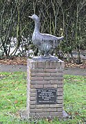 De gans, Voorst
 -
 The IJssel near Bussloo


References edit
- ^ "Burgemeester Jos Penninx" [Mayor Jos Penninx] (in Dutch). Gemeente Voorst. Retrieved 20 July 2014.
- ^ "Kerncijfers wijken en buurten 2020" [Key figures for neighbourhoods 2020]. StatLine (in Dutch). CBS. 24 July 2020. Retrieved 19 September 2020.
- ^ "Postcodetool for 7391KA". Actueel Hoogtebestand Nederland (in Dutch). Het Waterschapshuis. Retrieved 20 July 2014.
- ^ "Bevolkingsontwikkeling; regio per maand" [Population growth; regions per month]. CBS Statline (in Dutch). CBS. 1 January 2021. Retrieved 2 January 2022.
External links edit
 Media related to Voorst, Gelderland at Wikimedia Commons
- Official website