
KNOWPIA
WELCOME TO KNOWPIA

Voskhod, Moscow Oblast 
Summary
Voskhod (Russian: Восхо́д) is a closed urban locality (a settlement) in Moscow Oblast, Russia. It was formerly called Novopetrovsk-2 (Новопетровск-2).[citation needed] Population: 2,007 (2010 Russian census);[2] 1,785 (2002 Census);[7]
Voskhod
Восход | |
|---|---|
Settlement[1] | |
 Flag  Coat of arms | |
Location of Voskhod .mw-parser-output .locmap .od{position:absolute}.mw-parser-output .locmap .id{position:absolute;line-height:0}.mw-parser-output .locmap .l0{font-size:0;position:absolute}.mw-parser-output .locmap .pv{line-height:110%;position:absolute;text-align:center}.mw-parser-output .locmap .pl{line-height:110%;position:absolute;top:-0.75em;text-align:right}.mw-parser-output .locmap .pr{line-height:110%;position:absolute;top:-0.75em;text-align:left}.mw-parser-output .locmap .pv>div{display:inline;padding:1px}.mw-parser-output .locmap .pl>div{display:inline;padding:1px;float:right}.mw-parser-output .locmap .pr>div{display:inline;padding:1px;float:left}html.skin-theme-clientpref-night .mw-parser-output .od,html.skin-theme-clientpref-night .mw-parser-output .od .pv>div,html.skin-theme-clientpref-night .mw-parser-output .od .pl>div,html.skin-theme-clientpref-night .mw-parser-output .od .pr>div{background:#000;color:#fff}html.skin-theme-clientpref-night .mw-parser-output .locmap{filter:grayscale(0.6)}@media(prefers-color-scheme:dark){html.skin-theme-clientpref-os .mw-parser-output .locmap{filter:grayscale(0.6)}html.skin-theme-clientpref-os .mw-parser-output .od,html.skin-theme-clientpref-os .mw-parser-output .od .pv>div,html.skin-theme-clientpref-os .mw-parser-output .od .pl>div,html.skin-theme-clientpref-os .mw-parser-output .od .pr>div{background:#000;color:#fff}}  Voskhod Location of Voskhod 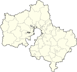 Voskhod Voskhod (Moscow Oblast) | |
| Coordinates: 55°58′27″N 36°27′26″E / 55.97417°N 36.45722°E | |
| Country | Russia |
| Federal subject | Moscow Oblast[1] |
| Founded | 1965 |
| Population | |
| • Total | 2,007 |
| • Estimate (2018)[3] | 1,866 (−7%) |
| • Subordinated to | closed administrative-territorial formation of Voskhod[1] |
| • Capital of | closed administrative-territorial formation of Voskhod[1] |
| • Urban okrug | Voskhod Urban Okrug[4] |
| • Capital of | Voskhod Urban Okrug[4] |
| Time zone | UTC+3 (MSK |
| Postal code(s)[6] | 143562 |
| Dialing code(s) | +7 49631 |
| OKTMO ID | 46763000051 |
Overview edit
It is located near the Moscow-Volokolamsk highway and the Novorozhdestvensky Forest,[8] and was involved in the November 1941 Battle of Moscow between Germany and the Soviet Union.
Administrative and municipal status edit
Within the administrative divisions framework, it is incorporated as the closed administrative-territorial formation of Voskhod—an administrative unit with the status equal to that of the districts.[1] As a municipal division, the closed administrative-territorial formation of Voskhod is incorporated as Voskhod Urban Okrug.[4]
References edit
Notes edit
- ^ a b c d e Law #11/2013-OZ
- ^ a b Russian Federal State Statistics Service (2011). Всероссийская перепись населения 2010 года. Том 1 [2010 All-Russian Population Census, vol. 1]. Всероссийская перепись населения 2010 года [2010 All-Russia Population Census] (in Russian). Federal State Statistics Service.
- ^ "26. Численность постоянного населения Российской Федерации по муниципальным образованиям на 1 января 2018 года". Federal State Statistics Service. Retrieved January 23, 2019.
- ^ a b c Law #205/2004-OZ
- ^ "Об исчислении времени". Официальный интернет-портал правовой информации (in Russian). June 3, 2011. Retrieved January 19, 2019.
- ^ Почта России. Информационно-вычислительный центр ОАСУ РПО. (Russian Post). Поиск объектов почтовой связи (Postal Objects Search) (in Russian)
- ^ Federal State Statistics Service (May 21, 2004). Численность населения России, субъектов Российской Федерации в составе федеральных округов, районов, городских поселений, сельских населённых пунктов – районных центров и сельских населённых пунктов с населением 3 тысячи и более человек [Population of Russia, Its Federal Districts, Federal Subjects, Districts, Urban Localities, Rural Localities—Administrative Centers, and Rural Localities with Population of Over 3,000] (XLS). Всероссийская перепись населения 2002 года [All-Russia Population Census of 2002] (in Russian).
- ^ "Швебиг Анатолий Петрович". Archived from the original on September 26, 2011. Retrieved October 12, 2007.
Sources edit
- Московская областная Дума. Закон №11/2013-ОЗ от 31 января 2013 г. «Об административно-территориальном устройстве Московской области», в ред. Закона №249/2019-ОЗ от 29 ноября 2019 г. «О внесении изменений в Закон Московской области "Об административно-территориальном устройстве Московской области"». Вступил в силу на следующий день после официального опубликования (13 января 2013 г.). Опубликован: "Ежедневные Новости. Подмосковье", №24, 12 февраля 2013 г. (Moscow Oblast Duma. Law #11/2013-OZ of January 31, 2013 On the Administrative-Territorial Structure of Moscow Oblast, as amended by the Law #249/2019-OZ of November 29, 2019 On amending the Law of Moscow Oblast "On the Administrative-Territorial Structure of Moscow Oblast". Effective as of the day following the day of the official publication (January 13, 2013).).
- Московская областная Дума. Закон №205/2004-ОЗ от 29 декабря 2004 г. «О наделении муниципальных образований, расположенных на территориях закрытых административно-территориальных образований в Московской области, статусом городских округов». Вступил в силу со дня официального опубликования. Опубликован: "Ежедневные Новости. Подмосковье", №8, 19 января 2005 г. (Moscow Oblast Duma. Law #205/2004-OZ of December 29, 2004 On Granting Urban Okrug Status to the Municipal Formations Located on the Territories of the Closed Administrative-Territorial Formations of Moscow Oblast. Effective as of the day of the official publication.).