
KNOWPIA
WELCOME TO KNOWPIA

Vouvray 
Summary
Vouvray (UK: /ˈvuːvreɪ/, US: /vuːˈvreɪ/,[3][4] French pronunciation: [vuvʁɛ] ⓘ) is a commune in the Indre-et-Loire department in central France.[5] It is around 9 km east of the centre of Tours.
Vouvray | |
|---|---|
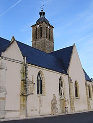 The church in Vouvray | |
 Coat of arms | |
Location of Vouvray .mw-parser-output .locmap .od{position:absolute}.mw-parser-output .locmap .id{position:absolute;line-height:0}.mw-parser-output .locmap .l0{font-size:0;position:absolute}.mw-parser-output .locmap .pv{line-height:110%;position:absolute;text-align:center}.mw-parser-output .locmap .pl{line-height:110%;position:absolute;top:-0.75em;text-align:right}.mw-parser-output .locmap .pr{line-height:110%;position:absolute;top:-0.75em;text-align:left}.mw-parser-output .locmap .pv>div{display:inline;padding:1px}.mw-parser-output .locmap .pl>div{display:inline;padding:1px;float:right}.mw-parser-output .locmap .pr>div{display:inline;padding:1px;float:left}html.skin-theme-clientpref-night .mw-parser-output .od,html.skin-theme-clientpref-night .mw-parser-output .od .pv>div,html.skin-theme-clientpref-night .mw-parser-output .od .pl>div,html.skin-theme-clientpref-night .mw-parser-output .od .pr>div{background:#000;color:#fff}html.skin-theme-clientpref-night .mw-parser-output .locmap{filter:grayscale(0.6)}@media(prefers-color-scheme:dark){html.skin-theme-clientpref-os .mw-parser-output .locmap{filter:grayscale(0.6)}html.skin-theme-clientpref-os .mw-parser-output .od,html.skin-theme-clientpref-os .mw-parser-output .od .pv>div,html.skin-theme-clientpref-os .mw-parser-output .od .pl>div,html.skin-theme-clientpref-os .mw-parser-output .od .pr>div{background:#000;color:#fff}}  Vouvray  Vouvray | |
| Coordinates: 47°24′46″N 0°48′00″E / 47.4128°N 0.8°E | |
| Country | France |
| Region | Centre-Val de Loire |
| Department | Indre-et-Loire |
| Arrondissement | Tours |
| Canton | Vouvray |
| Intercommunality | Touraine-Est Vallées |
| Government | |
| • Mayor (2020–2026) | Brigitte Pineau[1] |
| Area 1 | 22.92 km2 (8.85 sq mi) |
| Population (2021)[2] | 3,346 |
| • Density | 150/km2 (380/sq mi) |
| Time zone | UTC+01:00 (CET) |
| • Summer (DST) | UTC+02:00 (CEST) |
| INSEE/Postal code | 37281 /37210 |
| Elevation | 48–121 m (157–397 ft) |
| 1 French Land Register data, which excludes lakes, ponds, glaciers > 1 km2 (0.386 sq mi or 247 acres) and river estuaries. | |
It is best known for its production of white wine, rated among the best in France.
Population edit
|
| ||||||||||||||||||||||||||||||||||||||||||||||||||||||||||||||||||||||||||||||||||||||||||||||||||||||||||||||||||
| Source: EHESS[6] and INSEE (1968-2017)[7] | |||||||||||||||||||||||||||||||||||||||||||||||||||||||||||||||||||||||||||||||||||||||||||||||||||||||||||||||||||
Education edit
Schools include a public preschool;[8] a public elementary school, Ecole élémentaire publique de Vouvray;[9][10] a public junior high school, Collège public Gaston Huet;[11][12] and a private elementary and junior high school, Ecole et Collège Sainte Thérèse à Vouvray.[13][14]
See also edit
References edit
- ^ "Répertoire national des élus: les maires". data.gouv.fr, Plateforme ouverte des données publiques françaises (in French). 2 December 2020.
- ^ "Populations légales 2021". The National Institute of Statistics and Economic Studies. 28 December 2023.
- ^ Wells, John C. (2008). Longman Pronunciation Dictionary (3rd ed.). Longman. ISBN 978-1-4058-8118-0.
- ^ Jones, Daniel (2011). Roach, Peter; Setter, Jane; Esling, John (eds.). Cambridge English Pronouncing Dictionary (18th ed.). Cambridge University Press. ISBN 978-0-521-15255-6.
- ^ INSEE commune file
- ^ Des villages de Cassini aux communes d'aujourd'hui: Commune data sheet Vouvray, EHESS (in French).
- ^ Population en historique depuis 1968, INSEE
- ^ "Ecole maternelle publique." Vouvray. Retrieved on September 6, 2016.
- ^ "Ecole élémentaire publique." Vouvray. Retrieved on September 6, 2016.
- ^ Home. Ecole élémentaire publique de Vouvray. Retrieved on September 6, 2016.
- ^ "Collège public Gaston Huet." Vouvray. Retrieved on September 6, 2016.
- ^ Home. Collège public Gaston Huet. Retrieved on September 6, 2016.
- ^ Home . Ecole et Collège Sainte Thérèse à Vouvray. Retrieved on September 6, 2016.
- ^ "Ecole primaire privée Sainte-Thérèse"/"Collège privé Sainte-Thérèse." Vouvray. Retrieved on September 6, 2016.
Wikimedia Commons has media related to Vouvray.