
KNOWPIA
WELCOME TO KNOWPIA

Waldbillig 
Summary
Waldbillig (Luxembourgish: Waldbëlleg or (locally) Bëlleg [ˈbələɕ]) is a commune and small town in the canton of Echternach, Luxembourg.
Waldbillig
Waldbëlleg, Bëlleg | |
|---|---|
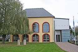 Town hall | |
 Coat of arms | |
 Map of Luxembourg with Waldbillig highlighted in orange, and the canton in dark red | |
| Coordinates: 49°47′45″N 6°17′10″E / 49.7958°N 6.2861°E | |
| Country | |
| Canton | Echternach |
| Area | |
| • Total | 23.28 km2 (8.99 sq mi) |
| • Rank | 40th of 100 |
| Highest elevation | 387 m (1,270 ft) |
| • Rank | 63rd of 100 |
| Lowest elevation | 186 m (610 ft) |
| • Rank | 18th of 100 |
| Population (2023) | |
| • Total | 1,960 |
| • Rank | 82nd of 100 |
| • Density | 84/km2 (220/sq mi) |
| • Rank | 78th of 100 |
| Time zone | UTC+1 (CET) |
| • Summer (DST) | UTC+2 (CEST) |
| LAU 2 | LU0001008 |
| Website | waldbillig.lu |
As of 2024[update], the town of Waldbillig, which lies in the centre of the commune, has a population of 599.[1]
Populated places edit
The commune consists of the following villages, alongside their population:
- Christnach (Chrëschtnech; population: 822)
- Freckeisen (Freckeisen; population: 24)
- Haller (Haler; population: 427)
- Mullerthal (Mëllerdall; population: 62)
- Niesenthal (Nisendaller Haff; population: ?)
- Waldbillig (Waldbëlleg; population: 599)
- Fléckenhaff (lieu-dit)
- Grondhaff-Schlass (lieu-dit)
- Haarthaff (lieu-dit)
- Kelleschhaff (lieu-dit)
- Savelborn[a] (Suewelbuer) (lieu-dit)
- Uelegsmillen (lieu-dit)
- Notes
- ^ Part of the farm belongs to the section of Medernach of the commune of Vallée de l'Ernz.
History edit
Population edit
References edit
External links edit
 Media related to Waldbillig at Wikimedia Commons