


Summary
Wallsend is a western suburb of Newcastle, New South Wales, Australia, 11 kilometres (6.8 mi) from Newcastle's central business district. It is split between the local government areas of City of Newcastle and City of Lake Macquarie.
| Wallsend Newcastle, New South Wales | |||||||||||||||
|---|---|---|---|---|---|---|---|---|---|---|---|---|---|---|---|
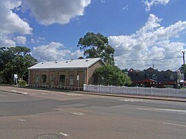 Railway Goods Shed building (1860s and 1870s). | |||||||||||||||
 Wallsend | |||||||||||||||
 | |||||||||||||||
| Coordinates | 32°53′53″S 151°40′05″E / 32.898°S 151.668°E | ||||||||||||||
| Population | 12,470 (2016 census)[1] | ||||||||||||||
| • Density | 1,022/km2 (2,647/sq mi) | ||||||||||||||
| Postcode(s) | 2287 | ||||||||||||||
| Elevation | 9 m (30 ft) | ||||||||||||||
| Area | 12.2 km2 (4.7 sq mi) | ||||||||||||||
| Location |
| ||||||||||||||
| LGA(s) | |||||||||||||||
| Parish | Kahibah | ||||||||||||||
| State electorate(s) | Wallsend | ||||||||||||||
| Federal division(s) | |||||||||||||||
| |||||||||||||||
History edit
The Awabakal and Worimi peoples are acknowledged by City of Newcastle as the traditional custodians of the land situated within the Newcastle local government area, including wetlands, rivers, creeks, and coastal environments. It is known that their heritage and cultural ties to Newcastle date back tens of thousands of years.[2]
Lieutenant Edward Close, an engineer and founder of Morpeth, recorded that part of the Wallsend area was called Barrahinebin by the Aboriginal custodians. Close reported that Barrahinebin was used to describe the area bounded by the Hunter River, Ironbark Creek and Mount Sugarloaf.[3]
Wallsend was named after a North of England coal mining township, initially built at the end of a Roman defensive wall, a town to the east of Newcastle upon Tyne. The name was given to the area by Alexander Brown in the 1850s when he purchased land bounded by what are now Newcastle Road, Boundary, and Croudace Streets and beyond Gunambi Road. The company he formed to operate the colliery which opened in January 1861 was called the Newcastle-Wallsend Coal Company.[3][4]
The suburb began as two mining towns, Wallsend and Plattsburg. Wallsend was the more developed and as it grew it linked to Plattsburg via Nelson Street. Wallsend was proclaimed a separate municipality in early 1874, but the two areas had re-joined by 1915. The coal mined at Wallsend was of very good quality and the township prospered, creating the commercial hub it is today.[5]
Modern day Wallsend edit
Today Wallsend has outgrown the historic main street and received investment and expansion from local business and national companies. The main street of Wallsend has also experienced a changing face of business with new restaurants and real estate agencies, as well as home building companies occupying previous local businesses that have migrated to the larger Wallsend Village shopping centre (formerly owned by Stockland).[6]
Education edit
Plattsburg Public School is a government co-educational school located on Ranclaud Street.[7]
There is another co-educational government primary school called Wallsend Public School located on 26 Martindale Street.[8]
There is also a catholic co-educational primary school called St Patrick's Primary School located on Macquarie Street.[9]
Wallsend junior campus, which a part of Callaghan Campus, is a 7–10 co-educational government high school located on Macquarie street.[10]
Heritage listings edit
Wallsend has a number of heritage-listed sites, including:
- 76 Cowper Street: Wallsend Railway Goods Shed[11]
Sports edit
References edit
- ^ Australian Bureau of Statistics (27 June 2017). "Wallsend (State Suburb)". 2016 Census QuickStats. Retrieved 9 February 2018.
- ^ "Aboriginal Culture". City of Newcastle. Retrieved 16 June 2021.
- ^ a b Norm Barney, "Growth Driven By Rich Coal Deposit", Newcastle Herald (supplement) 11 November 1997 page 7.
- ^ Hunter Valley Place Names and their Meanings
- ^ Newcastle City Council, Discover our Suburbs
- ^ "Home – Wallsend Village Shopping Centre". www.wallsendvillage.com.au. Retrieved 6 January 2024.
- ^ "Home – Plattsburg Public School". plattsburg-p.schools.nsw.gov.au. Retrieved 16 September 2020.
- ^ "Home – Wallsend Public School". wallsend-p.schools.nsw.gov.au. Retrieved 16 September 2020.
- ^ Schoolzine; Schoolzine. "St Patrick's Primary School Wallsend Website". St Patrick's Primary School Wallsend Website. Retrieved 16 September 2020.
- ^ "Home – Callaghan College Wallsend Campus". wallsend-h.schools.nsw.gov.au. Retrieved 16 September 2020.
- ^ "Railway Goods Shed". New South Wales State Heritage Register. Department of Planning & Environment. H00739. Retrieved 18 May 2018.
 Text is licensed by State of New South Wales (Department of Planning and Environment) under CC-BY 4.0 licence.
External links edit
- Wallsend Town Committee: www.wallsendtown.com.au