


Summary
Wandsbeker Chaussee is a U-Bahn and S-Bahn hub of the rail network in the district of Eilbek in the German city of Hamburg. It is now served by Hamburg S-Bahn line S1 and Hamburg U-Bahn line U1 and consists of two separate stations for the S-Bahn and U-Bahn. It is classified by Deutsche Bahn as a category 4 station.[4]
Wandsbeker Chaussee | |||||||||||||||||||||
|---|---|---|---|---|---|---|---|---|---|---|---|---|---|---|---|---|---|---|---|---|---|
| HVV rapid transit station | |||||||||||||||||||||
 | |||||||||||||||||||||
| General information | |||||||||||||||||||||
| Location | Wandsbeker Chaussee 288[1] 22089 Hamburg, Germany | ||||||||||||||||||||
| Coordinates | 53°34′13″N 10°03′35″E / 53.57016°N 10.05973°E | ||||||||||||||||||||
| Operated by |
| ||||||||||||||||||||
| Line(s) |
| ||||||||||||||||||||
| Platforms |
| ||||||||||||||||||||
| Tracks | 4 | ||||||||||||||||||||
| Connections | Bus, Taxi | ||||||||||||||||||||
| Construction | |||||||||||||||||||||
| Structure type | Terrain cutting (S-Bahn) Underground (U-Bahn) | ||||||||||||||||||||
| Accessible | Yes | ||||||||||||||||||||
| Other information | |||||||||||||||||||||
| Station code | |||||||||||||||||||||
| Fare zone | HVV: A/105[5] | ||||||||||||||||||||
| Website | www.bahnhof.de | ||||||||||||||||||||
| History | |||||||||||||||||||||
| Opened | |||||||||||||||||||||
| Electrified | 29 January 1908, 6.3 kV AC system (overhead; turned off in 1955)[6] 10 April 1941, 1.2 kV DC system (3rd rail)[6] | ||||||||||||||||||||
| Services | |||||||||||||||||||||
| |||||||||||||||||||||
| Location | |||||||||||||||||||||
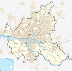 Wandsbeker Chaussee Location in Hamburg  Wandsbeker Chaussee Location in Schleswig-Holstein  Wandsbeker Chaussee Location in Germany  Wandsbeker Chaussee Location in Europe | |||||||||||||||||||||
History edit
Today's S-Bahn station was established in 1906 as part of the extension of the link line to Ohlsdorf as a station for the Hamburg-Altonaer Stadt- und Vorortbahn (Hamburg-Altona City and Suburban railway, the predecessor of the S-Bahn). The name S-Bahn was not used not until 1934.
The U-Bahn station was taken into service in 1962 with the opening of the new U-Bahn line to Wandsbek. The intermediate level with counter areas has been rebuilt several times: the ticket offices were reduced or eliminated, the ticket machines have been replaced several times (initially with numerous single price vending machines and later with multiple ticket machines) and the locker facilities have been removed. The platform remained largely in its original condition until 2008. In 2009, the walls behind the tracks were completely redecorated. Since then, the tiles have borne an image in different shades of blue, similar to Wartenau station, which had earlier been given a pattern in shades of red.
Structure edit
The station is located at Wandsbeker Chaussee, on the border between the districts of Hamburg Eilbek and Wandsbek. The S-Bahn tracks are in a cutting below the road and cross it at approximately right angles. The central platform of the S-Bahn starts just south of Wandsbeker Chaussee and extends below Pappelallee. The Hamburg freight rail bypass runs a few metres to the east and parallel with the tracks of the S-Bahn.
The U-Bahn station is located on two underground levels below the S-Bahn. Its central platform is located approximately between Seumestraße and Menckesallee under Wandsbeker Chaussee. At both ends, there are stairs that each lead to lobbies, which are accessible to the surface via multiple exits.
No direct path has been built between the S-Bahn and the U-Bahn stations. Connecting passengers must therefore walk a short distance on the surface.
S-Bahn and U-Bahn services edit
The following services stop at the station:
| Line | Route |
|---|---|
| Norderstedt Mitte – Richtweg – Garstedt – Ochsenzoll – Kiwittsmoor – Langenhorn Nord – Langenhorn Markt – Fuhlsbüttel Nord – Fuhlsbüttel – Klein Borstel – Ohlsdorf – Sengelmannstraße – Alsterdorf – Lattenkamp – Hudtwalckerstraße – Kellinghusenstraße – Klosterstern – Hallerstraße – Stephansplatz – Jungfernstieg – Meßberg – Steinstraße – Hauptbahnhof Süd – Lohmühlenstraße – Lübecker Straße – Wartenau – Ritterstraße – Wandsbeker Chaussee – Wandsbek Markt – Straßburger Straße – Alter Teichweg – Wandsbek-Gartenstadt – Trabrennbahn – Farmsen – Berne – Meiendorfer Weg – Volksdorf | – Buckhorn – Hoisbüttel – Ohlstedt | – Buchenkamp – Ahrensburg West – Ahrensburg Ost – Schmalenbeck – Kiekut – Großhansdorf | |
| Wedel – Rissen – Sülldorf – Iserbrook – Blankenese – Hochkamp – Klein Flottbek (Botanischer Garten) – Othmarschen – Bahrenfeld – Altona – Königstraße – Reeperbahn – Landungsbrücken – Stadthausbrücke – Jungfernstieg – Hauptbahnhof – Berliner Tor – Landwehr – Hasselbrook – Wandsbeker Chaussee – Friedrichsberg – Barmbek – Alte Wöhr (Stadtpark) – Rübenkamp (City Nord) – Ohlsdorf | – Hamburg Airport (Flughafen) | – Kornweg (Klein Borstel) – Hoheneichen – Wellingsbüttel – Poppenbüttel |
Gallery edit
-
 Platforms of Wandsbeker Chaussee S-Bahn station

See also edit
Notes edit
- ^ "Wandsbeker Chaussee". bahnhof.de (in German). Deutsche Bahn AG. Retrieved 25 October 2014.
- ^ "Wandsbeker Chaussee". hamburger-untergrundbahn.de (in German). Retrieved 25 October 2014.
- ^ Eisenbahnatlas Deutschland (German railway atlas) (2009/2010 ed.). Schweers + Wall. 2009. ISBN 978-3-89494-139-0.
- ^ a b "Stationspreisliste 2024" [Station price list 2024] (PDF) (in German). DB Station&Service. 24 April 2023. Retrieved 29 November 2023.
- ^ "Tarifplan" (PDF). Hamburger Verkehrsverbund. 9 December 2018. Retrieved 18 October 2019.
- ^ a b Cf. „Streckenelektrifizierungen“, on: Königlich preußische Eisenbahndirection zu Altona, retrieved on 19 January 2018.
External links edit
- "Wandsbeker Chaussee" (in German). Hamburger-Untergrundbahn.de. Retrieved 24 May 2014.
- Line and route network plans, hvv.de (in German and English)