
KNOWPIA
WELCOME TO KNOWPIA

Wannehain 
Summary
Wannehain is a commune in the Nord department in northern France,[3] on the border with Belgium.
Wannehain | |
|---|---|
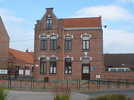 The town hall in Wannehain | |
 Coat of arms | |
Location of Wannehain .mw-parser-output .locmap .od{position:absolute}.mw-parser-output .locmap .id{position:absolute;line-height:0}.mw-parser-output .locmap .l0{font-size:0;position:absolute}.mw-parser-output .locmap .pv{line-height:110%;position:absolute;text-align:center}.mw-parser-output .locmap .pl{line-height:110%;position:absolute;top:-0.75em;text-align:right}.mw-parser-output .locmap .pr{line-height:110%;position:absolute;top:-0.75em;text-align:left}.mw-parser-output .locmap .pv>div{display:inline;padding:1px}.mw-parser-output .locmap .pl>div{display:inline;padding:1px;float:right}.mw-parser-output .locmap .pr>div{display:inline;padding:1px;float:left}html.skin-theme-clientpref-night .mw-parser-output .od,html.skin-theme-clientpref-night .mw-parser-output .od .pv>div,html.skin-theme-clientpref-night .mw-parser-output .od .pl>div,html.skin-theme-clientpref-night .mw-parser-output .od .pr>div{background:#000;color:#fff}html.skin-theme-clientpref-night .mw-parser-output .locmap{filter:grayscale(0.6)}@media(prefers-color-scheme:dark){html.skin-theme-clientpref-os .mw-parser-output .locmap{filter:grayscale(0.6)}html.skin-theme-clientpref-os .mw-parser-output .od,html.skin-theme-clientpref-os .mw-parser-output .od .pv>div,html.skin-theme-clientpref-os .mw-parser-output .od .pl>div,html.skin-theme-clientpref-os .mw-parser-output .od .pr>div{background:#000;color:#fff}}  Wannehain  Wannehain | |
| Coordinates: 50°34′10″N 3°15′59″E / 50.5694°N 3.2664°E | |
| Country | France |
| Region | Hauts-de-France |
| Department | Nord |
| Arrondissement | Lille |
| Canton | Templeuve-en-Pévèle |
| Intercommunality | Pévèle Carembault |
| Government | |
| • Mayor (2020–2026) | Jean-Luc Lefebvre[1] |
| Area 1 | 3.71 km2 (1.43 sq mi) |
| Population (2021)[2] | 1,331 |
| • Density | 360/km2 (930/sq mi) |
| Time zone | UTC+01:00 (CET) |
| • Summer (DST) | UTC+02:00 (CEST) |
| INSEE/Postal code | 59638 /59830 |
| Elevation | 34–61 m (112–200 ft) (avg. 43 m or 141 ft) |
| 1 French Land Register data, which excludes lakes, ponds, glaciers > 1 km2 (0.386 sq mi or 247 acres) and river estuaries. | |
The HSL 1 railway line to Brussels crosses the border at Wannehain.
Heraldry edit
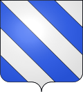 |
The arms of Wannehain are blazoned : Bendy argent and azure. (Fretin, Saultain and Wannehain use the same arms.)
Population
edit
See also editReferences edit
Wikimedia Commons has media related to Wannehain.
| ||||||||||||||||||||||||||||||