


Summary
Welshpool Road is a major arterial road running through the metropolitan area of Perth, Western Australia. Although the road is now split in two, having had its western and eastern sections disconnected due to the extension of Roe Highway, it remains Welshpool's second most important road (after Orrong Road), and the highest quality access road for the Darling Scarp.
Welshpool Road Welshpool Road East | |||
|---|---|---|---|
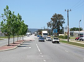 | |||
| View east along Welshpool Road in Welshpool | |||
 | |||
| General information | |||
| Type | Road | ||
| Length | 15 km (9.3 mi) | ||
| Route number(s) | |||
| Former route number | |||
| Major junctions | |||
| |||
| West end | |||
| |||
| East end | William Street, Welshpool | ||
| |||
| West end | |||
| |||
| East end | |||
| Location(s) | |||
| Major suburbs | Queens Park, Wattle Grove, Lesmurdie | ||
Welshpool Road East is part of State Route 8,[1] while the entire road was previously allocated State Route 35.[2]
Route description edit
Welshpool Road edit
Welshpool Road west of Roe Highway is 5.5 km (3.4 mi) long, and unlike Welshpool Road East, did not have a West suffix added after the road's disconnection. The road is typical of those major in the Welshpool Area; although of a reasonable quality, being a 4-lane single or dual carriageway it contains only a handful of traffic lights, is choked by traffic in peak hour, has industrial business dotting the road, and has many minor roads which have no form of control, give way and stop signs excepted.
Welshpool Road begins as an extension of a west-east section of Albany Highway (Albany Highway continues to the south of the intersection). Continuing through Welshpool, it meets Leach Highway soon after. Leach Highway marks the most dangerous intersection for both Welshpool Road and Leach Highway; the intersection is also one of Perth's busiest.[3] It then meets Kewdale Road, passing through outer Welshpool after this point. The final controlled intersection for the road is McDowell Street. McDowell Street extends north, meets Orrong Road, and then continues into neighbouring Kewdale. Although of importance for barely 300 m (980 ft), McDowell Street distributes traffic onto Orrong Road, allowing motorists to continue their journey along Welshpool Road East.
For those who continue along Welshpool Road, the road sharply turns south after 500 m (1,600 ft), and continues as William Street.
Junctions edit
| LGA | Location[4] | km | mi | Destinations | Notes |
|---|---|---|---|---|---|
| Victoria Park–Canning boundary | East Victoria Park–St James boundary | 0 | 0.0 | Traffic light intersection; Welshpool Road continues as Albany Highway west of this point | |
| Canning | Welshpool | 0.9 | 0.56 | Sevenoaks Street | Traffic light intersection |
| Rutland Ave and Railway Parade | Left in/left out only (no straight across or right turns) | ||||
| 1.0 | 0.62 | Adams Drive | |||
| 1.1 | 0.68 | Tomlinson Road | |||
| 1.4 | 0.87 | John Street | |||
| 1.6 | 0.99 | Traffic light intersection | |||
| 1.8 | 1.1 | Ewing Street | |||
| 1.9 | 1.2 | Moriarty Road | |||
| 2.1 | 1.3 | Radium Street North | |||
| 2.3 | 1.4 | Pilbara Street | |||
| Welshpool & Queens Park | 2.6 | 1.6 | Mills Street | ||
| 3.0 | 1.9 | Kewdale Road/Hamilton Street | Traffic lights intersection Left turn only from Hamilton Street, no entry to Hamilton Street except for Welshpool Road westbound | ||
| 3.3 | 2.1 | Treasure Road | |||
| 3.6 | 2.2 | George Street | |||
| 4.0 | 2.5 | Wharf Street | |||
| 4.2 | 2.6 | Murray Road South | |||
| 4.8 | 3.0 | McDowell Street | Traffic light intersection | ||
| East Cannington | 5.4 | 3.4 | Station Street | Welshpool Road continues as William Street east of this point | |
| 1.000 mi = 1.609 km; 1.000 km = 0.621 mi | |||||
Welshpool Road East edit
Welshpool Road East (9.5 km long) had an East suffix added after the road's disconnection. At a similar quality to Welshpool Road, its 4-lane section is an entire dual carriageway; it changes to a 2 to 3 lane single carriageway after climbing most of the Darling Scarp, however. With only 4 traffic lights in total (two of those at Roe Highway's diamond interchange), traffic problems are relatively minor, the only congestion being towards Roe Highway westbound.
Allocated State Route 8, Welshpool Road East starts as an extension of Orrong Road. Soon after meeting Roe Highway, it meets Hale Road. Hale Road serves as the main road for Forrestfield, eventually passing through a rural Maida Vale and climbing the Darling Scarp. Welshpool Road then passes through Wattle Grove, a mostly rural foothill suburb; however, this section is suburban. It then meets Tonkin Highway; this marks both State Route 8 and Welshpool Road's final traffic light and departure from the Swan Coastal Plain.
After this point, the scenery transitions to semi-rural; however, the quality of the road remains high. After about 2 km (1.2 mi), the road starts to climb the Darling Scarp, varying from 6 to 10 degree angle of slope. A short time after this, the median which was previously as wide as 4 lanes thins out dramatically, and becomes negligible. The road continues to climb quite steeply; similar to Great Eastern Highway the climb is constant; Kalamunda Road's climb of the escarpment is undulating. Welshpool Road East then meets Lesmurdie Road, and finally changes to a 2-lane single carriageway. After this point, westbound traffic is given two overtaking lanes that last for about 750 m (2,460 ft) each. Finishing its climb in Carmel, Welshpool Road terminates into Canning Road.
Junctions edit
| LGA | Location[5] | km | mi | Destinations | Notes |
|---|---|---|---|---|---|
| Canning | Welshpool & East Cannington | 0 | 0.0 | Diamond interchange for Roe Highway, Welshpool Road East continues as Orrong Road west of this point | |
| Kalamunda | Wattle Grove | 0.6 | 0.37 | Hale Road northeast Logistics Boulevard southwest | Traffic light intersection. Traffic exiting Logistics Boulevard can only turn left onto Welshpool Road |
| 2.2 | 1.4 | Traffic light intersection | |||
| 2.7 | 1.7 | Crystal Brook Road | |||
| 3.5 | 2.2 | Lewis Road | |||
| Lesmurdie | 6.2 | 3.9 | Crystal Brook Road | ||
| 6.7 | 4.2 | Gladys Road | |||
| 7.1 | 4.4 | Lesmurdie Road | |||
| Lesmurdie & Carmel | 8.2 | 5.1 | Pomeroy Road | ||
| Carmel | 10.2 | 6.3 | Eastern terminus at T-junction | ||
| 1.000 mi = 1.609 km; 1.000 km = 0.621 mi | |||||
History edit
Roe Highway's extension beyond Welshpool Road in 2002 represented the biggest change to Perth's transport infrastructure since the Graham Farmer Freeway was opened in 2000. Welshpool Road, Orrong Road and William Street were the 3 major roads affected due to the extension.
Before Roe Highway's extension in 2002, the highway's north and southbound lanes separated, leaving a 250 m (820 ft) gap between them once they met Welshpool Road. After this, they both formed one lane and came back together, continuing as William Street. Orrong Road would terminate into Welshpool Road in the form of a T-junction.
Due to the extension of Roe Highway, major changes were made. Firstly, Welshpool Road was disconnected; William Street was disconnected from Roe Highway, and Orrong Road was extended to meet Roe Highway in the form of a diamond interchange. Orrong Road now continues as Welshpool Road East. Welshpool Road West now continues as William Street.
Notes edit
References edit
- ^ Distance book (12 ed.). Main Roads Western Australia. 2012. pp. 4–5. ISBN 978-0-7309-7657-8. Retrieved 3 January 2014.
- ^ "Route Numbering System" (PDF). Main Roads Western Australia. Archived from the original (PDF) on 27 July 2008. Retrieved 3 January 2014.
- ^ "Leach Highway & Welshpool Intersection Upgrade".
- ^ Google (31 January 2017). "Welshpool Road" (Map). Google Maps. Google. Retrieved 31 January 2017.
- ^ Google (31 January 2017). "Welshpool Road East" (Map). Google Maps. Google. Retrieved 31 January 2017.
- Skyview WA - Department of Land Information, Western Australia
- UBD Street Directory - 46th & 49th Editions
- Main Roads WA