


Summary
West Melton is a town in the Selwyn District, in the Canterbury region of New Zealand's South Island. It is located 24 kilometres (15 mi) west of Christchurch and is part of the Christchurch metropolitan area.[3] The town has a population of 2,450 (June 2023), making it the 123rd-largest urban area in New Zealand, the 16th-largest in Canterbury and fifth-largest in the Selwyn District (behind Darfield and before Leeston).
West Melton | |
|---|---|
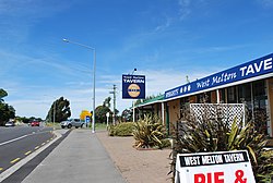 West Melton Tavern, 2011 | |
 | |
| Coordinates: 43°31′S 172°22′E / 43.517°S 172.367°E | |
| Country | New Zealand |
| Region | Canterbury |
| Territorial authority | Selwyn District |
| Ward | Malvern |
| Community | Malvern |
| Electorates |
|
| Government | |
| • Territorial authority | Selwyn District Council |
| • Regional council | Environment Canterbury |
| • Mayor of Selwyn | Sam Broughton |
| • Selwyn MP | Nicola Grigg |
| • Te Tai Tonga MP | Tākuta Ferris |
| Area | |
| • Total | 2.99 km2 (1.15 sq mi) |
| Elevation | 88 m (289 ft) |
| Population (June 2023)[2] | |
| • Total | 2,450 |
| • Density | 820/km2 (2,100/sq mi) |
| Time zone | UTC+12 (New Zealand Standard Time) |
| • Summer (DST) | UTC+13 (New Zealand Daylight Time) |
| Local iwi | Ngāi Tahu |
History edit

West Melton was first settled in the 1870s, where it has long been associated with horse racing (trotting), cropping, and sheep farming. Recently, it has become associated with wine growing and deer farming. In 1881, Alfred Saunders arrived in West Melton, where he bought a farm that he referred to as a “bleak and wild looking property”.[4]
On 26 October 2014, West Melton residents celebrated the town's 150th anniversary.[5]
Urban expansion edit
In 2007, West Melton saw the start of its urban expansion.[4] Gainsborough and Halkett Grove subdivisions were the first developments to be built, followed by Preston Downs to the west of Gainsborough and a third subdivision called Wilfield built to the south of Gainsborough.
One more subdivision and a southern extension of Wilfield are planned to be built. This third subdivision is being developed by Hughes Developments Ltd, and will be built to the east of Gainsborough. A retirement village, developed by Marama Te Wai Ltd, is to be built to the west of Preston Downs. This is in contrast to scaled-down plans. In December 2020, original plans were for a 50-hectare subdivision to be built, however, in June 2022, only 12.5 hectares was allocated for zoning change.[6]
The spread of housing developments into fertile rural land has led to tensions between the traditional farming community and recent arrivals. It is common for these tensions to spill onto community notice boards.
Demographics edit
West Melton is described by Statistics New Zealand as a small urban area, and covers 2.99 km2 (1.15 sq mi).[1] It had an estimated population of 2,450 as of June 2023,[2] with a population density of 819 people per km2.
| Year | Pop. | ±% p.a. |
|---|---|---|
| 2006 | 327 | — |
| 2013 | 780 | +13.22% |
| 2018 | 2,085 | +21.73% |
| 2023 | 2,450 | +3.28% |
| Source: [7] | ||
Before the 2023 census, West Melton had a larger boundary, covering 5.32 km2 (2.05 sq mi).[1] Using that boundary, West Melton had a population of 2,085 at the 2018 New Zealand census, an increase of 1,305 people (167.3%) since the 2013 census, and an increase of 1,758 people (537.6%) since the 2006 census. There were 675 households, comprising 1,017 males and 1,068 females, giving a sex ratio of 0.95 males per female. The median age was 39.7 years (compared with 37.4 years nationally), with 549 people (26.3%) aged under 15 years, 207 (9.9%) aged 15 to 29, 1,116 (53.5%) aged 30 to 64, and 210 (10.1%) aged 65 or older.
Ethnicities were 94.0% European/Pākehā, 5.9% Māori, 0.9% Pasifika, 5.2% Asian, and 2.3% other ethnicities. People may identify with more than one ethnicity.
The percentage of people born overseas was 19.0, compared with 27.1% nationally.
Although some people chose not to answer the census's question about religious affiliation, 51.9% had no religion, 40.1% were Christian, 0.1% were Hindu, 0.3% were Muslim, 1.0% were Buddhist and 1.3% had other religions.
Of those at least 15 years old, 444 (28.9%) people had a bachelor's or higher degree, and 153 (10.0%) people had no formal qualifications. The median income was $55,400, compared with $31,800 nationally. 573 people (37.3%) earned over $70,000 compared to 17.2% nationally. The employment status of those at least 15 was that 918 (59.8%) people were employed full-time, 246 (16.0%) were part-time, and 27 (1.8%) were unemployed.[7]
Rural surrounds edit
Halkett is a rural statistical area north of West Melton and south of the Waimakariri River. It covers 86.01 km2 (33.21 sq mi). It had an estimated population of 1,740 as of June 2023,[2] with a population density of 20 people per km2.
Newtons Road is a rural statistical area south of West Melton, and north of Burnham Military Camp and Rolleston. It covers 153.83 km2 (59.13 sq mi). It had an estimated population of 3,870 as of June 2023,[2] with a population density of 25 people per km2.
| Year | Pop. | ±% p.a. |
|---|---|---|
| 2006 | 3,891 | — |
| 2013 | 4,752 | +2.90% |
| 2018 | 4,998 | +1.01% |
| Source: [8] | ||
Before the 2023 census, Newtons Road had a smaller boundary, covering 153.14 km2 (59.13 sq mi).[1] Using that boundary, Halkett and Newtons Road together had a population of 4,998 at the 2018 New Zealand census, an increase of 246 people (5.2%) since the 2013 census, and an increase of 1,107 people (28.5%) since the 2006 census. There were 1,698 households, comprising 2,622 males and 2,376 females, giving a sex ratio of 1.1 males per female, with 888 people (17.8%) aged under 15 years, 774 (15.5%) aged 15 to 29, 2,643 (52.9%) aged 30 to 64, and 693 (13.9%) aged 65 or older.
Ethnicities were 93.1% European/Pākehā, 7.6% Māori, 1.4% Pasifika, 2.6% Asian, and 1.7% other ethnicities. People may identify with more than one ethnicity.
The percentage of people born overseas was 15.2, compared with 27.1% nationally.
Although some people chose not to answer the census's question about religious affiliation, 53.0% had no religion, 38.8% were Christian, 0.1% had Māori religious beliefs, 0.1% were Muslim, 0.3% were Buddhist and 1.0% had other religions.
Of those at least 15 years old, 873 (21.2%) people had a bachelor's or higher degree, and 663 (16.1%) people had no formal qualifications. 1,035 people (25.2%) earned over $70,000 compared to 17.2% nationally. The employment status of those at least 15 was that 2,271 (55.3%) people were employed full-time, 798 (19.4%) were part-time, and 66 (1.6%) were unemployed.[8]
| SA2 name | Population | Dwellings | Median age | Median income |
|---|---|---|---|---|
| West Melton | 2,085 | 675 | 39.7 years | $55,400 |
| Halkett | 1,656 | 585 | 46.2 years | $38,800 |
| Newtons Road | 3,342 | 1,113 | 45.2 years | $39,600 |
Services edit

West Melton has a shopping precinct including a Four Square supermarket, community centre and a domain, as well as a primary school. West Melton Aerodrome is located in the area, as is the Canterbury Astronomical Society.
West Melton also has a Rugby Football club with a long and proud history. The club is known for its exciting style of Rugby at the Rippa Rugby level, with many of those players going on to play U8. Although success at senior level has been elusive, the following players have gone on to higher representative level...[citation needed]
The West Melton Car Key club is another popular club enjoyed by the residents of this small Canterbury town. Established in 2015 in the Gainsborough subdivision, this club was set up to promote stronger relationships between neighbours and to provide alternative entertainment to the local pubs on cold winter nights.[citation needed]
The West Melton community centre was demolished in 2020 and replaced with an improved Gymnasium with multiple features such as; Badminton courts and a yoga room.[citation needed]
A skate park and playground were built next to the community centre. The skate park finished completion in 2022, while the playground was completed in 2023 [9]
Education edit
West Melton School is a full primary school catering for years 1 to 8.[10] It had a roll of 436 as of February 2024.[11] The school opened in 1871.[12]
Transport edit
Bus edit
West Melton is serviced with the 86 bus route, a weekday morning and evening express route that connects Darfield with the Central Christchurch.[13]
Road edit
West Melton is accessed by State Highway 73 which pass through the centre of the town. West Melton is also closely linked to the newly built extension of the Christchurch Southern Motorway via Weedons Ross Road Interchange.
On 20 March 2023, West Melton's first set of traffic lights were installed and turned on at the intersection of State Highway 73 and Weedons Ross Road.[14][15]
Sport edit
Moore Park Speedway is a motorcycle speedway venue approximately 5 kilometres north of the town. It is located on Weedons Ross Road, adjacent to West Melton airfield.[16][17][18] The track is a significant venue for important motorcycle speedway events and has held the final of the New Zealand Solo Championship in 2012, 2015, 2018 and 2021.[19]
References edit
- ^ a b c d "ArcGIS Web Application". statsnz.maps.arcgis.com. Retrieved 28 March 2024.
- ^ a b c d "Population estimate tables - NZ.Stat". Statistics New Zealand. Retrieved 25 October 2023.
- ^ "Functional urban areas – methodology and classification | Stats NZ". www.stats.govt.nz. Retrieved 23 June 2021.
- ^ a b "The growing West Melton | West Melton". 30 September 2014. Retrieved 10 December 2022.
- ^ "Sunday Celebrations | West Melton". 6 October 2014. Retrieved 10 December 2022.
- ^ "Private plan change request 77: rezone approx. 50 hectares in West Melton". Selwyn District Council. Retrieved 10 December 2022.
- ^ a b "Statistical area 1 dataset for 2018 Census". Statistics New Zealand. March 2020. West Melton (334600). 2018 Census place summary: West Melton
- ^ a b "Statistical area 1 dataset for 2018 Census". Statistics New Zealand. March 2020. Halkett (334400) and Newtons Road (334500).
- ^ "Skate parks". Selwyn District Council. Retrieved 21 February 2024.
- ^ Education Counts: West Melton School
- ^ "New Zealand Schools Directory". New Zealand Ministry of Education. Retrieved 14 March 2024.
- ^ "Haere Mai, Nau Mai - Welcome". West Melton School. Retrieved 19 October 2021.
- ^ "Darfield/City | Metro Christchurch". www.metroinfo.co.nz. Retrieved 21 September 2020.
- ^ "Canterbury package | Waka Kotahi NZ Transport Agency". www.nzta.govt.nz. Retrieved 30 September 2020.
- ^ Yumpu.com. "Selwyn_Times: March 22, 2023". yumpu.com. Retrieved 3 April 2023.
- ^ "Track Info". Sporty. Retrieved 13 February 2024.
- ^ "Moore Park Motorcycle Speedway, Canterbury". Speedway Racing New Zealand. Retrieved 13 February 2024.
- ^ "Home". Moore Park Speedway. Retrieved 13 February 2024.
- ^ "Historyczne Zestawienie Wynikow 1929-2023". Speedway History. Retrieved 13 February 2024.
External links edit
- Selwyn District Council
- West Melton & Halkett