


Summary
West Milwaukee is a village in Milwaukee County, Wisconsin, United States, which is located in the center of the county approximately a mile south of American Family Field. The population was 4,114 at the 2020 census.
West Milwaukee, Wisconsin | |
|---|---|
 Village Hall and Police Station | |
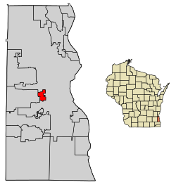 Location of West Milwaukee in Milwaukee County, Wisconsin. | |
| Coordinates: 43°0′52″N 87°58′24″W / 43.01444°N 87.97333°W | |
| Country | |
| State | |
| County | Milwaukee |
| Area | |
| • Total | 1.12 sq mi (2.90 km2) |
| • Land | 1.12 sq mi (2.90 km2) |
| • Water | 0.00 sq mi (0.00 km2) |
| Elevation | 653 ft (199 m) |
| Population | |
| • Total | 4,114 |
| • Density | 3,700/sq mi (1,400/km2) |
| Time zone | UTC-6 (Central (CST)) |
| • Summer (DST) | UTC-5 (CDT) |
| Area code | 414 |
| FIPS code | 55-85875[4] |
| GNIS feature ID | 1576537[2] |
| Website | westmilwaukee |
History edit
The village was incorporated in 1906 to provide low taxes for industry.[5]
Geography edit
West Milwaukee is located at 43°0′52″N 87°58′24″W / 43.01444°N 87.97333°W (43.014564, -87.973469).[6]
According to the United States Census Bureau, the village has a total area of 1.12 square miles (2.90 km2), all of it land.[7]
Demographics edit
| Census | Pop. | Note | %± |
|---|---|---|---|
| 1910 | 1,458 | — | |
| 1920 | 2,101 | 44.1% | |
| 1930 | 4,168 | 98.4% | |
| 1940 | 5,010 | 20.2% | |
| 1950 | 5,429 | 8.4% | |
| 1960 | 5,043 | −7.1% | |
| 1970 | 4,405 | −12.7% | |
| 1980 | 3,535 | −19.8% | |
| 1990 | 3,973 | 12.4% | |
| 2000 | 4,201 | 5.7% | |
| 2010 | 4,206 | 0.1% | |
| 2020 | 4,114 | −2.2% | |
| U.S. Decennial Census[8] | |||
2010 census edit
As of the census[3] of 2010, there were 4,206 people, 1,979 households, and 856 families living in the village. The population density was 3,755.4 inhabitants per square mile (1,450.0/km2). There were 2,145 housing units at an average density of 1,915.2 per square mile (739.5/km2). The racial makeup of the village was 69.4% White, 10.2% African American, 0.8% Native American, 3.2% Asian, 12.1% from other races, and 4.3% from two or more races. Hispanic or Latino of any race were 25.4% of the population.
There were 1,979 households, of which 25.7% had children under the age of 18 living with them, 25.7% were married couples living together, 12.5% had a female householder with no husband present, 5.1% had a male householder with no wife present, and 56.7% were non-families. 45.6% of all households were made up of individuals, and 9.3% had someone living alone who was 65 years of age or older. The average household size was 2.12 and the average family size was 3.14.
The median age in the village was 34.7 years. 22.3% of residents were under the age of 18; 8.8% were between the ages of 18 and 24; 32.8% were from 25 to 44; 26.4% were from 45 to 64; and 9.6% were 65 years of age or older. The gender makeup of the village was 52.0% male and 48.0% female.
2000 census edit

As of the census[4] of 2000, there were 4,201 people, 2,059 households, and 891 families living in the village. The population density was 3,722.0 people per square mile (1,435.4/km2). There were 2,197 housing units at an average density of 1,946.5 per square mile (750.7/km2). The racial makeup of the village was 83.58% White, 3.50% African American, 1.55% Native American, 2.55% Asian, 0.07% Pacific Islander, 5.86% from other races, and 2.90% from two or more races. Hispanic or Latino of any race were 12.00% of the population.
There were 2,059 households, out of which 22.0% had children under the age of 18 living with them, 27.5% were married couples living together, 10.5% had a female householder with no husband present, and 56.7% were non-families. 46.1% of all households were made up of individuals, and 13.4% had someone living alone who was 65 years of age or older. The average household size was 2.03 and the average family size was 2.96.
In the village, the population was spread out, with 20.8% under the age of 18, 10.3% from 18 to 24, 34.8% from 25 to 44, 20.2% from 45 to 64, and 13.9% who were 65 years of age or older. The median age was 36 years. For every 100 females, there were 103.7 males. For every 100 females age 18 and over, there were 103.8 males.
The median income for a household in the village was $35,250, and the median income for a family was $43,036. Males had a median income of $34,135 versus $23,234 for females. The per capita income for the village was $18,396. About 7.5% of families and 11.6% of the population were below the poverty line, including 9.1% of those under age 18 and 23.0% of those age 65 or over.
Property Taxes edit
As of 2018, Wisconsin had some of the highest property taxes in the country. The state's average effective property tax rate is 1.96%, (median real estate taxes paid: $3,257) the ninth highest average of any state in the U.S.[9] As of 2016 West Milwaukee was the ninth highest taxed ($32.38 per $1000 of assessed value) municipality in the state of Wisconsin.[10]
Education edit
West Milwaukee is served by the West Allis – West Milwaukee School District. Schools within the village's boundaries include:[11]
- Pershing Elementary School
- West Milwaukee Intermediate School (formerly West Milwaukee High School)
- West Milwaukee also has one private school:[11]
- Cristo Rey Jesuit High School (formerly St. Florian's Parish School)
Recreation edit

West Milwaukee has three parks: West Milwaukee Park, Centennial Park and Lions Park.[12] West Milwaukee park is the largest park in the village with an area of 21.1 acres. It has a walking or jogging track, a wading pool, a children's play center and two baseball diamonds.[13]
References edit
- ^ "2019 U.S. Gazetteer Files". United States Census Bureau. Archived from the original on October 9, 2020. Retrieved August 7, 2020.
- ^ a b "US Board on Geographic Names". United States Geological Survey. October 25, 2007. Archived from the original on February 12, 2012. Retrieved January 31, 2008.
- ^ a b "U.S. Census website". United States Census Bureau. Archived from the original on December 27, 1996. Retrieved November 18, 2012.
- ^ a b "U.S. Census website". United States Census Bureau. Archived from the original on December 27, 1996. Retrieved January 31, 2008.
- ^ Hayward, Karen. "West Milwaukee". Encyclopedia of Milwaukee. Retrieved January 1, 2023.
- ^ "US Gazetteer files: 2010, 2000, and 1990". United States Census Bureau. February 12, 2011. Archived from the original on August 24, 2019. Retrieved April 23, 2011.
- ^ "US Gazetteer files 2010". United States Census Bureau. Archived from the original on January 25, 2012. Retrieved November 18, 2012.
- ^ "Census of Population and Housing". Census.gov. Archived from the original on July 1, 2021. Retrieved June 4, 2015.
- ^ Olya, Gabrielle. "States With the Highest Property Taxes". Yahoo Finance. Yahoo. Archived from the original on June 4, 2019. Retrieved March 16, 2019.
- ^ Anderson, Scott (December 22, 2016). "Tax Rates: Every Wisconsin City and Village Ranked". Patch. Patch Media. Archived from the original on October 8, 2018. Retrieved March 16, 2019.
- ^ a b "Schools". www.westmilwaukee.org. Archived from the original on July 28, 2016. Retrieved February 13, 2016.
- ^ "West Milwaukee Park". westmilwaukee. Village Of West Milwaukee. Archived from the original on April 14, 2019. Retrieved April 14, 2019.
- ^ "Milwaukee County Parks" (PDF). county.milwaukee.gov. MILWAUKEE COUNTY PARKS. Archived (PDF) from the original on March 17, 2021. Retrieved October 1, 2021.
External links edit
- Official website