
KNOWPIA
WELCOME TO KNOWPIA

West Woodhay Down 
Summary
West Woodhay Down is a 1.5-hectare (3.7-acre) biological Site of Special Scientific Interest in Berkshire and Hampshire. It is lowland Calcareous grassland with a northwest facing bank, and forms part of the northern slopes of Walbury Hill and Combe Hill. The site was formerly included as part of Inkpen and Walbury Hills SSSI.[1][2][3][4][5]
| Site of Special Scientific Interest | |
 | |
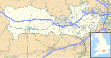 Location within Berkshire | |
| Location | Berkshire Hampshire |
|---|---|
| Grid reference | SU 387 617[1] |
| Coordinates | 51°21′11″N 1°26′49″W / 51.353°N 1.447°W |
| Interest | Biological |
| Area | 1.5 hectares (3.7 acres)[1] |
| Notification | 1985[1] |
| Location map | Magic Map |
West Woodhay Down is in the civil parishes of West Woodhay and East Woodhay, to the south-west of the town of Newbury. West Woodhay parish is within the unitary authority area of West Berkshire and the ceremonial county of Berkshire, whilst East Woodhay is within the district of Basingstoke and Deane in the administrative county of Hampshire.[1][5]
Flora edit
The site has the following Flora:[4]
- Bromus erectus
- Blackstonia perfoliata
- Leontodon autumnalis
- Linum catharticum
- Galium cruciata
- Asperula cynanchica
- Primula veris
- Scabiosa columbaria
- Reseda lutea
- Sanguisorba minor
- Gymnadenia conopsea
- Anacamptis pyramidalis
- Helianthemum nummularium
- Centaurea scabiosa
- Campanula rotundifolia
- Listera ovata
- Herminium monorchis
- Coeloglossum viride
- Polygala calcarea
- Saxifraga granulata
- Crataegus
- Whitebeam
- Crataegus monogyna
References edit
Wikimedia Commons has media related to West Woodhay Down.
- ^ a b c d e "Designated Sites View: West Woodhay Down". Sites of Special Scientific Interest. Natural England. Archived from the original on 7 June 2022. Retrieved 3 March 2020.
- ^ "Map of West Woodhay Down". Sites of Special Scientific Interest. Natural England. Retrieved 3 March 2020.
- ^ "Condition of SSSI Units for Site West Woodhay Down SSSI". Natural england. Retrieved 6 March 2017.
- ^ a b "SITE NAME: WEST WOODHAY DOWN" (PDF). Archived from the original (PDF) on 7 March 2017. Retrieved 6 March 2017.
- ^ a b Explorer 158: Newbury & Hungerford (Map). Ordnance Survey. ISBN 9780319243510.