


Summary
Whitle is a historic hamlet in Derbyshire. The Whitle area is now part of the town of New Mills, and lies between the centre of the town and the hamlet of Thornsett.
| Whitle | |
|---|---|
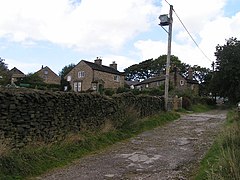 Whitle from the south | |
 Whitle Location within Derbyshire | |
| OS grid reference | SK029866 |
| District | |
| Shire county | |
| Region | |
| Country | England |
| Sovereign state | United Kingdom |
| Post town | HIGH PEAK |
| Postcode district | SK22 |
| Dialling code | 01663 |
| Police | Derbyshire |
| Fire | Derbyshire |
| Ambulance | East Midlands |
| UK Parliament | |
The main approach to the hamlet is via an unadopted road from the south, connecting with Apple Tree Road. This continues north-east as a public bridleway and private driveway to Mellor Road. Public footpaths lead north-west and WSW across New Mills Golf Course, which is immediately west of the hamlet.[1]
History edit
The placename is thought to derive simply from "white hill". At one point, Whitle was part of the Lordship of Longdendale.[2] In 1713 the hamlet was included in the newly formed township of New Mills and to this day it remains within the town's boundaries. The Inclosure Act 1826[3] refers to, and maps, four distinct areas within Whitle: New Mills Lee, Whitle Bank, Shaw Marsh and Broadhurst Edge.
By comparing maps and written records of the Whitle enclosure, Bryant[3] shows that, in 1826, the area contained around 20 buildings. These buildings included "Stafford's Mill", "Barnes's Mill", a "Whitle School" (on the site of 41–45 Mellor Road) and also a "Poor House" (set back from the southeastern end of present-day Watford Road). Close to the Poor House a toll gate was sited on what is now known as Batemill Road.
All of the major surviving buildings in Whitle were Grade II listed in 1977: Whitle Farmhouse[4] and its barn;[5] Bower House[6] and its barns;[7] Fold House;[8] Whitle Cottage;[9] Hilltop Cottage;[10] and Century Cottage, dated 1666.[11]
See also edit
References edit
- ^ OL1 Dark Peak area (Map). 1:25000. Explorer. Ordnance Survey.
- ^ Lewis, Steve. "History of New Mills". Retrieved 7 February 2018.
- ^ a b Bryant, R.M. (1983). History Notes No.3: Whitle Enclosure. Derbyshire: New Mills Local History Society.
- ^ Historic England. "Farmhouse and attached farm buildings (occupied by D Stafford) (Grade II) (1334777)". National Heritage List for England. Retrieved 7 February 2018.
- ^ Historic England. "Barn at Whitle Farm (occupied by D Stafford) (Grade II) (1054715)". National Heritage List for England. Retrieved 7 February 2018.
- ^ Historic England. "Bower House (Grade II) (1088127)". National Heritage List for England. Retrieved 7 February 2018.
- ^ Historic England. "Three barns to Bower House Farm (Grade II) (1088129)". National Heritage List for England. Retrieved 7 February 2018.
- ^ Historic England. "Fold House (Grade II) (1054710)". National Heritage List for England. Retrieved 7 February 2018.
- ^ Historic England. "Whitle Cottage (Grade II) (1088128)". National Heritage List for England. Retrieved 7 February 2018.
- ^ Historic England. "Hilltop Cottage (Grade II) (1334776)". National Heritage List for England. Retrieved 7 February 2018.
- ^ Historic England. "Century Cottage (Grade II) (1054708)". National Heritage List for England. Retrieved 7 February 2018.