


Summary
Wilder is a city in Canyon County, Idaho, United States. The population was 1,533 at the 2010 census.
Wilder, Idaho | |
|---|---|
 | |
| Motto: "Golden Gate To The Treasure Valley"[1] | |
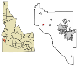 Location of Wilder in Canyon County, Idaho. | |
| Coordinates: 43°40′35″N 116°54′36″W / 43.67639°N 116.91000°W | |
| Country | United States |
| State | Idaho |
| County | Canyon |
| Area | |
| • Total | 0.72 sq mi (1.88 km2) |
| • Land | 0.71 sq mi (1.85 km2) |
| • Water | 0.01 sq mi (0.03 km2) |
| Elevation | 2,428 ft (740 m) |
| Population | |
| • Total | 1,533 |
| • Estimate (2019)[4] | 1,823 |
| • Density | 2,549.65/sq mi (984.52/km2) |
| Time zone | UTC-7 (Mountain (MST)) |
| • Summer (DST) | UTC-6 (MDT) |
| ZIP code | 83676 |
| Area code | 208 |
| FIPS code | 16-87670 |
| GNIS feature ID | 0398357 |
| Website | cityofwilder |
| Census | Pop. | Note | %± |
|---|---|---|---|
| 1920 | 349 | — | |
| 1930 | 381 | 9.2% | |
| 1940 | 507 | 33.1% | |
| 1950 | 555 | 9.5% | |
| 1960 | 603 | 8.6% | |
| 1970 | 564 | −6.5% | |
| 1980 | 1,260 | 123.4% | |
| 1990 | 1,232 | −2.2% | |
| 2000 | 1,462 | 18.7% | |
| 2010 | 1,533 | 4.9% | |
| 2019 (est.) | 1,823 | [4] | 18.9% |
| U.S. Decennial Census[5] | |||
Wilder is part of the Boise City–Nampa, Idaho Metropolitan Statistical Area.
History edit

Wilder was established in 1919,[1] and was named for Marshall P. Wilder, a magazine editor.[6]
Geography edit
Wilder is located at 43°40′35″N 116°54′36″W / 43.67639°N 116.91000°W (43.676451, -116.910122).[7]
According to the United States Census Bureau, the city has a total area of 0.74 square miles (1.92 km2), of which, 0.73 square miles (1.89 km2) is land and 0.01 square miles (0.03 km2) is water.[8]
Demographics edit
2010 census edit
At the 2010 census there were 1,533 people, 453 households, and 353 families living in the city. The population density was 2,100.0 inhabitants per square mile (810.8/km2). There were 501 housing units at an average density of 686.3 per square mile (265.0/km2). The racial makup of the city was 44.6% White, 0.2% African American, 1.8% Native American, 0.4% Asian, 51.1% from other races, and 1.9% from two or more races. Hispanic or Latino of any race were 75.9%.[3]
Of the 453 households 52.5% had children under the age of 18 living with them, 54.1% were married couples living together, 16.8% had a female householder with no husband present, 7.1% had a male householder with no wife present, and 22.1% were non-families. 18.8% of households were one person and 7.2% were one person aged 65 or older. The average household size was 3.38 and the average family size was 3.89.
The median age was 27 years. 37.6% of residents were under the age of 18; 9.4% were between the ages of 18 and 24; 25.6% were from 25 to 44; 18.2% were from 45 to 64; and 9.1% were 65 or older. The gender makeup of the city was 48.7% male and 51.3% female.
2000 census edit
At the 2000 census there were 1,462 people, 389 households, and 315 families living in the city. The population density was 3,885.7 inhabitants per square mile (1,500.3/km2). There were 421 housing units at an average density of 1,118.9 per square mile (432.0/km2). The racial makup of the city was 33.99% White, 0.21% African American, 0.14% Native American, 0.27% Asian, 0.07% Pacific Islander, 62.93% from other races, and 2.39% from two or more races. Hispanic or Latino of any race were 76.40%.[9]
Of the 389 households 52.2% had children under the age of 18 living with them, 65.6% were married couples living together, 9.8% had a female householder with no husband present, and 19.0% were non-families. 17.2% of households were one person and 10.5% were one person aged 65 or older. The average household size was 3.76 and the average family size was 4.30.
The age distribution was 39.2% under the age of 18, 13.3% from 18 to 24, 25.2% from 25 to 44, 15.1% from 45 to 64, and 7.2% 65 or older. The median age was 24 years. For every 100 females, there were 99.7 males. For every 100 females age 18 and over, there were 100.7 males.
The median household income was $21,731 and the median family income was $25,625. Males had a median income of $22,188 versus $16,250 for females. The per capita income for the city was $7,601. About 27.7% of families and 31.6% of the population were below the poverty line, including 37.4% of those under age 18 and 26.3% of those age 65 or over.
Economy edit
Wilder has a meat processing plant, SSI, manufacturing frozen individual serving hamburgers and french fries. Wilder is primarily an agricultural community, with onions, hops, seed corn, beans and alfalfa seed among the major crops.
Notable people edit
References edit
- ^ a b "City of Wilder, Idaho". City of Wilder, Idaho. Retrieved September 2, 2012.
- ^ "2019 U.S. Gazetteer Files". United States Census Bureau. Retrieved July 9, 2020.
- ^ a b "U.S. Census website". United States Census Bureau. Retrieved December 18, 2012.
- ^ a b "Population and Housing Unit Estimates". United States Census Bureau. May 24, 2020. Retrieved May 27, 2020.
- ^ "Census of Population and Housing". Census.gov. Retrieved June 4, 2015.
- ^ "Profile for Wilder, Idaho, ID". ePodunk. Retrieved September 2, 2012.
- ^ "US Gazetteer files: 2010, 2000, and 1990". United States Census Bureau. February 12, 2011. Retrieved April 23, 2011.
- ^ "US Gazetteer files 2010". United States Census Bureau. Retrieved December 18, 2012.
- ^ "U.S. Census website". United States Census Bureau. Retrieved January 31, 2008.
- ^ "Former Idaho Gov. Phil Batt dead at 96". ktvb.com. March 4, 1927. Retrieved March 4, 2023.
External links edit
- City of Wilder, Idaho Website Portal style website, Government, Business, Library, Recreation and more
- City-Data.com Comprehensive Statistical Data and more about Wilder