


Summary
Willard-Hay is a neighborhood within the larger Near North community in the northwest side of the U.S. city of Minneapolis which is known locally as the "Northside". The neighborhood is often known as Willard-Homewood by residents; the portion south of Plymouth is Homewood. It is named after two elementary schools within its boundaries, Frances Willard and John Hay.44°59′47″N 93°18′40″W / 44.9964°N 93.3112°W[3]
Willard-Hay | |
|---|---|
 | |
| Nickname: Willard-Homewood | |
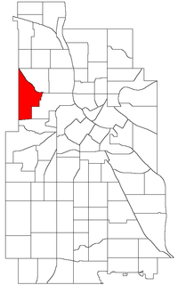 Location of Willard-Hay within the U.S. city of Minneapolis | |
| Country | United States |
| State | Minnesota |
| County | Hennepin |
| City | Minneapolis |
| Community | Near North |
| City Council Wards | 4, 5 |
| Government | |
| • Council Member | LaTrisha Vetaw |
| • Council Member | Jeremiah Ellison |
| Area | |
| • Total | 1.068 sq mi (2.77 km2) |
| Population (2020)[2] | |
| • Total | 8,942 |
| • Density | 8,400/sq mi (3,200/km2) |
| Time zone | UTC-6 (CST) |
| • Summer (DST) | UTC-5 (CDT) |
| ZIP code | 55411 |
| Area code | 612 |
Demographics edit
| Census | Pop. | Note | %± |
|---|---|---|---|
| 1980 | 8,678 | — | |
| 1990 | 8,409 | −3.1% | |
| 2000 | 9,277 | 10.3% | |
| 2010 | 8,611 | −7.2% | |
| 2020 | 8,942 | 3.8% |
Geography edit
The boundaries are roughly Olson Memorial Highway on the south, Penn Avenue on the east, (though a small portion of the neighborhood is northeast of Penn and Plymouth) Broadway Avenue on the northeast and Theodore Wirth Park on the west.
It is primarily located in Ward 5, represented by city council member Jeremiah Ellison. A small portion in the northwest (north of 26th Ave) is in Ward 4, represented by LaTrisha Vetaw.[4] Willard-Hay is in Legislative District 59B[5], represented by State Senator Bobby Joe Champion and State Representative Esther Agbaje.
The Homewood Historic district is located in Willard-Hay, bounded by Plymouth Avenue to the north, Penn Avenue to the east, Oak Park Avenue to the south and Xerxes Avenue to the west. This area was central to the North Side Jewish community beginning in the early 1910s.[6] It was designated by the city as a historic district on February 28, 2017[7] due to its rich Jewish history. This designation sparked some controversy among Homewood residents.[8][9]
References edit
- ^ "Willard-Hay neighborhood in Minneapolis, Minnesota (MN), 55411 detailed profile". City-Data. 2011. Retrieved 2013-11-17.
- ^ "Willard-Hay neighborhood data". Minnesota Compass. Retrieved 2023-02-19.
- ^ Willard-Hay, Minneapolis, MN. Google Earth. Retrieved 2011-03-09.
- ^ "Find My Ward". City of Minneapolis. Retrieved 19 April 2024.
- ^ "Legislative District 59B - Map" (PDF). Poll Finder. Minnesota Secretary of State. February 15, 2022. Retrieved 22 April 2024.
- ^ Minneapolis Heritage Preservation Commission; Minneapolis Department of Community Planning and Economic Development (September 2017). "Designation Study: Homewood Historic District, Minneapolis" (PDF). City of Minneapolis. Archived from the original (PDF) on 2019-05-03. Retrieved 23 April 2024.
- ^ "Local Historic District Designation: Homewood Historic District (RCA-2017-01009)". Legislative Information Management System (LIMS). City of Minneapolis. Retrieved 23 April 2024.
- ^ CBS Minnesota (February 27, 2017). "Mpls. Neighborhood's 'Historic' Designation Causes Problems For Residents". WCCO News. Retrieved April 23, 2024.
- ^ Nelson, Emma (March 2, 2017). "Historic designation effort draws a line through close-knit Homewood neighborhood". Star Tribune. Retrieved 23 April 2024.
External links edit
- Minneapolis Neighborhood Profile - Willard-Hay