
KNOWPIA
WELCOME TO KNOWPIA

Wirral Urban District 
Summary
53°18′56″N 3°02′37″W / 53.3155°N 3.0435°W
| Wirral | |
|---|---|
 | |
| Area | |
| • 1931 | 5,639 acres |
| Population | |
| • 1931 | 9,599 |
| History | |
| • Created | 1933 |
| • Abolished | 1974 |
| • Succeeded by | Metropolitan Borough of Wirral |
| Status | urban district |
| • HQ | Heswall |
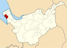
Wirral Urban District was an urban district in Cheshire, England from 1933 to 1974. It was created from part of the disbanded Wirral Rural District and covered an area in the south-west of the Wirral Peninsula. The civil parishes of Barnston, Gayton, Heswall cum Oldfield, Irby, Pensby, and Thurstaston were entirely within its boundaries. Additionally, the district encompassed parts of Arrowe, Brimstage and Thornton Hough civil parishes.[1]
On 1 April 1974, under the Local Government Act 1972, it was abolished and its area absorbed into the Metropolitan Borough of Wirral of the metropolitan county of Merseyside.[2]
References edit