


Summary
Woensdrecht is a village in the municipality of Woensdrecht, North Brabant, Netherlands. Woensdrecht is known for Woensdrecht Air Base, a military air base.
Woensdrecht | |
|---|---|
Village | |
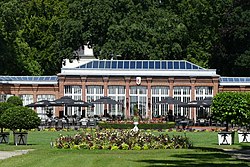 Mattemburgh | |
 Woensdrecht Location in the province of North Brabant in the Netherlands  Woensdrecht Woensdrecht (Netherlands) | |
| Coordinates: 51°25′46″N 4°17′57″E / 51.42944°N 4.29917°E | |
| Country | Netherlands |
| Province | North Brabant |
| Municipality | Woensdrecht |
| Area | |
| • Total | 14.94 km2 (5.77 sq mi) |
| Elevation | 1.2 m (3.9 ft) |
| Population (2021)[1] | |
| • Total | 1,475 |
| • Density | 99/km2 (260/sq mi) |
| Time zone | UTC+1 (CET) |
| • Summer (DST) | UTC+2 (CEST) |
| Postal code | 4634[1] |
| Dialing code | 0164 |
History edit
The village was first mentioned in 1249 as Wunsdrecht. The etymology is unclear.[3] Woensdrecht developed in the Middle Ages on the border of sand and clay ground.[4] In 1583 and 1584, the village was destroyed during the Eighty Years' War and was resettled after 1590.[5]
Woensdrecht was home to 792 people in 1840.[5] During the 20th century, Woensdrecht and Hoogerheide merged into a single urban area.[4] In 1935, a little airfield was built near the village. During World War II, Woensdrecht Air Base became a large military airport, and remained a military airport after the war. In 1944, it was severely damaged by war, and the ruinous church tower has remained.[5]
In 1983, it was announced that 48 nuclear cruise missiles were to be installed in Woensdrecht and the village became the site of frequent anti-nuclear protests. Despite strong opposition against nuclear weapons, the government decided to place the cruise missiles, but with a two-year delay.[6] On 8 December 1987, the Intermediate-Range Nuclear Forces Treaty was signed which resulted in a cancellation of the cruise missiles in the Netherlands.[7]
References edit
- ^ a b c "Kerncijfers wijken en buurten 2021". Central Bureau of Statistics. Retrieved 19 April 2022.
three entries
- ^ "Postcodetool for 4634PA". Actueel Hoogtebestand Nederland (in Dutch). Het Waterschapshuis. Retrieved 19 April 2022.
- ^ "Woensdrecht - (geografische naam)". Etymologiebank (in Dutch). Retrieved 19 April 2022.
- ^ a b Chris Kolman & Ronald Stenvert (1997). Woensdrecht-Hoogerheide (in Dutch). Zwolle: Waanders. ISBN 90 400 9945 6. Retrieved 19 April 2022.
- ^ a b c "Woensdrecht". Plaatsengids (in Dutch). Retrieved 19 April 2022.
- ^ "Meer dan een half miljoen betogers op het Malieveld tegen kruisraketten". Dag van Toen (in Dutch). 29 October 1983. Retrieved 19 April 2022.
- ^ "Treaty Between The United States Of America And The Union Of Soviet Socialist Republics On The Elimination Of Their Intermediate-Range And Shorter-Range Missiles (INF Treaty)". U.S. Department of State. Retrieved 19 April 2022.
- "History of Woensdrecht". Gemeente Woensdrecht. Retrieved 30 September 2012.
- "ViaMichelin Maps and Routes". Michelin. Retrieved 1 October 2012.