


Summary
Woodbine is a borough in Cape May County, in the U.S. state of New Jersey. The borough, and all of Cape May County, is part of the South Jersey region of the state and of the Ocean City metropolitan statistical area, which is part of the Philadelphia-Wilmington-Camden, PA-NJ-DE-MD combined statistical area, also known as the Delaware Valley or Philadelphia metropolitan area.[18] As of the 2020 United States census, the borough's population was 2,128,[9] a decrease of 344 (−13.9%) from the 2010 census count of 2,472,[19][20] which in turn reflected a decline of 244 (−9.0%) from the 2,716 counted in the 2000 census.[21]
Woodbine, New Jersey | |
|---|---|
 | |
 Seal | |
| Motto: "Gateway to the Jersey Cape" | |
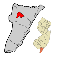 Location of Woodbine in Cape May County highlighted in red (left). Inset map: Location of Cape May County in New Jersey highlighted in orange (right). | |
 Census Bureau map of Woodbine, New Jersey | |
 Woodbine Location in Cape May County  Woodbine Location in New Jersey  Woodbine Location in the United States | |
| Coordinates: 39°13′42″N 74°48′35″W / 39.22835°N 74.809621°W[1][2] | |
| Country | |
| State | |
| County | |
| Incorporated | March 3, 1903 |
| Government | |
| • Type | Borough |
| • Body | Borough Council |
| • Mayor | William Pikolycky (R, term ends December 31, 2026)[3][4] |
| • Municipal clerk | Alex Bauer[5] |
| Area | |
| • Total | 8.02 sq mi (20.77 km2) |
| • Land | 8.02 sq mi (20.77 km2) |
| • Water | 0.00 sq mi (0.00 km2) 0.00% |
| • Rank | 232nd of 565 in state 6th of 16 in county[1] |
| Elevation | 33 ft (10 m) |
| Population | |
| • Total | 2,128 |
| • Estimate (2022)[10] | 2,142 |
| • Rank | 482nd of 565 in state 10th of 16 in county[11] |
| • Density | 265.4/sq mi (102.5/km2) |
| • Rank | 486th of 565 in state 14th of 16 in county[11] |
| Time zone | UTC−05:00 (Eastern (EST)) |
| • Summer (DST) | UTC−04:00 (Eastern (EDT)) |
| ZIP Code | |
| Area code(s) | 609 Exchanges: 628, 861[14] |
| FIPS code | 3400981890[1][15][16] |
| GNIS feature ID | 0885446[1][17] |
| Website | www |
Woodbine was incorporated as a borough by an act of the New Jersey Legislature on March 3, 1903, from portions of Dennis Township.[22][23]
History edit
Woodbine was founded in 1891 as a settlement for Eastern European Jews. The Baron DeHirsch Fund, organized by philanthropist Maurice de Hirsch, purchased 5,300 acres (21 km2) of land in Dennis Township in Cape May County to start a settlement. Immigrants from Poland and Russia were invited to settle the new community. Within two years, they cleared the forest and built a settlement with thriving farms, with 800 acres (3.2 km2) of land set aside as town lots. The residential center of Woodbine still uses the same grid that was originally laid out in 1891. Using modern agricultural practices under the direction of agriculturist and chemist Hirsch Loeb Sabsovich,[24][25] the first colonists (Woodbine was sometimes called the "Jewish Colony" in the early days) turned Woodbine into a model agricultural community.
Woodbine was incorporated as a borough by an act of the New Jersey Legislature on March 3, 1903, from portions of Dennis Township.[22] Because most of the original settlers were Jewish, Woodbine became known as "the first self-governing Jewish community since the fall of Jerusalem."[26]
The community started the Baron DeHirsch Agricultural College in 1894. Until it was closed during World War I (1917), the college was a model of progressive education. The college and its graduates won many state, national, and international awards. World War I, however, signaled a change in the community from an agricultural economy to one with a light manufacturing economy. The Baron DeHirsch Agricultural College became what is today the Woodbine Developmental Center, a state-run facility for training the mentally handicapped. The Developmental Center is Cape May County's largest employer.[27]
During World War II, the United States Army built an airfield in Woodbine to be used as a training base and as a base for anti-submarine patrols. German U-boats were very active off the East Coast of America, especially off the Jersey coast. Today, Woodbine Municipal Airport is the center of Woodbine's redevelopment efforts.[28]
Geography edit
According to the United States Census Bureau, the borough had a total area of 8.02 square miles (20.77 km2), all of which was land.[1][2]
The borough borders Dennis Township and Upper Township.[29][30][31]
Climate edit
The climate in this area is characterized by hot, humid summers and generally mild to cool winters. According to the Köppen Climate Classification system, Woodbine has a humid subtropical climate, abbreviated "Cfa" on climate maps.[32]
Demographics edit
| Census | Pop. | Note | %± |
|---|---|---|---|
| 1910 | 2,399 | — | |
| 1920 | 1,406 | −41.4% | |
| 1930 | 2,164 | 53.9% | |
| 1940 | 2,111 | −2.4% | |
| 1950 | 2,417 | 14.5% | |
| 1960 | 2,823 | 16.8% | |
| 1970 | 2,625 | −7.0% | |
| 1980 | 2,809 | 7.0% | |
| 1990 | 2,678 | −4.7% | |
| 2000 | 2,716 | 1.4% | |
| 2010 | 2,472 | −9.0% | |
| 2020 | 2,128 | −13.9% | |
| 2022 (est.) | 2,142 | [10] | 0.7% |
| Population sources:1910–2000[33] 1910–1920[34] 1910[35] 1910–1930[36] 1940–2000[37] 2000[38][39] 2010[19][20] 2020[9] | |||
2010 census edit
The 2010 United States census counted 2,472 people, 757 households, and 516 families in the borough. The population density was 308.2 per square mile (119.0/km2). There were 1,079 housing units at an average density of 134.5 per square mile (51.9/km2). The racial makeup was 58.21% (1,439) White, 24.72% (611) Black or African American, 0.24% (6) Native American, 0.73% (18) Asian, 0.00% (0) Pacific Islander, 12.30% (304) from other races, and 3.80% (94) from two or more races. Hispanic or Latino of any race were 23.22% (574) of the population.[19]
Of the 757 households, 27.7% had children under the age of 18; 38.0% were married couples living together; 23.4% had a female householder with no husband present and 31.8% were non-families. Of all households, 26.3% were made up of individuals and 9.5% had someone living alone who was 65 years of age or older. The average household size was 2.61 and the average family size was 3.13.[19]
20.6% of the population were under the age of 18, 8.5% from 18 to 24, 24.4% from 25 to 44, 33.4% from 45 to 64, and 13.2% who were 65 years of age or older. The median age was 43.0 years. For every 100 females, the population had 135.0 males. For every 100 females ages 18 and older there were 143.1 males.[19]
The Census Bureau's 2006–2010 American Community Survey showed that (in 2010 inflation-adjusted dollars) median household income was $28,125 (with a margin of error of +/− $7,957) and the median family income was $25,254 (+/− $5,816). Males had a median income of $35,500 (+/− $7,453) versus $31,298 (+/− $9,891) for females. The per capita income for the borough was $15,734 (+/− $2,126). About 33.9% of families and 38.1% of the population were below the poverty line, including 35.8% of those under age 18 and 15.8% of those age 65 or over.[40]
2000 census edit
As of the 2000 United States census[15] there were 2,716 people, 773 households, and 558 families residing in the borough. The population density was 339.6 inhabitants per square mile (131.1/km2). There were 1,080 housing units at an average density of 135.1 per square mile (52.2/km2). The racial makeup of the borough was 53.39% White, 32.40% African American, 0.22% Native American, 0.11% Asian, 11.01% from other races, and 2.87% from two or more races. Hispanic or Latino of any race were 21.24% of the population.[38][39]
There were 773 households, out of which 41.5% had children under the age of 18 living with them, 39.1% were married couples living together, 27.8% had a female householder with no husband present, and 27.8% were non-families. 23.0% of all households were made up of individuals, and 9.6% had someone living alone who was 65 years of age or older. The average household size was 2.77 and the average family size was 3.21.[38][39]
In the borough the population was spread out, with 26.6% under the age of 18, 8.0% from 18 to 24, 31.3% from 25 to 44, 23.7% from 45 to 64, and 10.4% who were 65 years of age or older. The median age was 36 years. For every 100 females, there were 142.5 males. For every 100 females age 18 and over, there were 158.2 males.[38][39]
The median income for a household in the borough was $30,298, and the median income for a family was $31,786. Males had a median income of $30,139 versus $24,150 for females. The per capita income for the borough was $13,335. About 18.8% of families and 17.9% of the population were below the poverty line, including 23.9% of those under age 18 and 11.6% of those age 65 or over.[38][39]
Government edit

Local government edit
Woodbine is governed under the borough form of New Jersey municipal government, which is used in 218 municipalities (of the 564) statewide, making it the most common form of government in New Jersey.[41] The governing body is comprised of the mayor and the borough council, with all positions elected at-large on a partisan basis as part of the November general election. A mayor is elected directly by the voters to a four-year term of office. The borough council is comprised of six members elected to serve three-year terms on a staggered basis, with two seats coming up for election each year in a three-year cycle.[6] The borough form of government used by Woodbine is a "weak mayor / strong council" government in which council members act as the legislative body with the mayor presiding at meetings and voting only in the event of a tie. The mayor can veto ordinances subject to an override by a two-thirds majority vote of the council. The mayor makes committee and liaison assignments for council members, and most appointments are made by the mayor with the advice and consent of the council.[42][43]
As of 2023[update], the mayor of Woodbine is Republican William Pikolycky, whose term of office ends on December 31, 2026. The members of the Woodbine Borough Council are Council President Eduardo Ortiz (R, 2025), David Bennet (R, 2023), Michael E. Benson (R, 2024), Hector L. Cruz (R, 2023), Joseph E. Johnson III (R, 2024) and Mary Helen Perez (R, 2025).[3][44][45][46][47][48]
In 2018, the borough had an average property tax bill of $1,947, the lowest in the county, compared to an average bill of $4,301 in Cumberland County and $8,767 statewide.[49][50]
Federal, state and county representation edit
Woodbine is located in the 2nd Congressional District[51] and is part of New Jersey's 1st state legislative district.[52][53][54]
For the 118th United States Congress, New Jersey's 2nd congressional district is represented by Jeff Van Drew (R, Dennis Township).[55] New Jersey is represented in the United States Senate by Democrats Cory Booker (Newark, term ends 2027)[56] and Bob Menendez (Englewood Cliffs, term ends 2025).[57][58]
For the 2024-2025 session, the 1st legislative district of the New Jersey Legislature is represented in the State Senate by Mike Testa (R, Vineland) and in the General Assembly by Antwan McClellan (R, Ocean City) and Erik K. Simonsen (R, Lower Township).[59]
Cape May County is governed by a five-person Board of County Commissioners whose members are elected at-large on a partisan basis to three-year terms of office on a staggered basis, with either one or two seats coming up for election each year; At an annual reorganization held each January, the commissioners select one member to serve as director and another to serve as vice-director.[60] As of 2024[update], Cape May County's Commissioners are:
Director Leonard C. Desiderio (R, Sea Isle City, 2024),[61] Robert Barr (R, Ocean City; 2025),[62] Will Morey (R, Wildwood Crest; 2026),[63] Melanie Collette (R. Middle Township; 2026),[64] and Vice-Director Andrew Bulakowski (R, Lower Township; 2025).[65][60][66]
The county's constitutional officers are: Clerk Rita Marie Rothberg (R, 2025, Ocean City),[67][68] Sheriff Robert Nolan (R, 2026, Lower Township)[69][70] and Surrogate E. Marie Hayes (R, 2028, Ocean City).[71][72][73][66]

Politics edit
As of March 2011, there were a total of 1,470 registered voters in Woodbine, of which 286 (19.5%) were registered as Democrats, 537 (36.5%) were registered as Republicans and 647 (44.0%) were registered as Unaffiliated. There were no voters registered to other parties.[74]
In the 2012 presidential election, Democrat Barack Obama received 71.6% of the vote (641 cast), ahead of Republican Mitt Romney with 27.4% (245 votes), and other candidates with 1.0% (9 votes), among the 917 ballots cast by the borough's 1,410 registered voters (22 ballots were spoiled), for a turnout of 65.0%.[75][76] In the 2008 presidential election, Democrat Barack Obama received 66.4% of the vote (708 cast), ahead of Republican John McCain, who received 29.8% (318 votes), with 1,066 ballots cast among the borough's 1,386 registered voters, for a turnout of 76.9%.[77] In the 2004 presidential election, Democrat John Kerry received 59.0% of the vote (526 ballots cast), outpolling Republican George W. Bush, who received around 38.6% (344 votes), with 891 ballots cast among the borough's 1,344 registered voters, for a turnout percentage of 66.3.[78]
In the 2013 gubernatorial election, Republican Chris Christie received 49.3% of the vote (302 cast), ahead of Democrat Barbara Buono with 46.3% (284 votes), and other candidates with 4.4% (27 votes), among the 793 ballots cast by the borough's 1,387 registered voters (180 ballots were spoiled), for a turnout of 57.2%.[79][80] In the 2009 gubernatorial election, Democrat Jon Corzine received 56.5% of the vote (476 ballots cast), ahead of both Republican Chris Christie with 29.2% (246 votes) and Independent Chris Daggett with 3.3% (28 votes), with 842 ballots cast among the borough's 1,540 registered voters, yielding a 54.7% turnout.[81]
Education edit

The Woodbine School District serves students in public school for pre-kindergarten through eighth grade at Woodbine Elementary School.[82][83] As of the 2022–23 school year, the district, comprising one school, had an enrollment of 239 students and 29.0 classroom teachers (on an FTE basis), for a student–teacher ratio of 8.2:1.[84]
Public school students in ninth through twelfth grades attend Middle Township High School as part of a sending/receiving relationship that began with the 2013-14 school year;[85] students from Avalon, Dennis Township and Stone Harbor also attend the school.[86][87][88] As of the 2022–23 school year, the high school had an enrollment of 790 students and 65.0 classroom teachers (on an FTE basis), for a student–teacher ratio of 12.2:1.[89]
Students are also eligible to attend Cape May County Technical High School in Cape May Court House, which serves students from the entire county in its comprehensive and vocational programs, which are offered without charge to students who are county residents.[90][91] Special needs students may be referred to Cape May County Special Services School District in the Cape May Court House area.
The Roman Catholic Diocese of Camden operates Bishop McHugh Regional School, a Catholic K–8 school, in the Ocean View area, in Dennis Township,[92] which has a Cape May Courthouse postal address.[93] It is the parish school of Marmora/Woodbine Catholic Church and three other churches.[94]
The Cape May County Public Library operates the Woodbine Branch.[95]
Infrastructure edit
The Cape May County Municipal Utilities Authority's Sanitary Landfill is in Woodbine.[96]
Transportation edit
Roads and highways edit
As of May 2010[update], the borough had a total of 32.45 miles (52.22 km) of roadways, of which 19.61 miles (31.56 km) were maintained by the municipality and 12.84 miles (20.66 km) by Cape May County.[97]
No Interstate, U.S. or state highways traverse Woodbine. The most significant roads serving the borough are County Route 550 and County Route 557.
Public transportation edit
NJ Transit offers the 313 inter-city bus route that runs between Cape May and Philadelphia.[98][99]
Notable people edit
People who were born in, residents of, or otherwise closely associated with Woodbine include:
- Samuel Gallu (1918–1991), writer and producer and director of film and television[100]
- Bubba Green (born 1957), former defensive lineman who played in the NFL for one season for the Baltimore Colts[101]
- Jacob Goodale Lipman (1874–1939), professor of agricultural chemistry and researcher in the fields of soil chemistry and bacteriology[102]
- Calvin Murray (born 1958), running back who played in the NFL for the Philadelphia Eagles[103]
- Gregory Goodwin Pincus (1903–1967), biologist and researcher who co-invented the combined oral contraceptive pill[104]
- Joseph Rabinowitz, founder of the Woodbine Children's Clothing Company, the community's largest employer, who was elected at age 37 in 1910 as third mayor of Woodbine; his descendants include grandson, Jay Rabinowitz, former chief justice of the Supreme Court of Alaska; Robert Rabinowitz, creator of Beatlemania, clinical psychologist Barrie R. Cassileth and Olympic athlete Judy Rabinowitz[105][106][107]
- Herman Rosenthal (1843–1917), author, editor and librarian[108]
- Hirsch Loeb Sabsovich (1860–1921), agronomist, chemist and agricultural educator who served as the first mayor of Woodbine[25]
References edit
- ^ a b c d e 2019 Census Gazetteer Files: New Jersey Places, United States Census Bureau. Accessed July 1, 2020.
- ^ a b US Gazetteer files: 2010, 2000, and 1990, United States Census Bureau. Accessed September 4, 2014.
- ^ a b Borough Council Members, Borough of Woodbine, updated August 25, 2022. Accessed August 27, 2023. Note that as of date accessed Benson and Johnson have incorrect term-end dates.
- ^ 2023 New Jersey Mayors Directory, New Jersey Department of Community Affairs, updated February 8, 2023. Accessed February 10, 2023.
- ^ Borough Staff, Borough of Woodbine. Accessed December 25, 2022.
- ^ a b 2012 New Jersey Legislative District Data Book, Rutgers University Edward J. Bloustein School of Planning and Public Policy, March 2013, p. 8.
- ^ "ArcGIS REST Services Directory". United States Census Bureau. Retrieved October 11, 2022.
- ^ U.S. Geological Survey Geographic Names Information System: Borough of Woodbine, Geographic Names Information System. Accessed March 14, 2013.
- ^ a b c Total Population: Census 2010 - Census 2020 New Jersey Municipalities, New Jersey Department of Labor and Workforce Development. Accessed December 1, 2022.
- ^ a b Annual Estimates of the Resident Population for Minor Civil Divisions in New Jersey: April 1, 2020 to July 1, 2022, United States Census Bureau, released May 2023. Accessed May 18, 2023.
- ^ a b Population Density by County and Municipality: New Jersey, 2020 and 2021, New Jersey Department of Labor and Workforce Development. Accessed March 1, 2023.
- ^ Look Up a ZIP Code for Woodbine, NJ, United States Postal Service. Accessed December 10, 2011.
- ^ Zip Codes, State of New Jersey. Accessed September 1, 2013.
- ^ Area Code Lookup - NPA NXX for Woodbine, NJ, Area-Codes.com. Accessed September 1, 2013.
- ^ a b U.S. Census website, United States Census Bureau. Accessed September 4, 2014.
- ^ Geographic Codes Lookup for New Jersey, Missouri Census Data Center. Accessed April 1, 2022.
- ^ US Board on Geographic Names, United States Geological Survey. Accessed September 4, 2014.
- ^ New Jersey: 2020 Core Based Statistical Areas and Counties, United States Census Bureau. Accessed December 22, 2022.
- ^ a b c d e DP-1 - Profile of General Population and Housing Characteristics: 2010 for Woodbine borough, Cape May County, New Jersey Archived February 12, 2020, at archive.today, United States Census Bureau. Accessed October 18, 2012.
- ^ a b Profile of General Demographic Characteristics: 2010 for Woodbine borough Archived May 6, 2012, at the Wayback Machine, New Jersey Department of Labor and Workforce Development. Accessed October 18, 2012.
- ^ Table 7. Population for the Counties and Municipalities in New Jersey: 1990, 2000 and 2010, New Jersey Department of Labor and Workforce Development, February 2011. Accessed May 1, 2023.
- ^ a b Snyder, John P. The Story of New Jersey's Civil Boundaries: 1606-1968, Bureau of Geology and Topography; Trenton, New Jersey; 1969. p. 116. Accessed October 18, 2012.
- ^ Honeyman, Abraham Van Doren. Index-analysis of the Statutes of New Jersey, 1896-1909: Together with References to All Acts, and Parts of Acts, in the 'General Statutes' and Pamphlet Laws Expressly Repealed: and the Statutory Crimes of New Jersey During the Same Period, p. 315. New Jersey Law Journal Publishing Company, 1910. Accessed November 1, 2015.
- ^ Katznelson, J. L.; Ginzburg, Baron D., eds. (1912). . Jewish Encyclopedia of Brockhaus and Efron (in Russian). Vol. 13. St. Petersburg: Brockhaus & Efron. pp. 802–803.
- ^ a b Sabsovich, Katharine. Adventures in Idealism: A Personal Record of the Life of Professor Sabsovich, Stratford Press, 1922. Accessed August 9, 2016. "In its gratitude, of course, Woodbine unanimously elected Professor Sabsovich its first Mayor, and its Mayor he continued until he was called to New York City to assume the responsibilities of general manager of the Baron de Hirsch Fund."
- ^ Shaw, Albert. The American Monthly Review of Reviews, Volume 36, p. 354. Accessed July 30, 2013.
- ^ Leach, Ben. "Explosion rocks vacant laundryroom at Woodbine State School, no one injured", The Press of Atlantic City, August 2, 2010. Accessed July 30, 2013. "The Woodbine Developmental Center is a state-run facility for training of the handicapped and is Cape May County's largest employer."
- ^ Woodbine Municipal Airport, Borough of Woodbine. Accessed July 30, 2013.
- ^ Areas touching Woodbine, MapIt. Accessed March 13, 2020.
- ^ Cape May County, Coalition for a Healthy NJ. Accessed March 13, 2020.
- ^ New Jersey Municipal Boundaries, New Jersey Department of Transportation. Accessed November 15, 2019.
- ^ Climate Summary for Woodbine, New Jersey
- ^ Barnett, Bob. Population Data for Cape May County Municipalities, 1810 - 2000, WestJersey.org, January 6, 2011. Accessed October 18, 2012.
- ^ Compendium of censuses 1726-1905: together with the tabulated returns of 1905, New Jersey Department of State, 1906. Accessed July 30, 2013.
- ^ Thirteenth Census of the United States, 1910: Population by Counties and Minor Civil Divisions, 1910, 1900, 1890, United States Census Bureau, p. 336. Accessed October 18, 2012.
- ^ Fifteenth Census of the United States: 1930 - Population Volume I, United States Census Bureau, p. 715. Accessed October 18, 2012.
- ^ Table 6: New Jersey Resident Population by Municipality: 1940 - 2000, Workforce New Jersey Public Information Network, August 2001. Accessed May 1, 2023.
- ^ a b c d e Census 2000 Profiles of Demographic / Social / Economic / Housing Characteristics for Woodbine borough, New Jersey[permanent dead link], United States Census Bureau. Accessed October 18, 2012.
- ^ a b c d e DP-1: Profile of General Demographic Characteristics: 2000 - Census 2000 Summary File 1 (SF 1) 100-Percent Data for Woodbine borough, Cape May County, New Jersey Archived February 12, 2020, at archive.today, United States Census Bureau. Accessed October 18, 2012.
- ^ DP03: Selected Economic Characteristics from the 2006-2010 American Community Survey 5-Year Estimates for Woodbine borough, Cape May County, New Jersey Archived February 12, 2020, at archive.today, United States Census Bureau. Accessed October 18, 2012.
- ^ Inventory of Municipal Forms of Government in New Jersey, Rutgers University Center for Government Studies, July 1, 2011. Accessed June 1, 2023.
- ^ Cerra, Michael F. "Forms of Government: Everything You've Always Wanted to Know, But Were Afraid to Ask" Archived 2014-09-24 at the Wayback Machine, New Jersey State League of Municipalities. Accessed November 30, 2014.
- ^ "Forms of Municipal Government in New Jersey", p. 6. Rutgers University Center for Government Studies. Accessed June 1, 2023.
- ^ 2023 Municipal Data Sheet, Borough of Woodbine. Accessed August 27, 2023. Note that term-end dates for Ortiz and Perez are incorrect.
- ^ 2023 County & Municipal Elected Officials Cape May County, NJ -- July 2023, Cape May County, New Jersey, August 3, 2023. Accessed August 23, 2023.
- ^ Summary Results Report 2022 November Cape May General Election November 8, 2022 Official Results, Cape May County, New Jersey, updated November 17, 2022. Accessed January 1, 2023.
- ^ 2021 General Election Successful Candidates, Cape May County, New Jersey, updated November 16, 2021. Accessed January 1, 2022.
- ^ 2020 General Election Successful Candidates, Cape May County, New Jersey, updated December 4, 2020. Accessed January 1, 2021.
- ^ 2018 Property Tax Information, New Jersey Department of Community Affairs, updated January 16, 2019. Accessed November 7, 2019.
- ^ Marcus, Samantha. "These are the towns with the lowest property taxes in each of N.J.’s 21 counties", NJ Advance Media for NJ.com, April 30, 2019. Accessed November 7, 2019. "New Jersey’s average property tax bill may have hit $8,767 last year — a new record — but taxpayers in some parts of the state pay just a fraction of that.... The average property tax bill in Woodbine Borough was $1,947 in 2018 the lowest in Cape May County."
- ^ Plan Components Report, New Jersey Redistricting Commission, December 23, 2011. Accessed February 1, 2020.
- ^ Municipalities Sorted by 2011-2020 Legislative District, New Jersey Department of State. Accessed February 1, 2020.
- ^ 2019 New Jersey Citizen's Guide to Government, New Jersey League of Women Voters. Accessed October 30, 2019.
- ^ Districts by Number for 2011-2020, New Jersey Legislature. Accessed January 6, 2013.
- ^ Directory of Representatives: New Jersey, United States House of Representatives. Accessed January 3, 2019.
- ^ U.S. Sen. Cory Booker cruises past Republican challenger Rik Mehta in New Jersey, PhillyVoice. Accessed April 30, 2021. "He now owns a home and lives in Newark's Central Ward community."
- ^ Biography of Bob Menendez, United States Senate, January 26, 2015. "Menendez, who started his political career in Union City, moved in September from Paramus to one of Harrison's new apartment buildings near the town's PATH station.."
- ^ Home, sweet home: Bob Menendez back in Hudson County. nj.com. Accessed April 30, 2021. "Booker, Cory A. - (D - NJ) Class II; Menendez, Robert - (D - NJ) Class I"
- ^ Legislative Roster for District 1, New Jersey Legislature. Accessed January 12, 2024.
- ^ a b Board of County Commissioners, Cape May County, New Jersey. Accessed April 28, 2022. "Cape May County Government is governed by a Board of County Commissioners. These individuals are elected at large by the citizens of Cape May County and hold spaced 3-year terms." Note that as of date accessed, Desiderio is listed with an incorrect term-end year of 2020.
- ^ Leonard C. Desiderio, Cape May County, New Jersey. Accessed April 28, 2022.
- ^ E. Marie Hayes, Cape May County, New Jersey. Accessed April 28, 2022.
- ^ Will Morey, Cape May County, New Jersey. Accessed April 28, 2022.
- ^ Jeffrey L. Pierson, Cape May County, New Jersey. Accessed April 28, 2022.
- ^ Andrew Bulakowski, Cape May County New Jersey. Accessed January 30, 2023.
- ^ a b 2021 County & Municipal Elected Officials Cape May County, NJ -- July 2021, Cape May County, New Jersey, September 13, 2021. Accessed April 28, 2022.
- ^ County Clerk, Cape May County, New Jersey. Accessed April 28, 2022.
- ^ Members List: Clerks, Constitutional Officers Association of New Jersey. Accessed April 28, 2022.
- ^ Sheriff's Page Page, Cape May County, New Jersey. Accessed April 28, 2022.
- ^ Members List: Sheriffs, Constitutional Officers Association of New Jersey. Accessed April 28, 2022.
- ^ Surrogate, Cape May County, New Jersey. Accessed April 28, 2022.
- ^ Members List: Surrogates, Constitutional Officers Association of New Jersey. Accessed April 28, 2022.
- ^ Constitutional Officers, Cape May County, New Jersey. Accessed April 28, 2022.
- ^ Voter Registration Summary - Cape May, New Jersey Department of State Division of Elections, March 23, 2011. Accessed October 18, 2012.
- ^ "Presidential General Election Results - November 6, 2012 - Cape May County" (PDF). New Jersey Department of Elections. March 15, 2013. Retrieved December 24, 2014.
- ^ "Number of Registered Voters and Ballots Cast - November 6, 2012 - General Election Results - Cape May County" (PDF). New Jersey Department of Elections. March 15, 2013. Retrieved December 24, 2014.
- ^ 2008 Presidential General Election Results: Cape May County, New Jersey Department of State Division of Elections, December 23, 2008. Accessed October 18, 2012.
- ^ 2004 Presidential Election: Cape May County, New Jersey Department of State Division of Elections, December 13, 2004. Accessed October 18, 2012.
- ^ "Governor - Cape May County" (PDF). New Jersey Department of Elections. January 29, 2014. Retrieved December 24, 2014.
- ^ "Number of Registered Voters and Ballots Cast - November 5, 2013 - General Election Results - Cape May County" (PDF). New Jersey Department of Elections. January 29, 2014. Retrieved December 24, 2014.
- ^ 2009 Governor: Cape May County Archived October 17, 2012, at the Wayback Machine, New Jersey Department of State Division of Elections, December 31, 2009. Accessed October 18, 2012.
- ^ School Performance Reports for the Woodbine School District, New Jersey Department of Education. Accessed March 10, 2024.
- ^ New Jersey School Directory for the Woodbine School District, New Jersey Department of Education. Accessed February 1, 2024.
- ^ District information for Woodbine School District, National Center for Education Statistics. Accessed February 1, 2024.
- ^ Woodbine School District 2016 Report Card Narrative, New Jersey Department of Education. Accessed August 9, 2017. "The Woodbine Elementary School is a single building rural school that houses students in preschool through eighth grade. Currently, the school has an enrollment of 220 students. Following graduation from eighth grade, the students attend Middle Township High School, the Cape May County Technical High School, as well as other private schools for their secondary education."
- ^ Middle Township High School 2015 School Report Card, New Jersey Department of Education. Accessed May 30, 2016. "Middle Township High School is a four-year, accredited, comprehensive high school situated in central Cape May County. The school serves the communities of Middle Township, Dennis Township, Avalon, Stone Harbor, and Woodbine Borough."
- ^ About Us, Woodbine School District. Accessed March 10, 2024. "The Woodbine School District is a single building rural school district that houses students in preschool through eighth grade. Currently, the school has an enrollment of 250 students. The students from Woodbine Elementary School attend Middle Township High School, Cape May County Vocational School, as well as other private and charter schools for their secondary education."
- ^ Home page, Middle Township Public Schools. Accessed March 10, 2024. "The high school is a four-year comprehensive public high school that serves students in ninth through twelfth grades. In addition to students from Middle Township, students from Avalon, Dennis Township, Stone Harbor and Woodbine attend the high school as part of sending/receiving relationships."
- ^ School data for Middle Township High School, National Center for Education Statistics. Accessed February 1, 2024.
- ^ Frequently Asked Questions, Cape May County Technical High School. Accessed October 27, 2019. "All residents of Cape May County are eligible to attend Cape May County Technical High School.... The Cape May County Technical High School is a public school so there is no cost to residents of Cape May County."
- ^ Technical High School Admissions, Cape May County Technical High School. Accessed October 27, 2019. "All students who are residents of Cape May County may apply to the Technical High School."
- ^ Leach, Ben (September 10, 2010). "Bishop McHugh Regional Catholic School in Ocean View opens doors to kindergartners, pre-K students". Press of Atlantic City. Retrieved September 14, 2020.
Bishop McHugh Regional Catholic School in the Ocean View section of Dennis Township
- ^ "Zoning Map" (PDF). Dennis Township. Retrieved September 14, 2020. - Compare to the address: "2221 Rt. 9 North, Cape May Court House, NJ 08210"
- ^ "About". Bishop McHugh Regional School. Retrieved September 14, 2020.
- ^ Library Locations: Woodbine, Cape May County Library. Accessed January 17, 2022.
- ^ Sanitary Landfill, Cape May County Municipal Utilities Authority. Accessed January 17, 2023. Address: 2050 Route 610 Woodbine, NJ 08270.
- ^ Cape May County Mileage by Municipality and Jurisdiction, New Jersey Department of Transportation, May 2010. Accessed July 18, 2014.
- ^ Cape May County Bus/Rail Connections, backed up by the Internet Archive as of May 22, 2009. Accessed December 15, 2014.
- ^ South Jersey Transit Guide Archived 2018-09-29 at the Wayback Machine, Cross County Connection, as of April 1, 2010. Accessed December 15, 2014.
- ^ Associated Press. "Samuel Gallu, 73, Playwright, Tv Producer", The Morning Call, March 30, 1991. Accessed June 13, 2020. "Samuel G. Gallu Jr., a television producer who also wrote the play Give 'Em Hell, Harry, about Harry S. Truman died of cancer Wednesday in Doylestown Hospital.... Born in Woodbine, N.J., Gallu sang opera in the 1940s with the Metropolitan Opera Workshop."
- ^ Cook, Jim Jr. "Baltimore stray electricity: Settlement reached in electrocution death of South Jersey native's daughter", NJ.com, March 21, 2013. Accessed November 2, 2015. "Anthony 'Bubba' Green grew up in Woodbine in Cape May County and attended Millville Senior High School, where he led the high school's 1975 football team to victory in the state title."
- ^ Staff. "Dr. Jacob Lipman, Soil Chemist, Dies; Dean of New Jersey College of Agriculture and Head of Experiment Station; Won Honors by Research; Promoted Scientific Farming --Served as Member of State Civic Organizations", The New York Times, April 20, 1939. Accessed November 2, 2015. "The family came to the United States in 1888 and after several years in New York the father bought a farm in Woodbine, N. J. There the boy gained several years' experience in farming."
- ^ "The Philadelphia Eagles Tuesday re-signed running back Calvin Murray", United Press International, October 27, 1981. Accessed August 18, 2020. "A native of Woodbine, N.J., Murray was the No. 2 all-time ground gainer at Ohio State, finishing his college career with 2,576 yards."
- ^ "People & Events: Gregory Pincus (1903-1967)", American Experience. Accessed November 2, 2015. "Born in 1903 to Russian Jewish immigrants in Woodbine, New Jersey, Pincus won a scholarship to Cornell University, where he excelled in biology."
- ^ Staff. "Woodbine's history recalled", Courier-Post, April 16, 2001. Accessed August 22, 2011. "'It was like a large extended family here', said Julie Meranze-Levitt, whose grandfather Joseph Rabinowitz was the borough's third mayor".
- ^ Exhibits: Farming & Factories - Joseph Rabinowitz, Sam Azeez Museum of Woodbine Heritage. Accessed August 22, 2011.
- ^ Formal portrait of Lena and Joseph Rabinowitz on the occasion of their 50th Anniversary September 29th, 1948. Joseph Rabinowitz was a former mayor of Woodbine, NJ., Children's Clothing Company, Woodbine, NJ., Woodbine Children's Clothing Company, Woodbine, NJ., Images of Joseph Rabinowitz and Woodbine from the Temple University Library. Accessed August 22, 2011.
- ^ Sutton, Robert P. Modern American Communes: A Dictionary, p. 143. Greenwood Publishing Group, 2005. ISBN 9780313321818. Accessed November 2, 2015. "Herman Rosenthal (1843-1917) was born in Friedrichsstadt, Russia, and was a founder of the Sicily Island colony and a resident of the Woodbine colony."
External links edit
- Woodbine Borough website
- Woodbine School District
- School Performance Reports for the Woodbine School District, New Jersey Department of Education
- School Data for the Woodbine School District, National Center for Education Statistics
- The Cape May County Gazette Local community newspaper
- The Beachcomber