


Summary
The Woodhaven Boulevard station is a local station on the IND Queens Boulevard Line of the New York City Subway, consisting of four tracks. Located in Elmhurst, Queens, it is served by the M train on weekdays, the R train at all times except nights, and the E and F trains at night. The station serves the adjacent Queens Center Mall, as well as numerous bus lines.
Woodhaven Blvd | ||||||||||||||||||||||||||||||||||||||||||||||||||||||||||||||||||||
|---|---|---|---|---|---|---|---|---|---|---|---|---|---|---|---|---|---|---|---|---|---|---|---|---|---|---|---|---|---|---|---|---|---|---|---|---|---|---|---|---|---|---|---|---|---|---|---|---|---|---|---|---|---|---|---|---|---|---|---|---|---|---|---|---|---|---|---|---|
 Southbound platform | ||||||||||||||||||||||||||||||||||||||||||||||||||||||||||||||||||||
| Station statistics | ||||||||||||||||||||||||||||||||||||||||||||||||||||||||||||||||||||
| Address | Woodhaven Boulevard & Queens Boulevard Elmhurst, NY 11373 | |||||||||||||||||||||||||||||||||||||||||||||||||||||||||||||||||||
| Borough | Queens | |||||||||||||||||||||||||||||||||||||||||||||||||||||||||||||||||||
| Locale | Elmhurst | |||||||||||||||||||||||||||||||||||||||||||||||||||||||||||||||||||
| Coordinates | 40°44′00″N 73°52′13″W / 40.73347°N 73.870397°W | |||||||||||||||||||||||||||||||||||||||||||||||||||||||||||||||||||
| Division | B (IND)[1] | |||||||||||||||||||||||||||||||||||||||||||||||||||||||||||||||||||
| Line | IND Queens Boulevard Line | |||||||||||||||||||||||||||||||||||||||||||||||||||||||||||||||||||
| Services | E F M R | |||||||||||||||||||||||||||||||||||||||||||||||||||||||||||||||||||
| Transit | ||||||||||||||||||||||||||||||||||||||||||||||||||||||||||||||||||||
| Structure | Underground | |||||||||||||||||||||||||||||||||||||||||||||||||||||||||||||||||||
| Platforms | 2 side platforms | |||||||||||||||||||||||||||||||||||||||||||||||||||||||||||||||||||
| Tracks | 4 | |||||||||||||||||||||||||||||||||||||||||||||||||||||||||||||||||||
| Other information | ||||||||||||||||||||||||||||||||||||||||||||||||||||||||||||||||||||
| Opened | December 31, 1936 | |||||||||||||||||||||||||||||||||||||||||||||||||||||||||||||||||||
| Accessible | not ADA-accessible; accessibility planned | |||||||||||||||||||||||||||||||||||||||||||||||||||||||||||||||||||
| Opposite- direction transfer | Yes | |||||||||||||||||||||||||||||||||||||||||||||||||||||||||||||||||||
| Former/other names | Woodhaven Boulevard–Slattery Plaza Woodhaven Boulevard–Queens Mall | |||||||||||||||||||||||||||||||||||||||||||||||||||||||||||||||||||
| Traffic | ||||||||||||||||||||||||||||||||||||||||||||||||||||||||||||||||||||
| 2023 | 4,237,180[2] | |||||||||||||||||||||||||||||||||||||||||||||||||||||||||||||||||||
| Rank | 66 out of 423[2] | |||||||||||||||||||||||||||||||||||||||||||||||||||||||||||||||||||
| ||||||||||||||||||||||||||||||||||||||||||||||||||||||||||||||||||||
| ||||||||||||||||||||||||||||||||||||||||||||||||||||||||||||||||||||
| ||||||||||||||||||||||||||||||||||||||||||||||||||||||||||||||||||||
| ||||||||||||||||||||||||||||||||||||||||||||||||||||||||||||||||||||
| ||||||||||||||||||||||||||||||||||||||||||||||||||||||||||||||||||||


Woodhaven Boulevard was opened on December 31, 1936, as Woodhaven Boulevard–Slattery Plaza. At the time, the station was part of the Independent Subway System. The plaza was demolished in the 1950s, but the name tablets displaying the station's original name were kept. In the 1980s, the Woodhaven Boulevard station was renamed after Queens Center, an adjacent shopping mall. The station was renovated in the 1990s.
History edit

Construction and opening edit
The Queens Boulevard Line was one of the first built by the city-owned Independent Subway System (IND), and was planned to stretch between the IND Eighth Avenue Line in Manhattan and 178th Street and Hillside Avenue in Jamaica, Queens, with a stop at Woodhaven Boulevard.[4][5] The line was first proposed in 1925.[6] Construction of the line was approved by the New York City Board of Estimate on October 4, 1928.[7] The line was constructed using the cut-and-cover tunneling method, and to allow pedestrians to cross, temporary bridges were built over the trenches.[8]
The first section of the line opened on August 19, 1933 from the connection to the Eighth Avenue Line at 50th Street to Roosevelt Avenue in Jackson Heights.[9] Later that year, a $23 million loan was approved to finance the remainder of the line, along with other IND lines.[10] The remainder of the line was built by the Public Works Administration.[11][12] In 1934 and 1935, construction of the extension to Jamaica was suspended for 15 months and was halted by strikes.[13] Construction was further delayed due to a strike in 1935, instigated by electricians opposing wages paid by the General Railway Signal Company.[14] By August 1935, work had resumed on the Woodhaven Boulevard station and three other stations on the Queens Boulevard Line.[15]
During the station's construction, the main road of Queens Boulevard was depressed into underpasses at the intersections with Woodhaven Boulevard and Horace Harding Boulevard (also known as Nassau Boulevard). The easternmost underpass now carries Queens Boulevard below the Long Island Expressway (LIE), which replaced Horace Harding Boulevard.[16]
In August 1936, tracks were installed all the way to 178th Street, and the stations to Union Turnpike were completed.[13] On December 31, 1936, the IND Queens Boulevard Line was extended by eight stops, and 3.5 miles (5.6 km), from its previous terminus at Roosevelt Avenue to Union Turnpike.[17][18][19] As a result of the extension, areas in Elmhurst were accessible by subway.[20] The E train, which initially served all stops on the new extension, began making express stops in April 1937,[21] and local GG trains began serving the extension at the time.[22]
Later years edit
The station was originally named "Woodhaven Blvd–Slattery Plaza", after Slattery Plaza, the area where four main Queens thoroughfares (Eliot Avenue and Horace Harding, Woodhaven, and Queens Boulevards) intersected.[23][24] The plaza, which no longer exists, featured several "mom-and-pop" small businesses.[24] The plaza and subway station were named after Colonel John R. Slattery,[23] former New York City Board of Transportation chief engineer who died in 1932 while supervising the construction of the IND Eighth Avenue Line.[25] The construction of the LIE along the Horace Harding corridor in the 1950s resulted in the demolition of Slattery Plaza, although the name tablets retained the original name even after the plaza's demolition.[23][24][26]
Renovation edit
Queens Center Mall first opened in 1973,[27] but the name convention on subway maps was not in use until the mid-to-late 1980s.[a] The station became dilapidated by the 1980s due to lack of maintenance over the years, and in 1981, the Metropolitan Transportation Authority (MTA) listed the station among the 69 most deteriorated stations in the subway system.[28] The station was also heavily used, serving 15,000 passengers per weekday by 1993.[29]
In April 1991, the entrance at the north side of Queens Boulevard near an overpass of the Long Island Expressway was closed, along with fifteen other entrances across the subway system to reduce crime. In June 1992, subway riders held a protest rally, demanding the reopening of the entrance. In 1993, the Woodhaven Boulevard station began a three-year renovation project as part of a general refurbishment of seventy New York City Subway stations.[30] The refurbishment added a new token booth, new signage and platform edge strips, replaced platform tiles, staircase components, and lighting, and restored the station's restrooms. Four new turnstiles were added at the east end of the station, a new east-end staircase was added to the north side of Queens Boulevard and the west-end staircase was widened. A new public address system was added to the station, the west end token booth was moved closer to the turnstiles and turnstiles equipped for the Automated Fare Collection system were installed. The project was expected to be completed in September 1996.[29][31] After the renovation, the station retained the now out-of-date "Woodhaven Blvd–Slattery Plaza" name tablets.[26]
In 2019, as part of an initiative to increase the accessibility of the New York City Subway system, the MTA announced that it would install elevators at the Woodhaven Boulevard station as part of the MTA's 2020–2024 Capital Program.[32] In November 2022, the MTA announced that it would award a $965 million contract for the installation of 21 elevators across eight stations,[33] including Woodhaven Boulevard. [34][35]: 81 A joint venture of ASTM and Halmar International would construct the elevators under a public-private partnership. Currently, the station is currently undergoing renovations to install elevators at the station. [34][35]: 80
Station layout edit
| Ground | Street level | Exit/entrance |
| Mezzanine | Fare control, station agent, MetroCard machines | |
| Platform level | Side platform | |
| Southbound local | ← ← ← ← | |
| Southbound express | ← | |
| Northbound express | | |
| Northbound local | | |
| Side platform | ||
There are four tracks and two side platforms;[36] the two center express tracks are used by the E and F trains at all times except late nights.[37] The E and F trains serve the station at night,[38][39] the M train serves the station on weekdays during the day,[40] and the R train serves the station at all times except late nights.[41] The station is between Grand Avenue–Newtown to the west and 63rd Drive–Rego Park to the east.[42]
At either end of both platforms are bellmouth provisions to allow conversion into an express station. The tunnel wall extends outward to allow space for the two side platforms to be replaced with island platforms, and for the local tracks to be relocated outside the island platforms.[43] The station would have accommodated a major system expansion, with additional service coming from the Roosevelt Avenue Terminal station and the former LIRR Rockaway Line.[44][45] Requests to convert the station were also put forward by the local community shortly after the station opened, due to heavy bus traffic feeding into the station and overcrowding at the Roosevelt Avenue express stop.[46][47]
The name tablets on this station still retain the original name of Woodhaven Boulevard–Slattery Plaza.[26] The tilework in this station consists of blue tile bands with a black border,[48] similar to the tilework found at the Elmhurst Avenue stop, two stations west.[49] The tile band was part of a color-coded tile system used throughout the IND.[50] The tile colors were designed to facilitate navigation for travelers going away from Lower Manhattan. As such, the blue tiles used at the Woodhaven Boulevard station are also used at Jackson Heights–Roosevelt Avenue, the next express station to the west, while a different tile color is used at Forest Hills–71st Avenue, the next express station to the east. Blue tiles are similarly used at the other local stations between Roosevelt Avenue and 71st Avenue.[51][52] Near the edges of the platforms, I-beam piers are located every 15 feet (4.6 m) and support girders above the platforms. The roof girders are also connected to columns in the walls adjoining each platform.[53]: 3

The station's full-length mezzanine allows crossover from any of the station's four staircases from each platform, with a total of eight staircases from the mezzanine to platform level. There is no direct indoor access to the Queens Center Mall's entrance at the northwest corner of Queens Boulevard and 59th Avenue from the mezzanine.[54] The 1996 artwork here is called In Memory of The Lost Battalion by Pablo Tauler. It uses nine support beams in the station's mezzanine wrapped in different materials— including glass, iron, and stainless steel—to honor the soldiers who served in the 77th Infantry Division during World War I.[55][56]
The tunnel is covered by a U-shaped trough that contains utility pipes and wires. The outer walls of this trough are composed of columns, spaced approximately every 5 feet (1.5 m) with concrete infill between them. There is a 1-inch (25 mm) gap between the tunnel wall and the platform wall, which is made of 4-inch (100 mm)-thick brick covered over by a tiled finish. The columns between the tracks are also spaced every 5 feet (1.5 m), with no infill.[53]: 3

Exits edit
The full-time side at the west end of the mezzanine has three street stairs. One leads to the northeast corner of Queens Boulevard and 59th Avenue, the closest to the mall. The other two staircases are through a long passageway to both southern corners of Queens Boulevard and Woodhaven Boulevard, acting as a pedestrian underpass outside of fare control.[54][57] These staircases date back to the station's original opening.[16] There is an entrance to the southeast corner of Woodhaven and Queens Boulevards that, as a result of the construction of the Long Island Expressway in the mid-1950s, leads only to a sidewalk isolated between two entrance ramps to the expressway, requiring passengers to cross traffic signals on all sides.[57][58]
The part-time portion at the former Horace Harding Boulevard on the east end has a closed and removed booth and one street stair to the north side of Queens Boulevard at 92nd Street. This entrance abuts two expressway ramps and leads to the former Horace Harding Boulevard, now replaced by the LIE exit ramp.[54][57][58] This exit still has a directional mosaic pointing to it, listing the exit as 60th Avenue and 92nd Street on the north side of Queens Boulevard.[58] The construction of the Long Island Expressway removed this intersection.[54][57] This is also a staircase that dates to the station's opening.[16]
There is a closed exit to the south side of Queens Boulevard underneath the Long Island Expressway, between the ramp to the eastbound expressway and Eliot Avenue. It is covered with a trapdoor.[58][59]
Bus service edit
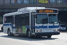
The station and the nearby Queens Center Mall are served by nine local MTA Regional Bus Operations routes and two express bus routes. Three of the four Woodhaven Boulevard bus lines (Q11, Q21, Q52 SBS) terminate at the station, with the Q53 SBS bus continuing westward towards the Woodside – 61st Street Station. Except for the Q88, Rego Park-bound Q59, Jamaica-bound Q60, and Corona-bound Q38, all northbound buses stop at the mall entrance, while all southbound buses as well as the QM10 and QM11 express buses stop at Hoffman Drive adjacent to Hoffman Park. The Q88 terminates at 92nd Street, in between the two halves of the mall.[54][60]
| Route | Stop location | North/West Terminal[60] | South/East Terminal[60] | via[60] | notes[60] | |
|---|---|---|---|---|---|---|
| Local Bus Routes | ||||||
| Queens Boulevard (northbound); Hoffman Drive (southbound) | Woodhaven Boulevard | Old Howard Beach or Hamilton Beach | Woodhaven and Cross Bay Boulevards | |||
| Howard Beach | Woodhaven and Cross Bay Boulevards, 155th Avenue, 157th Avenue | |||||
| Jackson Heights (82nd Street Station) | Glendale (81st Street and Myrtle Avenue) | 90th/92nd Streets, Dry Harbor Road, 80th Street | Some AM rush northbound service terminates here. | |||
| 59th Avenue; Hoffman Drive | Corona (60th Avenue and Otis Avenue) | Rego Park (62nd Drive and 108th Street) | Eliot Avenue, Metropolitan Avenue, Penelope Avenue, 63rd Drive | Via Middle Village–Metropolitan Avenue Station | ||
| Queens Boulevard (northbound); Hoffman Drive (southbound) | Woodhaven Boulevard | Arverne | Q53 trips: Broadway and Queens Boulevard All trips: Woodhaven and Cross Bay Boulevards, Rockaway Beach Boulevard |
Select Bus Service | ||
| Woodside (61st Street Station) | Rockaway Park (Beach 116th Street Station) | |||||
| Queens Boulevard | Williamsburg, Brooklyn | Rego Park (63rd Drive Station) | Grand Street and Grand Avenue, Queens Boulevard | |||
| East Midtown, Manhattan | South Jamaica | Queensboro Bridge, Queens Boulevard, Sutphin Boulevard | ||||
| 92nd Street and 59th Avenue | 92nd Street | Queens Village (Queens Village LIRR Station) | Horace Harding Expressway, 188th Street, 73rd Avenue, Springfield Boulevard | |||
| Express Bus Routes | ||||||
| Woodhaven Boulevard (near Hoffman Drive) | Midtown Manhattan | Rego Park / Elmhurst Loop (Drop-off Only) | 3rd or 6th Avenue | |||
| Downtown Manhattan | Downtown Loop | |||||
Notes edit
- ^ According to scans of 1980s subway maps:
- "1983 Subway Map". New York City Transit Authority. 1983. Retrieved July 10, 2016.
Woodhaven Blvd–Slattery Plaza
- "1987 Subway Map". New York City Transit Authority. 1987. Retrieved July 10, 2016.
Woodhaven Blvd–Queens Center
- "1983 Subway Map". New York City Transit Authority. 1983. Retrieved July 10, 2016.
References edit
- ^ "Glossary". Second Avenue Subway Supplemental Draft Environmental Impact Statement (SDEIS) (PDF). Vol. 1. Metropolitan Transportation Authority. March 4, 2003. pp. 1–2. Archived from the original (PDF) on February 26, 2021. Retrieved January 1, 2021.
- ^ a b "Annual Subway Ridership (2018–2023)". Metropolitan Transportation Authority. 2023. Retrieved April 20, 2024.
- ^ "Annual Subway Ridership (2018–2023)". Metropolitan Transportation Authority. 2023. Retrieved April 20, 2024.
- ^ See:
- Duffus, R.L. (September 22, 1929). "Our Great Subway Network Spreads Wider; New Plans of Board of Transportation Involve the Building of More Than One Hundred Miles of Additional Rapid Transit Routes for New York". The New York Times. ISSN 0362-4331. Retrieved August 19, 2015.
- Board of Transportation of the City of New York Engineering Department, Proposed Additional Rapid Transit Lines And Proposed Vehicular Tunnel, dated August 23, 1929
- ^ "Queens Lauded as Best Boro By Chamber Chief". The Brooklyn Daily Eagle. September 23, 1929. p. 40. Retrieved October 4, 2015.
- ^ "New Subway Routes in Hylan Program to Cost $186,046,000" (PDF). The New York Times. March 21, 1925. p. 1. ISSN 0362-4331. Retrieved March 27, 2020.
- ^ "$17,146,500 Voted For New Subways; Estimate Board Appropriates More Than $9,000,000 for Lines in Brooklyn. $6,490,000 For The Bronx Smaller Items for Incidental Work --Approves the Proposed Queens Boulevard Route". The New York Times. October 5, 1928. ISSN 0362-4331. Retrieved August 4, 2016.
- ^ Hirshon, Nicholas; Romano, Foreword by Ray (January 1, 2013). Forest Hills. Arcadia Publishing. ISBN 978-0-7385-9785-0.
- ^ "Two Subway Links Opened In Queens" (PDF). The New York Times. August 19, 1933. p. 13. ISSN 0362-4331. Retrieved December 11, 2016.
- ^ "Unfinished Sections of Subway Lines To Be Completed" (PDF). The New York Sun. December 13, 1933. p. 47. Retrieved July 30, 2016.
- ^ "Trains Testing Jamaica Link Of City Subway". The Brooklyn Daily Eagle. April 10, 1937. p. 3. Retrieved April 24, 2018.
- ^ "Test Trains Running In Queens Subway; Switch and Signal Equipment of New Independent Line Is Being Checked". The New York Times. December 20, 1936. ISSN 0362-4331. Retrieved April 26, 2016.
- ^ a b Neufeld, Ernest (August 23, 1936). "Men Toil Under Earth to Build Subway" (PDF). Long Island Daily Press. p. 2 (Section 2). Retrieved August 12, 2016.
- ^ See:
- "500 More Quit Subway Work On Boulevard: General Strike Order Issued Today; 72 Walk Out in Jamaica" (PDF). Long Island Daily Press. April 2, 1935. p. 2. Retrieved July 30, 2016.
- "Aldermen Probe Strike on Subway" (PDF). Long Island Daily Press. April 3, 1935. p. 4. Retrieved July 30, 2016.
- ^ "Work Progressing on Queens Subway". The New York Times. August 11, 1935. p. RE2. ISSN 0362-4331. ProQuest 101425888.
- ^ a b c "PLANS ARE CHANGED FOR QUEENS SUBWAY: Traffic Crossings at Nassau and Woodhaven Boulevards Altered to Avoid Congestion. VIADUCT PROJECT DROPPED Main Driveway to Be Depressed, Side Routes to Be at Grade-- New Bids Due Soon. How Plans Were Changed. Elimination Plans Received". The New York Times. June 22, 1930. Retrieved September 1, 2015.
- ^ Roger P. Roess; Gene Sansone (August 23, 2012). The Wheels That Drove New York: A History of the New York City Transit System. Springer Science & Business Media. pp. 416–417. ISBN 978-3-642-30484-2.
- ^ "City Subway Opens Queens Link Today; Extension Brings Kew Gardens Within 36 Minutes of 42d St. on Frequent Trains". The New York Times. December 31, 1936. ISSN 0362-4331. Retrieved April 26, 2016.
- ^ "Mayor Takes 2,000 for a Ride ln Queens Subway Extension: Heads Civic Leaders in 10-Car Train Over Route to Kew Gardens That Opens at 7 A. M. Today; Warns of 15-Cent Fare if Unity Plan Fails The Mayor Brings Rapid Transit to Kew Gardens". New York Herald Tribune. December 31, 1936. p. 34. ISSN 1941-0646. ProQuest 1222323973.
- ^ "New Retail Area In Queens Borough; Sees Roosevelt Avenue Subway Station as Great Shopping Centre. Advantages Pointed Out Accessibility to Many Home Communities Assures Potential Market". The New York Times. July 9, 1933. ISSN 0362-4331. Retrieved April 26, 2016.
- ^ "Trains Testing Jamaica Link Of City Subway". The Brooklyn Daily Eagle. April 10, 1937. p. 3. Retrieved April 24, 2018.
- ^ "Jamaica Will Greet Subway" (PDF). The New York Sun. April 23, 1937. p. 8. Retrieved April 24, 2018.
- ^ a b c Schneider, Daniel B. (October 15, 2000). "F.Y.I." The New York Times. ISSN 0362-4331. Retrieved October 6, 2023.
- ^ a b c Wilkinson, Christina; Walsh, Kevin (March 5, 2006). "REGO PARK, Queens". Forgotten NY. Retrieved August 18, 2015.
- ^ "PWA Party Views New Subway Link; Queens Section to Be Opened Tomorrow Is Inspected by Tuttle and Others". The New York Times. December 30, 1936. ISSN 0362-4331. Retrieved October 6, 2023.
- ^ a b c For more information on the current tablets that state "Woodhaven Blvd–Slattery Plaza", see the following sources:
- Schneider 2000.
- Karni, Annie (October 7, 2012). "Subway stations retain signs listing places and streets that no longer exist". nypost.com. New York Post. Retrieved June 27, 2015.
- Walsh, Kevin (July 29, 2014). "Ely Around in Queens". queens.brownstoner.com. Blank Slate Factory, Inc. Retrieved June 27, 2015.
- ^ Siwolop, Sana (March 3, 2004). "Commercial Real estate: Regional MarketT – Queens; Renovations And Renewal For a Mall". The New York Times. Retrieved July 11, 2016.
Built in 1973
- ^ Gargan, Edward A. (June 11, 1981). "Agency Lists Its 69 Most Deteriorated Subway Stations". The New York Times. Retrieved August 13, 2016.
- ^ a b Hernandez, Raymond (November 21, 1993). "Neighborhood Report: Elmhurst/East Elmhurst; An Offer of Help for the Tired Woodhaven Blvd. Station". The New York Times. Retrieved July 11, 2016.
- ^ Leahy, Jack (June 22, 1992). "Straphangers to rally for access: Riders want Woodhaven entrance open". New York Daily News. Retrieved June 21, 2020.
- ^ "The New Woodhaven Blvd Station Woodhaven Blvd station Built in the 30s Renewed for the 90s". New York City Transit. 1993. Retrieved March 31, 2019 – via Flickr.
- ^ "Press Release - MTA Headquarters - MTA Announces 20 Additional Subway Stations to Receive Accessibility Improvements Under Proposed 2020-2024 Capital Plan". mta.info. Metropolitan Transportation Authority. December 19, 2019. Archived from the original on April 21, 2020. Retrieved December 20, 2019.
- ^ Nessen, Stephen (November 28, 2022). "MTA to spend more than $1B on accessibility upgrades". Gothamist. Retrieved December 1, 2022.
- ^ a b Brachfeld, Ben (November 29, 2022). "MTA to spend $1 billion on subway, commuter rail accessibility upgrades". amNewYork. Retrieved December 1, 2022.
- ^ a b "Capital Program Oversight Committee Meeting November 2022". mta.info. Metropolitan Transportation Authority. November 29, 2022. Retrieved July 14, 2022.
- ^ Dougherty, Peter (2006) [2002]. Tracks of the New York City Subway 2006 (3rd ed.). Dougherty. OCLC 49777633 – via Google Books.
- ^ "Late Night Subway Service" (PDF). Metropolitan Transportation Authority. March 23, 2023. Retrieved June 2, 2023.
- ^ "E Subway Timetable, Effective December 4, 2022". Metropolitan Transportation Authority. Retrieved August 26, 2023.
- ^ "F Subway Timetable, Effective August 28, 2023". Metropolitan Transportation Authority. Retrieved August 26, 2023.
- ^ "M Subway Timetable, Effective August 28, 2023". Metropolitan Transportation Authority. Retrieved August 26, 2023.
- ^ "R Subway Timetable, Effective August 28, 2023". Metropolitan Transportation Authority. Retrieved August 26, 2023.
- ^ "Subway Map" (PDF). Metropolitan Transportation Authority. September 2021. Retrieved September 17, 2021.
- ^ "The Express Stop That Never Was". ltvsquad.com. LTV Squad. June 2, 2015. Retrieved June 27, 2015.
- ^ Kihss, Peter (April 13, 1967). "3 Routes Proposed to Aid Growing Queens Areas" (PDF). The New York Times. Retrieved June 27, 2015.
- ^ "Adding City Transit Line to Rockaways Is Chamber '47 Goal". Brooklyn Daily Eagle. January 2, 1947. p. 4. Retrieved October 10, 2015 – via Newspapers.com.
- ^ "Queens Bus Riders Join in Campaign For Station Shelters: Protection Is Sought At Slattery Place, Plus an Express Stop". Brooklyn Daily Eagle. December 15, 1940. p. 10. Retrieved October 10, 2015 – via Newspapers.com.
- ^ "Express Station Plea Is Weighed". Brooklyn Daily Eagle. October 20, 1940. p. 8. Retrieved October 10, 2015 – via Newspapers.com.
- ^ Cox, Jeremiah. "Woodhaven Blvd". The Subway Nut. Retrieved July 11, 2016.
- ^ "IND Queens Boulevard Line: Woodhaven Boulevard-Queens Mall". www.nycsubway.org. Retrieved July 11, 2016.
- ^ "Tile Colors a Guide in the New Subway; Decoration Scheme Changes at Each Express Stop to Tell Riders Where They Are". The New York Times. August 22, 1932. ISSN 0362-4331. Archived from the original on July 1, 2022. Retrieved July 1, 2022.
- ^ Carlson, Jen (February 18, 2016). "Map: These Color Tiles In The Subway System Used To Mean Something". Gothamist. Retrieved May 10, 2023.
- ^ Gleason, Will (February 18, 2016). "The hidden meaning behind the New York subway's colored tiles". Time Out New York. Retrieved May 10, 2023.
- ^ a b "New York MPS Elmhurst Avenue Subway Station (IND)". Records of the National Park Service, 1785 - 2006, Series: National Register of Historic Places and National Historic Landmarks Program Records, 2013 - 2017, Box: National Register of Historic Places and National Historic Landmarks Program Records: New York, ID: 05000672. National Archives.
- ^ a b c d e "MTA Neighborhood Maps: Forest Hills" (PDF). mta.info. Metropolitan Transportation Authority. 2015. Retrieved July 6, 2015.
- ^ "MTA Arts & Design: Woodhaven Boulevard". Metropolitan Transportation Authority. Archived from the original on September 23, 2015. Retrieved September 23, 2015.
- ^ Cook, Lauren. "NYC subway art you need to check out". am New York. Retrieved January 4, 2017.
- ^ a b c d *"SUBWAY-SIDEWALK INTERFACE PROJECT TECHNICAL MEMORANDUM IV ISSUES AND OPPORTUNITIES" (PDF). transalt.org. New York City Department of City Planning. November 2000. Archived from the original (PDF) on February 2, 2017. Retrieved December 6, 2015.
- "SUBWAY-SIDEWALK INTERFACE PROJECT: WOODHAVEN BOULEVARD STATION" (PDF). transalt.org. Transportation Alternatives, City of New York, New York City Department of City Planning, New York City Department of Transportation. 2000. Archived from the original (PDF) on August 17, 2016. Retrieved July 15, 2016.
- ^ a b c d Cox, Jeremiah. "Woodhaven Blvd (G,R,V)". The SubwayNut. Retrieved July 1, 2016.
- ^ "Picture of the closed subway entrance". Google Maps. Retrieved September 1, 2020.
- ^ a b c d e "Queens Bus Map" (PDF). Metropolitan Transportation Authority. August 2022. Retrieved September 29, 2022.
External links edit
- nycsubway.org – IND Queens Boulevard Line: Woodhaven Boulevard/Queens Mall
- Station Reporter — R Train
- Station Reporter — M Train
- MTA's Arts For Transit — Woodhaven Boulevard (IND Queens Boulevard Line)
- The Subway Nut — Woodhaven Boulevard Pictures
- Woodhaven Boulevard entrance from Google Maps Street View
- Horace Harding Boulevard (Long Island Expressway) entrance from Google Maps Street View
- Platforms from Google Maps Street View
- Mezzanine from Google Maps Street View