Summary
Wormhout (French pronunciation: [wɔʁmut]; before 1975: Wormhoudt; West Flemish: Wormout) is a commune in the Nord department in northern France.[3] Several people in Wormhout still speak West Flemish, a local dialect of Dutch and the traditional language of the region, while French-speakers form a majority, due to centuries of French political and cultural influence.
Wormhout | |
|---|---|
 The church in Wormhout | |
 Coat of arms | |
Location of Wormhout .mw-parser-output .locmap .od{position:absolute}.mw-parser-output .locmap .id{position:absolute;line-height:0}.mw-parser-output .locmap .l0{font-size:0;position:absolute}.mw-parser-output .locmap .pv{line-height:110%;position:absolute;text-align:center}.mw-parser-output .locmap .pl{line-height:110%;position:absolute;top:-0.75em;text-align:right}.mw-parser-output .locmap .pr{line-height:110%;position:absolute;top:-0.75em;text-align:left}.mw-parser-output .locmap .pv>div{display:inline;padding:1px}.mw-parser-output .locmap .pl>div{display:inline;padding:1px;float:right}.mw-parser-output .locmap .pr>div{display:inline;padding:1px;float:left}html.skin-theme-clientpref-night .mw-parser-output .od,html.skin-theme-clientpref-night .mw-parser-output .od .pv>div,html.skin-theme-clientpref-night .mw-parser-output .od .pl>div,html.skin-theme-clientpref-night .mw-parser-output .od .pr>div{background:#000;color:#fff}html.skin-theme-clientpref-night .mw-parser-output .locmap{filter:grayscale(0.6)}@media(prefers-color-scheme:dark){html.skin-theme-clientpref-os .mw-parser-output .locmap{filter:grayscale(0.6)}html.skin-theme-clientpref-os .mw-parser-output .od,html.skin-theme-clientpref-os .mw-parser-output .od .pv>div,html.skin-theme-clientpref-os .mw-parser-output .od .pl>div,html.skin-theme-clientpref-os .mw-parser-output .od .pr>div{background:#000;color:#fff}}  Wormhout  Wormhout | |
| Coordinates: 50°53′00″N 2°28′07″E / 50.8833°N 2.4686°E | |
| Country | France |
| Region | Hauts-de-France |
| Department | Nord |
| Arrondissement | Dunkerque |
| Canton | Wormhout |
| Intercommunality | Hauts de Flandre |
| Government | |
| • Mayor (2023–2026) | David Calcoen[1] |
| Area 1 | 27.41 km2 (10.58 sq mi) |
| Population (2021)[2] | 5,705 |
| • Density | 210/km2 (540/sq mi) |
| Demonym | Wormhoutois |
| Time zone | UTC+01:00 (CET) |
| • Summer (DST) | UTC+02:00 (CEST) |
| INSEE/Postal code | 59663 /59470 |
| Elevation | 5–33 m (16–108 ft) (avg. 19 m or 62 ft) |
| 1 French Land Register data, which excludes lakes, ponds, glaciers > 1 km2 (0.386 sq mi or 247 acres) and river estuaries. | |
The town's name is of Germanic origin, meaning "Wormwood."[4]
Neighbouring towns and villages :
- Ledringhem to the south-west, separated by river Peene Becque
- Esquelbecq

Population edit
| Year | Pop. | ±% p.a. |
|---|---|---|
| 1968 | 3,004 | — |
| 1975 | 4,332 | +5.37% |
| 1982 | 5,133 | +2.45% |
| 1990 | 5,057 | −0.19% |
| 1999 | 4,984 | −0.16% |
| 2007 | 5,223 | +0.59% |
| 2012 | 5,388 | +0.62% |
| 2017 | 5,632 | +0.89% |
| Source: INSEE[5] | ||
Heraldry edit
 |
The arms of Wormhout are blazoned : Or, a lion sable armed and langued gules. ('Flanders' and the communes of Thourotte, Crépy-en-Valois, Bollezeele, Feignies, Flines-lez-Raches and Wormhout use the same arms.)
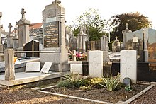
Sights
edit
Education editWormhout has a number of school providing education structures for all of the pupils around the town : école du bocage, école Roger Salengro, école Saint-Joseph, collège du Houtland, école Jean Moulin, collège Notre-Dame, lycée de l'Yser. Twinnage editWormhout is twinned with the resort town of Llandudno, Conwy, Wales. See also editReferences edit
Wikimedia Commons has media related to Wormhout.
|