


Summary
Wrentham (/ˈrɛntəm/) is a hamlet in southern Alberta, Canada within the County of Warner No. 5.[2] It is located southeast of the intersection of the Veteran Memorial Highway (Highway 36) and the historic Red Coat Trail (Highway 61), approximately 25 kilometres (16 mi) east of the Village of Stirling, 30 kilometres (19 mi) south of the Town of Taber and 55 kilometres (34 mi) west of the Village of Foremost.
Wrentham | |
|---|---|
Hamlet | |
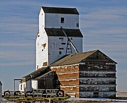 Grain elevator in Wrentham | |
| Motto: Come Enjoy Wrentham | |
 Location of Wrentham in Alberta | |
| Coordinates: 49°30′52″N 112°10′22″W / 49.51444°N 112.17278°W | |
| Country | Canada |
| Province | Alberta |
| Region | Southern Alberta |
| Census division | 2 |
| Municipal district | County of Warner No. 5 |
| Founded | 1910 |
| Incorporated | 1913 |
| Government | |
| • Type | Unincorporated |
| • Governing body | County of Warner No. 5 Council |
| Elevation | 946 m (3,104 ft) |
| Population (1991)[1] | |
| • Total | 58 |
| Time zone | UTC−7 (MST) |
| • Summer (DST) | UTC−6 (MDT) |
| Postal code span | |
| Area code | +1-403 |
| Highways | Highway 61 |
| Waterways | Chin Reservoir |
The hamlet was named by the Canadian Pacific Railway after Wrentham, a village in Suffolk, England.[3]
The hamlet is in Census Division No. 2 and in the federal riding of Lethbridge.
Demographics edit
Wrentham recorded a population of 58 in the 1991 Census of Population conducted by Statistics Canada.[1]
See also edit
References edit
- ^ a b "91 Census: Unincorporated Places — Population and Dwelling Counts" (PDF). Statistics Canada. June 1993. Retrieved September 25, 2021.
- ^ "Specialized and Rural Municipalities and Their Communities" (PDF). Alberta Municipal Affairs. January 12, 2022. Retrieved January 21, 2022.
- ^ ePodunk. "Wrentham, Alberta". Retrieved April 11, 2008.
49°30′52″N 112°10′22″W / 49.51444°N 112.17278°W