


Summary
Wudinna District Council is a rural local government area on central Eyre Peninsula, South Australia. Its seat is Wudinna, on the Eyre Highway, 580 kilometres (360 mi) west of Adelaide. The district's economy is largely driven by agriculture, mainly cereal crops, with beef and sheep commonly farmed as well.
| Wudinna District Council South Australia | |||||||||||||||
|---|---|---|---|---|---|---|---|---|---|---|---|---|---|---|---|
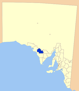 Location of the Wudinna District Council (formerly Le Hunte) | |||||||||||||||
| Population | 1,136 (LGA 2021)[1] | ||||||||||||||
| Established | 1925 | ||||||||||||||
| Area | 5,393.8 km2 (2,082.6 sq mi) | ||||||||||||||
| Mayor | Eleanor Scholz[2] | ||||||||||||||
| Council seat | Wudinna | ||||||||||||||
| Region | Eyre Western[3] | ||||||||||||||
| State electorate(s) | Flinders | ||||||||||||||
| Federal division(s) | Grey | ||||||||||||||
| Website | Wudinna District Council | ||||||||||||||
| |||||||||||||||
History edit
The District Council of Minnipa was established on 28 May 1925. Its boundaries were defined as including the hundreds of Minnipa, Yaninee, Pygery, Wudinna, Palabie, Wannamana, Mamblin, Warramboo, Kappakoola, Pordia and Cocata in the County of Le Hunte, and the hundreds of Condada, Moorkitabie, Carina, Addison and Travers in the County of Robinson, the latter five hundreds being annexed from the District Council of Streaky Bay.[4] The inaugural councillors appointed were Charles James Rowen, Arthur William Christian, William Mitchell, Thomas Knight, Edwin James Turley, Ellery John Drummond Oswald, and Edward Beck Smith.[4]
It was renamed the District Council of Le Hunte in 1932, after Sir George Ruthven Le Hunte, who as Governor of South Australia had proclaimed the County of Le Hunte in 1908.
It was again renamed on 24 April 2008 as Wudinna District Council.[5][6][7]
Localities edit
The district encompasses a number of towns and localities, including Cocata, Koongawa, Kyancutta, Minnipa, Pygery, Warramboo, Wudinna and Yaninee, Karcultaby, Mount Damper and Pinkawillinie.[8] The former locality of Paney, which was a small portion of the present bounded locality of Gawler Ranges, is also in Wudinna council area. Paney was merged into the Gawler Ranges locality when the latter's boundaries were formalised in April 2013.[9][10]
Facilities edit
The area has a number of sporting facilities with football, cricket, tennis and bowls all popular pastimes. Swimming pools are also located at Wudinna and Minnipa. The district also has a number of schools and a hospital.
Elected members edit
| Ward | Councillor | Notes | |
|---|---|---|---|
| Unsubdivided[2] | Richard DuBois | ||
| Tony Griffin | |||
| Newton (Ned) Luscombe | Deputy Mayor | ||
| Jill Rushmer | |||
| Eleanor Scholz | Mayor | ||
| Naomi Scholz | |||
| Craig Walladge | |||
Mayors and chairmen of the District Council of Le Hunte/Wudinna edit
- Ernest Harry Edmonds (1931–1939)[11]
- Alfred William Hurtle Barns (1939–1941)[11]
- Ernest Harry Edmonds (1941–1944)[11]
- David Trevenen Sampson (1944–1946)[11]
- Philip Warburton Symonds (1946–1947)[11]
- Harold Edward Broad (1947–1950)[11]
- Oswald John Murphy (1950–1951)[11]
- Victor Melrose Karger (1951–1952)[11]
- William Maxwell Heath (1952–1958)[11]
- Percy Archibald Tonkin (1958–1959)[11]
- George Harnet Phillips (1959–1965)[11]
- William Leonard Wilkins (1965–1976)[11]
- Eric Markey (1976–1977)[11]
- Murray Murvin Gerschwitz (1977–1979)[11]
- Newton Lloyd Simpson (1979–1982)[11]
- Murray Murvin Gerschwitz (1982–1987)[12]
- Tim Scholz (2003–2013)[13]
- Eleanor Scholz (2013–present)[14]
References edit
- ^ Australian Bureau of Statistics (28 June 2022). "Wudinna (Local Government Area)". Australian Census 2021 QuickStats. Retrieved 28 June 2022.
- ^ a b "Elected Members". District Council of Wudinna. Retrieved 14 February 2016.
- ^ "Eyre Western SA Government region" (PDF). The Government of South Australia. Retrieved 10 October 2014.
- ^ a b "Constitution of District of Minnipa" (PDF). South Australian Government Gazette. 1925 (22 ed.). Government of South Australia: 1005. 28 May 1925. Retrieved 13 October 2017.
- ^ "History". District Council of Wudinna. Retrieved 15 February 2016.
- ^ Hosking, P. (1936). The Official civic record of South Australia : centenary year, 1936. Adelaide: Universal Publicity Company. p. 648.
- ^ "Minnipa Council Meets". Port Lincoln Times (SA : 1927 – 1954). SA: National Library of Australia. 2 September 1932. p. 3. Retrieved 16 February 2016.
- ^ "Location SA Map Viewer". Government of South Australia. Retrieved 14 February 2016.
- ^ "Search for 'Paney, LOCB' (ID SA0042121)". Government of South Australia. Retrieved 22 July 2016.
The majority of the former locality was merged into the new rural locality of Gawler Ranges to ensure the whole of Gawler Ranges National Park is within the rural locality of the same name, while the small portion not within Gawler Ranges National Park was included to the existing locality of Pygery vide Government Gazette of 26 April 2013.
- ^ "Search for 'Gawler Ranges, LOCB' (ID SA0067063)". Government of South Australia. Retrieved 22 July 2016.
Name selected and boundaries created on 26 April 2013 for the long established local name. with a portion of the existing locality of Paney added to ensure the whole of the Gawler Ranges National Park is within the locality of the same name.
- ^ a b c d e f g h i j k l m n o Matthews, Penny (1986), South Australia, the civic record, 1836–1986, Wakefield Press, ISBN 978-0-949268-82-2
- ^ "Member List". Order of Australia Association – South Australian Branch. Retrieved 20 November 2016.
- ^ "Scholz gives iron ore mine update". Eyre Peninsula Tribune. 9 June 2015.
- ^ "Mine concern". West Coast Sentinel. 27 February 2013.
External links edit
- Council website
- Local Government Association of South Australia website
33°02′49″S 135°27′36″E / 33.047°S 135.46°E