


Summary
Wyre Forest is a local government district in Worcestershire, England. It is named after the ancient woodland of Wyre Forest. The largest town is Kidderminster, where the council is based. The district also includes the towns of Stourport-on-Severn and Bewdley, along with several villages and surrounding rural areas.
Wyre Forest | |
|---|---|
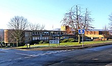
 Kidderminster, the district's largest town and administrative centre | |
 Wyre Forest shown within Worcestershire | |
| Sovereign state | United Kingdom |
| Constituent country | England |
| Region | West Midlands |
| Non-metropolitan county | Worcestershire |
| Status | Non-metropolitan district |
| Admin HQ | Kidderminster |
| Incorporated | 1 April 1974 |
| Government | |
| • Type | Non-metropolitan district council |
| • Body | Wyre Forest District Council |
| • MP | Mark Garnier |
| Area | |
| • Total | 75.4 sq mi (195.4 km2) |
| • Rank | 147th (of 296) |
| Population (2021 Census) | |
| • Total | 101,600 |
| • Rank | 237th (of 296) |
| • Density | 1,300/sq mi (520/km2) |
| Ethnicity (2021) | |
| • Ethnic groups | |
| Religion (2021) | |
| • Religion | List
|
| Time zone | UTC0 (GMT) |
| • Summer (DST) | UTC+1 (BST) |
| ONS code | 47UG (ONS) E07000239 (GSS) |
| OS grid reference | SO8264776847 |
The district borders Bromsgrove District to the east, Wychavon to the south-east, Malvern Hills District to the south-west, Shropshire to the north-west, and South Staffordshire to the north.
History edit
The district was formed on 1 April 1974 under the Local Government Act 1972. The new district covered the area of four former districts, which were all abolished at the same time:[2]
- Bewdley Municipal Borough
- Kidderminster Municipal Borough
- Kidderminster Rural District
- Stourport-on-Severn Urban District
The new district was named after the ancient woodland of Wyre Forest, much of which lies within the area.[3]
Since 2011, Wyre Forest has formed part of the Greater Birmingham & Solihull Local Enterprise Partnership.
Governance edit
Wyre Forest District Council | |
|---|---|
| Type | |
| Type | |
| Leadership | |
Ian Miller since December 2009[4] | |
| Structure | |
| Seats | 33 Councillors |
Political groups |
|
| Elections | |
Last election | 4 May 2023 |
Next election | 2027 |
| Meeting place | |
 | |
| Wyre Forest House, Finepoint Way, Kidderminster, DY11 7WF | |
| Website | |
| www | |
Wyre Forest District Council provides district-level services. County-level services are provided by Worcestershire County Council. The whole district is also covered by civil parishes, which form a third tier of local government.[5]
Political control edit
The council has been under Conservative majority control since the 2023 election.
The first elections to the council were held in 1973, initially operating as a shadow authority alongside the outgoing authorities until the new arrangements took effect on 1 April 1974. Political control of the council since 1974 has been as follows:[6][7][8][9][10]
| Party in control | Years | |
|---|---|---|
| No overall control | 1974–1976 | |
| Conservative | 1976–1979 | |
| No overall control | 1979–1996 | |
| Labour | 1996–1999 | |
| No overall control | 1999–2002 | |
| Health Concern | 2002–2002 | |
| No overall control | 2002–2008 | |
| Conservative | 2008–2009 | |
| No overall control | 2009–2010 | |
| Conservative | 2010–2012 | |
| No overall control | 2012–2015 | |
| Conservative | 2015–2019 | |
| No overall control | 2019–2023 | |
| Conservative | 2023–present | |
Leadership edit
The leaders of the council since 1974 have been:[11][12]
| Councillor | Party | From | To | |
|---|---|---|---|---|
| Graham Smith[13] | Labour | 1974 | 1975 | |
| Malcolm Cooper[14] | Conservative | 1975 | 1979 | |
| Anthony Batchelor[15] | Liberal | 1979 | May 1983 | |
| Graham Ballinger[16] | Conservative | 1983 | 1984 | |
| Anthony Batchelor | Liberal | 1984 | 1985 | |
| Mike Oborski | Liberal | 1985 | 1986 | |
| Gilbert Edwards | Liberal | 1986 | 1989 | |
| Jamie Shaw[17] | Labour | 1989 | 1994 | |
| Jane Bonnick[18][19] | Liberal Democrats | 1994 | Oct 1995 | |
| Jamie Shaw[20][21] | Labour | 1996 | 1999 | |
| (no leader) | 1999 | 2000 | ||
| Mike Oborski[22][23] | Liberal | 2000 | 15 May 2002 | |
| Liz Davies[24] | Health Concern | 15 May 2002 | 14 May 2003 | |
| Howard Martin[25] | Health Concern | 14 May 2003 | 13 Jun 2004 | |
| Stephen Clee | Conservative | 30 Jun 2004 | 16 May 2007 | |
| John Campion | Conservative | 16 May 2007 | 2 Apr 2014 | |
| Marcus Hart | Conservative | 2 Apr 2014 | 22 May 2019 | |
| Graham Ballinger | Health Concern | 22 May 2019 | 12 May 2021 | |
| Helen Dyke[18] | Independent | 12 May 2021 | 17 May 2023 | |
| Marcus Hart | Conservative | 17 May 2023 | ||
Composition edit
Following the 2023 election and a change of allegiance in February 2024, the composition of the council was:[26][27]
| Party | Councillors | |
|---|---|---|
| Conservative | 20 | |
| Independent | 7 | |
| Labour | 3 | |
| Liberal Democrats | 2 | |
| Green | 1 | |
| Total | 33 | |
The Green councillor sits in a group with the independents.[28] The next election is due in 2027.
Premises edit
The council is based at Wyre Forest House, which was purpose-built for the council and completed in 2012.[29] The building is in the parish of Stourport-on-Severn, but lies on the outskirts of Kidderminster and has a Kidderminster postal address. Prior to 2012 the council was based at the Civic Centre on New Street in Stourport-on-Severn, which had been completed in 1966 for the old Stourport-on-Severn Urban District Council.[30]
Elections edit
Since the last boundary changes in 2015 the council has comprised 33 councillors representing 12 wards, with each ward electing one, two or three councillors. Elections are held every four years.[31]
Wards edit

The wards are:[31]
- Aggborough & Spennells
- Areley Kings & Riverside
- Bewdley & Rock
- Blakebrook & Habberley South
- Broadwaters
- Foley Park & Hoobrook
- Franche & Habberley North
- Lickhill
- Mitton
- Offmore & Comberton
- Wribbenhall & Arley
- Wyre Forest Rural
Wider politics edit
The Wyre Forest parliamentary constituency, which covers most of the district, is represented by the Conservative MP Mark Garnier. He has held the seat since the 2010 general election, when he gained it from Richard Taylor of Health Concern, who had held the seat from 2001 to 2010.[32]
Demography edit
In Wyre Forest, the population size has increased by 3.7%, from around 98,000 in 2011 to 101,600 in 2021.[33]
Parishes edit

The whole district is divided into civil parishes. The parish councils for Bewdley, Kidderminster and Stourport-on-Severn take the style "town council".[34]
Schools edit
There are five secondary schools within the district.
Media edit
See also edit
References edit
- ^ a b UK Census (2021). "2021 Census Area Profile – Wyre Forest Local Authority (E07000239)". Nomis. Office for National Statistics. Retrieved 5 January 2024.
- ^ "The English Non-metropolitan Districts (Definition) Order 1972", legislation.gov.uk, The National Archives, SI 1972/2039, retrieved 31 May 2023
- ^ "The English Non-metropolitan Districts (Names) Order 1973", legislation.gov.uk, The National Archives, SI 1973/551, retrieved 31 May 2023
- ^ "New chief exec for district council". Kidderminster Shuttle. 23 October 2009. Retrieved 7 July 2023.
- ^ "Local Government Act 1972", legislation.gov.uk, The National Archives, 1972 c. 70, retrieved 31 May 2023
- ^ "Compositions calculator". The Elections Centre. Retrieved 9 September 2022.
- ^ "Wyre Forest". BBC News. 23 May 2014. Retrieved 24 May 2014.
- ^ Land, Jon (11 December 2009). "Huge boost for Labour in latest council by-elections". 24dash.com. Retrieved 16 April 2015.
- ^ "local elections 2010". theguardian.com. 7 May 2010. Retrieved 16 April 2015.
- ^ "Tories take total control of Wyre Forest Council". The Shuttle. 8 May 2015. Retrieved 9 May 2015.
- ^ "Council minutes". Wyre Forest District Council. Retrieved 19 September 2022.
- ^ "Past Leaders of Wyre Forest District Council". Wyre Forest District Council. Archived from the original on 4 March 2021. Retrieved 19 September 2022.
- ^ Alston, Trevor (12 December 1974). "Groups ready for a battle to stop the West Orbital route". Birmingham Post. p. 21. Retrieved 19 September 2022.
- ^ "Parties' musical chairs". Birmingham Post. 21 April 1976. p. 24. Retrieved 19 September 2022.
- ^ "Jobs are the big issue in carpet country". Evening Mail. Birmingham. 30 May 1983. p. 7. Retrieved 19 September 2022.
- ^ "Warning of 6p rate rise next year". Sandwell Evening Mail. West Bromwich. 20 September 1983. p. 19. Retrieved 19 September 2022.
- ^ "Council faces £1m shortfall". Sandwell Evening Mail. West Bromwich. 10 December 1992. p. 14. Retrieved 19 September 2022.
- ^ a b Rawlins, Jack (13 May 2021). "Helen Dyke appointed as Wyre Forest District Council leader". The Shuttle. Retrieved 19 September 2022.
- ^ "Leader resigns". Birmingham Mail. 12 October 1995. p. 5. Retrieved 19 September 2022.
- ^ Gray, Chris (4 May 1996). "Labour gains spark loony left warning". Birmingham Post. p. 1. Retrieved 19 September 2022.
- ^ "Wyre Forest Labour 'horrified' by James Shaw's child sex crime". Kidderminster Shuttle. 14 November 2019. Retrieved 19 September 2022.
- ^ Meadowcroft, Michael (5 April 2007). "Mike Oborski". The Guardian. Retrieved 19 September 2022.
- ^ "Town suffers from 18-mile factor". Worcester News. 14 March 2002. Retrieved 19 September 2022.
- ^ "Health party takes control". Worcester News. 9 May 2002. Retrieved 19 September 2022.
- ^ "New man at the helm". Worcester News. 15 May 2003. Retrieved 19 September 2022.
- ^ "Local elections 2023: live council results for England". The Guardian.
- ^ Rawlins, Jack (2 February 2024). "Wyre Forest Labour leader Leigh Whitehouse quits party". The Shuttle. Retrieved 11 February 2024.
- ^ "Independent and Green group". Wyre Forest District Council. Retrieved 11 February 2024.
- ^ "New £10.5m Wyre Forest District Council HQ to open its doors". The Shuttle. 28 September 2012. Retrieved 23 May 2015.
- ^ "History of the Civic". The Civic Stourport. Retrieved 7 July 2023.
- ^ a b "The Wyre Forest (Electoral Changes) Order 2015", legislation.gov.uk, The National Archives, SI 2015/70, retrieved 7 July 2023
- ^ Klensch, Sabine (7 May 2010). "General election 2010: Tories gain Wyre Forest from independent Taylor". politics.co.uk. Retrieved 23 April 2015.
- ^ "How the population changed in Wyre Forest, Census 2021 - ONS". www.ons.gov.uk. Retrieved 13 November 2022.
- ^ "Town and parish councils". Wyre Forest District Council. Retrieved 7 July 2023.
External links edit
- Wyre Forest District Council
52°23′20″N 2°15′18″W / 52.389°N 2.255°W