


Summary
Yamakita (山北町, Yamakita-machi) is a town located in Kanagawa Prefecture, Japan. As of 1 October 2023[update], the town had an estimated population of 9,468 and a population density of 42,1 persons per km².[1] The total area of the town is 224.70 square kilometres (86.76 sq mi).
Yamakita
山北町 | |
|---|---|
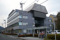 Yamakita Town Hall | |
 Flag  Seal | |
 Location of Yamakita in Kanagawa Prefecture | |
 Yamakita | |
| Coordinates: 35°21′N 139°4′E / 35.350°N 139.067°E | |
| Country | Japan |
| Region | Kantō |
| Prefecture | Kanagawa |
| District | Ashigarakami |
| Area | |
| • Total | 224.70 km2 (86.76 sq mi) |
| Population (May 1, 2021) | |
| • Total | 9,878 |
| • Density | 44/km2 (110/sq mi) |
| Time zone | UTC+9 (Japan Standard Time) |
| City symbols | |
| • Tree | Japanese beech |
| • Flower | Kerria |
| • Bird | Copper pheasant |
| Phone number | 046-75-1122 |
| Address | 1301-4 Yamakita, Yamakita-machi, Ashigarakami-gun, Kanagawa-ken 258-0195 |
| Website | Official website |

Geography edit
Yamakita is located in the mountainous western portion of Kanagawa Prefecture, bordering Shizuoka and Yamanashi Prefectures. Much of the town is within the boundaries of the Tanzawa-Ōyama Quasi-National Park. Yamakita is approximately 50 kilometers west of Yokohama. Lake Tanzawa is located in the center of the town.
Surrounding municipalities edit
Kanagawa Prefecture
Yamanashi Prefecture
Shizuoka Prefecture
Climate edit
Yamakita has a humid subtropical climate (Köppen Cfa) characterized by warm summers and cool winters with light to no snowfall. The average annual temperature in Yamakita is 11.6 °C. The average annual rainfall is 2042 mm with September as the wettest month. The temperatures are highest on average in August, at around 22.8 °C, and lowest in January, at around 0.4 °C.[2]
Demographics edit
Per Japanese census data,[3] the population of Yamakita has declined since the postwar period.
| Year | Pop. | ±% |
|---|---|---|
| 1950 | 16,710 | — |
| 1960 | 15,839 | −5.2% |
| 1970 | 14,235 | −10.1% |
| 1980 | 13,803 | −3.0% |
| 1990 | 14,342 | +3.9% |
| 2000 | 13,605 | −5.1% |
| 2010 | 11,764 | −13.5% |
| 2020 | 9,791 | −16.8% |
History edit
During the Edo period the area around Yamakita was part of Odawara Domain, along with most of western Sagami Province. After the cadastral reforms of the early Meiji period, Kawa village was one of several villages established within Ashigarakami district, Kanagawa Prefecture on April 1, 1889 with the creation of the modern municipalities system. In the Meiji era, the town prospered as a transportation hub with the opening of the Tokaido Main Line railway, but when the line changed its route due to the opening of the Tanna Tunnel, its role rapidly declined. Kawa village was elevated to town status on April 1, 1933 and renamed Yamakita. It merged with neighboring Kyowa, Shimizu and Miho villages on February 1, 1955 and further expanded by annexing the Hirayama area of former Kitaashigara village on April 1, 1955.
Government edit
Yamakita has a mayor-council form of government with a directly elected mayor and a unicameral town council of 14 members. Yamakita, together with the other municipalities in Ashigarakami District and Minamiashigara city, collectively contributes one member to the Kanagawa Prefectural Assembly. In terms of national politics, the town is part of Kanagawa 17th district of the lower house of the Diet of Japan.
Economy edit
The economy of Yamakita is based primarily on agriculture and forestry.
Education edit
Yamakita has two public elementary schools and two public middle schools operated by the town government. The town has one public high school operated by the Kanagawa Prefectural Board of Education, and there is one private high school.
Transportation edit
Railway edit
Highway edit
 Tōmei Expressway (Ōi-Matsuda interchange)
 National Route 246
Local attractions edit

- Mount Ōno
- Shasui Falls
- Nakagawa Cedar
Hot springs edit
- Nakagawa Hot Springs
Camping areas edit
- Yamakita Town Friendship Village
- Lake Tanzawa Campsite
- Lake Tanzawa Lodge
- West Tanzawa Nakagawa Lodge
- West Tanzawa Cottage Camp Ground
Parks edit
- Kawamura Castle ruins Historical Park
- Yamakita Railway Park
Festivals edit
- Yamakita Cherry Blossom Festival (end of March ~ beginning of April)
- Lake Tanzawa Fireworks Festival
- West Tanzawa Autumn Momiji Festival
Events edit
- Lake Tanzawa Fishing Festival
- Lake Tanzawa Canoe Marathon
- Lake Tanzawa Marathon
- Christmas in Lake Tanzawa
Sports edit
- Sakawa River Golf Club
Notable people from Yamakita edit
- Yoshimi Ozaki, marathon runner
References edit
- ^ "Yamakita town official statistics" (in Japanese). Japan.
- ^ "Yamakita climate: Temperature Yamakita & Weather By Month". en.climate-data.org. Retrieved 2023-10-16.
- ^ "Kanagawa (Japan): Cities, Towns and Villages in Prefecture - Population Statistics, Charts and Map". www.citypopulation.de. Retrieved 2023-10-16.
External links edit
- Official Website (in Japanese)