


Summary
Yangyang County (Korean: 양양군; RR: Yangyang-gun) is in Gangwon Province, South Korea. The county is located in the northeast of the country in Gangwon-do. Its population is about 31,000 (2004).
Yangyang
양양군 | |
|---|---|
| Korean transcription(s) | |
| • Hangul | 양양군 |
| • Hanja | 襄陽郡 |
| • Revised Romanization | Yangyang-gun |
| • McCune-Reischauer | Yangyang-gun |
 Flag Emblem of Yangyang | |
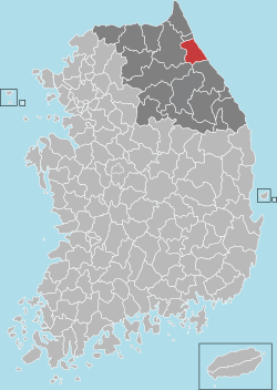 Location in South Korea | |
| Country | |
| Region | Gwandong |
| Administrative divisions | 1 eup, 5 myeon |
| Area | |
| • Total | 628.68 km2 (242.73 sq mi) |
| Population (2000) | |
| • Total | 30,141 |
| • Density | 50/km2 (100/sq mi) |
| • Dialect | Gangwon |
The Yangyang area is well known for its pine mushrooms (song-i), its fish—particularly salmon—and its sunrises.
Overview edit
In 2002, Yangyang opened its own airport, serving Gangneung to the south and Sokcho to the north. It was intended for the many tourists attracted by the Seorak-san national park. The airport was closed in 2009 due to a lack of passengers, but reopened a year later.[1]
The county is proud to unite the five major religions of Korea: Confucianism, Buddhism, Shamanism, Protestantism and Roman Catholicism. There are sites for all these faiths in Yangyang. Seonghwangsa is a shamanistic altar which was traditionally used for sacrificial rites. Yangyang Hyanggyo is a Confucian school built in 1340. Today the school mainly serves as a shrine, but classes are still held there. In 1921, Yangyang Cathedral was built. During the Korean War it was burnt to the ground but rebuilt afterwards.
The county is also proud of its five-day market. It is the largest traditional market in the area and renowned for the quality of its produce. The market is held on days ending in 4 and 9.
Tourism edit
- Naksansa
- Uisangdae
- Junjisaji pagoda
- Naksan Beach
- Osan Beach
- Dongho Beach
- Hajodae Beach
- Ingu Beach
- Jigyeong Beache
Climate edit
| Climate data for Yangyang (2007–2020 normals) | |||||||||||||
|---|---|---|---|---|---|---|---|---|---|---|---|---|---|
| Month | Jan | Feb | Mar | Apr | May | Jun | Jul | Aug | Sep | Oct | Nov | Dec | Year |
| Mean daily maximum °C (°F) | 4.5 (40.1) |
6.2 (43.2) |
11.2 (52.2) |
17.0 (62.6) |
22.6 (72.7) |
24.7 (76.5) |
27.6 (81.7) |
28.4 (83.1) |
24.0 (75.2) |
19.8 (67.6) |
13.2 (55.8) |
6.2 (43.2) |
17.1 (62.8) |
| Daily mean °C (°F) | 0.4 (32.7) |
1.9 (35.4) |
6.5 (43.7) |
12.0 (53.6) |
17.6 (63.7) |
20.6 (69.1) |
24.1 (75.4) |
24.7 (76.5) |
19.8 (67.6) |
15.0 (59.0) |
8.9 (48.0) |
2.1 (35.8) |
12.8 (55.0) |
| Mean daily minimum °C (°F) | −3.4 (25.9) |
−2.4 (27.7) |
1.6 (34.9) |
6.8 (44.2) |
12.8 (55.0) |
16.9 (62.4) |
21.2 (70.2) |
21.5 (70.7) |
16.0 (60.8) |
10.6 (51.1) |
4.7 (40.5) |
−1.7 (28.9) |
8.7 (47.7) |
| Average precipitation mm (inches) | 32.9 (1.30) |
35.7 (1.41) |
65.6 (2.58) |
71.4 (2.81) |
70.3 (2.77) |
116.7 (4.59) |
257.5 (10.14) |
265.6 (10.46) |
198.9 (7.83) |
87.6 (3.45) |
81.4 (3.20) |
27.6 (1.09) |
1,311.2 (51.62) |
| Average precipitation days (≥ 0.1 mm) | 3.4 | 4.9 | 8.1 | 8.1 | 7.7 | 10.1 | 13.6 | 14.1 | 10.4 | 7.0 | 7.0 | 3.5 | 97.9 |
| Source: Korea Meteorological Administration[2] | |||||||||||||
References edit
- ^ Sudworth, John (2009-05-18). "World | Asia-Pacific | South Korea's abandoned airports". London: BBC News. Retrieved 2009-05-19.
- ^ "Climatological Normals of Korea (1991 ~ 2020)" (PDF) (in Korean). Korea Meteorological Administration. Archived from the original (PDF) on 29 January 2022. Retrieved 7 June 2023.
External links edit
- Yangyang County government English-language home page
38°04′N 128°37′E / 38.067°N 128.617°E